Dão’s dedicated bikeway, Portugal

Dão's bikeway

Discover the Charm of Dão’s Bikeway

A Historical Transformation

Dão’s bikeway is a shining example of Portugal‘s commitment to sustainability and recreational spaces.

The journey of this dedicated bikeway began with the closure of the Dão train line in September 1988.

This historic railway, which opened in 1890, once linked Viseu to Santa Comba Dão, spanning about 49 kilometers.

In 2011, this defunct railway was transformed into the Ecopista do Dão, a remarkable cycle lane that has since become a favorite among cycling enthusiasts.
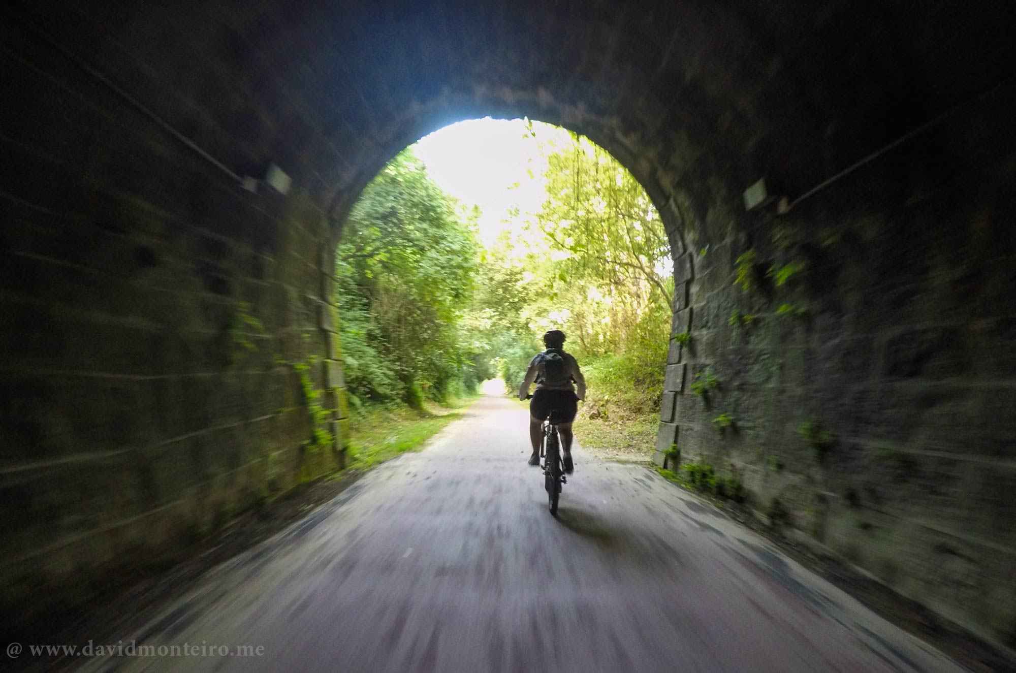
Dão's bikeway

The Appeal of Dão’s Bikeway

Dão’s bikeway is arguably Portugal’s most renowned cycle route, especially among those exceeding 30 kilometers.

Its gentle descent from Viseu to Santa Comba Dão makes it perfect for cyclists seeking a leisurely ride without strenuous effort.

The allure of a smooth, easy ride through picturesque landscapes is what makes Dão’s bikeway so inviting.

Navigating the Bikeway

Starting your adventure on Dão’s bikeway can be a bit tricky if you rely solely on public signage, which can be sparse.

However, a GPS device will guide you seamlessly to the starting point.

Once on the trail, navigation becomes straightforward with clear markings leading you along the entire route.

In the urban area of Viseu, stay vigilant for car crossings to ensure a safe start to your journey.
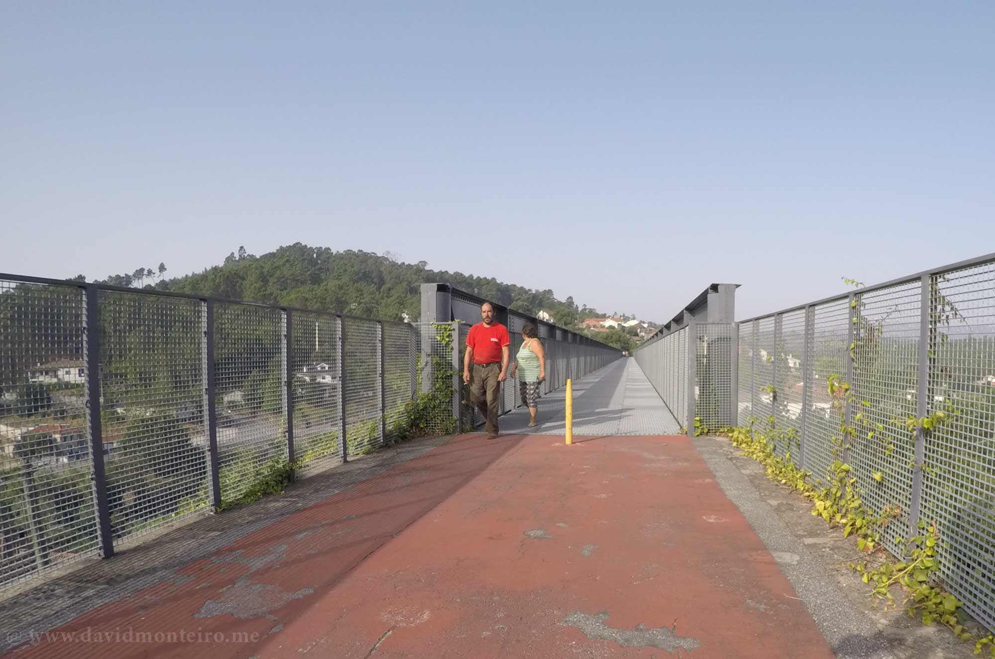
Dão's bikeway

Highlights Along the Route

As you pedal along Dão’s bikeway, you’ll encounter several points of interest that enrich the experience:

– 13 km: Torredeita** – Capture memories with an old steam engine train, perfect for a photo stop.
– 20 km: Parada de Gonta** – Take a break at the bar in the old train station for coffee or water.
– 30 km: Tondela** – This city offers various amenities and transport options if you decide to end your journey here.
– 45 km: Treixedo Bridge** – Marvel at the most iconic bridge on the route, a testament to the region’s historical architecture.

A Ride Through Nature

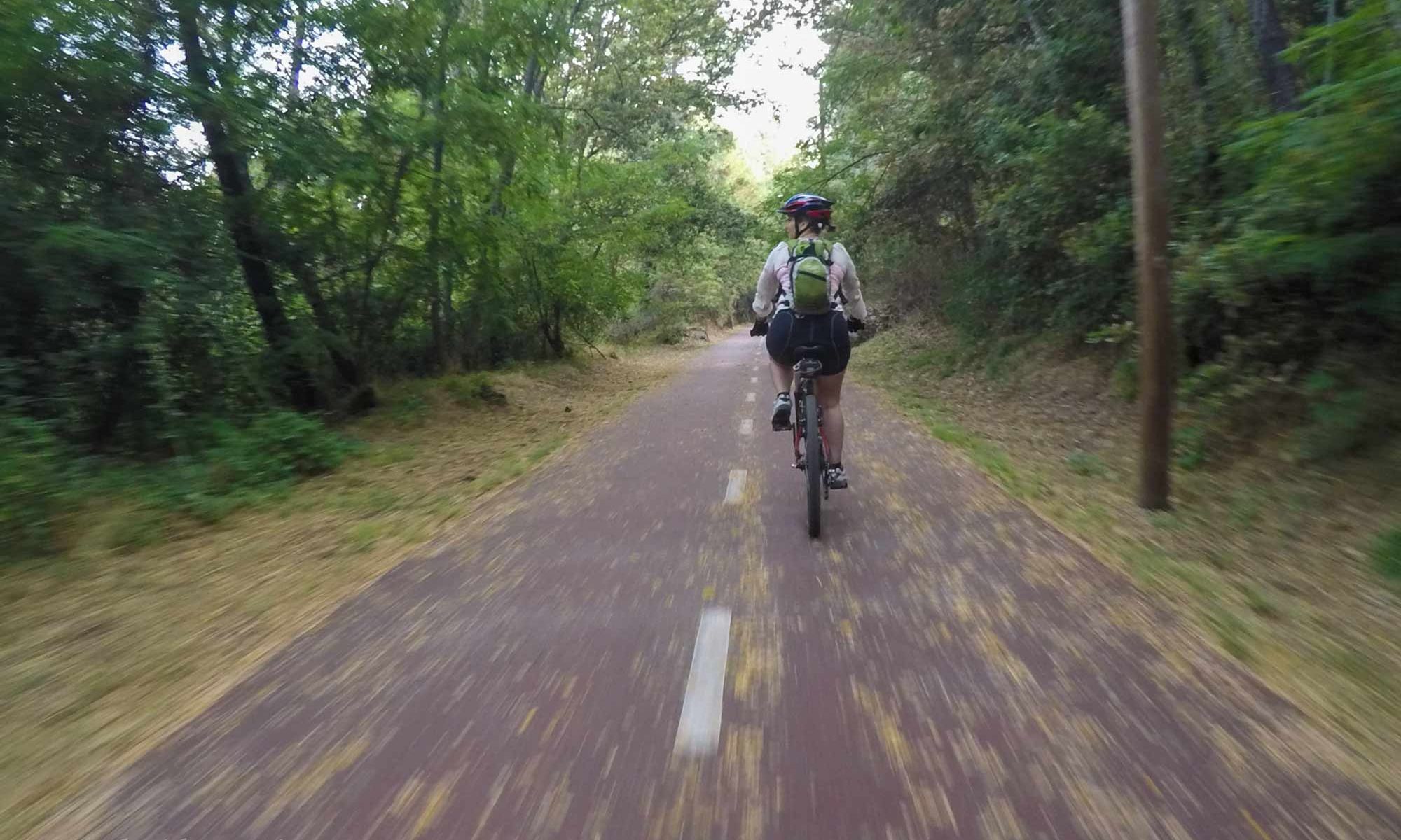
Throughout the bikeway, you’ll enjoy the shade of trees, providing a respite from the heat on sunny days.

These shady areas also offer excellent opportunities for dynamic photography, capturing the motion and beauty of your ride.

Dão’s bikeway features a well-maintained surface suitable for hybrid, cross-country, or mountain bikes.

While road bikes may not be ideal, some cyclists do take on the challenge.

Riding alongside the Dinha River, which later merges with the Dão River, adds a scenic touch to the latter part of the journey.

Conclusion

Dão’s bikeway offers a simple yet delightful cycling experience through Portugal’s picturesque landscapes.

From historical landmarks to natural beauty, this route has it all.

So, gear up and enjoy a memorable ride along Dão’s bikeway.

Are you interested in this journey or another from my offerings? Feel free to contact me through my travel agency, Iberactive.

Stay safe, enjoy yourself, and respect the natural world.

Have fun,
David Monteiro

Walking from Lagos to Burgau, Algarve, Portugal

Lagos to Burgau walking along the coast

Walking from Lagos to Burgau, Algarve, Portugal

One should consider walking from Lagos to Burgau as one of the options when in the area.

The southern area of Portugal’s Algarve boasts a coastal line with very compact yellow sand.

The coast exhibits a warm yellow hue that harmonizes perfectly with the surrounding colors.

It resembles a painting aiming to transport viewers to a summer setting, achieved with perfection only Nature can deliver.

The walking trail spans 16km (10 mi) and connects these two places, following the coastline throughout.

The walk offers a very relaxing experience with no significant elevation changes.

In addition to the beautiful sea landscape, this walk features several other points of interest:

Ponta da Piedade’s lighthouse stands proudly atop the cliffs, guiding ships with its beacon.

Visitors can ascend the tower, enjoying panoramic views of the surrounding coastline.

The lighthouse’s architecture showcases its maritime importance, while its light is a vital navigational aid for seafarers traversing the waters below.

    • Explore caves by the sea level near the lighthouse.

Visitors can navigate these caves by boat, marveling at their natural formations sculpted by the sea.

The caves provide a glimpse into the region’s geological history, offering an unforgettable adventure along the Algarve’s stunning coastline.

    • Discover Roman ruins at Luz Beach.
    • Enjoy panoramic views of the sea and cliffs.

Furthermore, it’s worth noting that you won’t encounter many Portuguese people walking around, adding a unique aspect to the experience.

Why? Well, walking isn’t quite the “thing” around here yet.

Have a nice walk.

David Monteirothese two places

Walking from Lagos to Burgau
A 16km’s (10mi) long trail connecting Lagos to Burgau
Easy walking with no relevant ascents
A 16km’s (10mi) long trail connecting Lagos to Burgau always walking along the coast.
Walking from Lagos to Burgau
Always walking along the coast.
Previous slide
Next slide

Salto do Cabrito, a handsome waterfall at São Miguel, Azores, Portugal

Salto do Cabrito walking trail

Discover the Salto do Cabrito Walking Trail in São Miguel Island, Azores

The stunning Salto do Cabrito walking trail on São Miguel Island, Azores, offers an unforgettable adventure for nature enthusiasts.

This trail combines breathtaking scenery, historical landmarks, and unique geothermal features, making it a must-visit destination.

Immerse Yourself in Caldeiras da Ribeira Grande

As you embark on this walking trail, your first stop should be the Caldeiras da Ribeira Grande.

This geothermal wonder is famous for its hot springs and bubbling mud pools.

The steamy atmosphere and the distinct sulfur smell create an otherworldly experience.

Take a moment to soak your feet in the warm waters and feel the earth’s natural energy beneath you.

Salto do Cabrito walking trail

Marvel at the Hydroelectric Central of Fajã do Redondo

Continuing along the trail, you will come across the historic Hydroelectric Central of Fajã do Redondo.

This impressive structure dates back to the early 20th century and played a crucial role in the island’s electrification.

The sight of this industrial marvel surrounded by lush greenery is truly captivating.

Don’t forget to take a few pictures and appreciate the blend of man-made and natural beauty.

Experience the Salto do Cabrito Walking Trail

The trail is well-marked and relatively easy to navigate, making it accessible for hikers of all levels.

This walking trail spans approximately 4 kilometers and offers a mix of flat paths and gentle inclines.

The highlight of the trail is undoubtedly the stunning Salto do Cabrito waterfall.

As you approach, you’ll hear the roar of the cascading water, and the sight of the 40-meter drop will leave you in awe.

Take a moment to breathe in the fresh air and revel in the beauty of this hidden gem.

São Miguel Island, Azores, Portugal

Explore Points of Interest in Ribeira Grande

Ribeira Grande, the charming town nearby, is filled with delightful points of interest.

Visit the historic town center with its cobbled streets and beautiful churches. The Ribeira Grande Municipal Museum offers a glimpse into the island’s rich history and culture.

For a taste of local cuisine, head to one of the many quaint restaurants and try the traditional Cozido das Furnas, a savory stew cooked using geothermal heat.

São Miguel Island, Azores, Portugal

Join me

Embark on this walking trail for an adventure filled with natural wonders, historical sites, and cultural treasures.

Whether you’re a seasoned hiker or a casual explorer, this trail promises an unforgettable experience on São Miguel Island.

If you’re interested in experiencing this adventure or any other from my repertoire, feel free to contact me via my travel agency, Iberactive

David Monteiro

A handsome waterfall
Easy to walk
Original
Previous slide
Next slide

Geres National Park – be safe in the park, Portugal

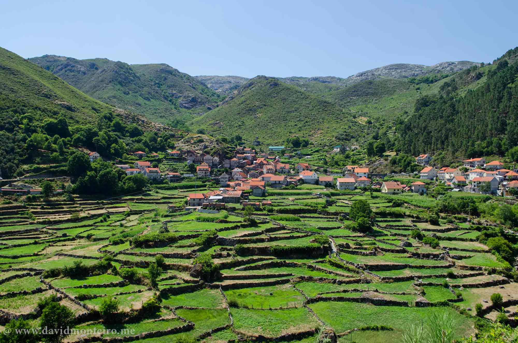
Stone walking trail at Geres

Geres National Park – be safe in the park, Portugal – new

The Geres mountain range, nestled in Portugal, captivates the minds of Portuguese mountaineers with its crystal-clear waterfalls, expansive valleys, and towering granite walls. 

However, despite its breathtaking beauty, it harbors inherent risks. Safety should be your utmost priority.

Geres National Park - walking group
Geres National Park – walking group

Geres: A Journey Through Time and Terrain

Just fifteen or twenty years ago, embarking on a journey to Geres was an adventure in itself for those residing in the Lisbon area. 

The arduous nine-hour drive seemed daunting, especially considering our accustomed three-hour limit for summer vacations. 

Today, advancements in infrastructure have reduced the travel time to less than five hours, yet the allure of Gerês remains undiminished.

Stone walking trail at Geres

Preserving Geres’ Wilderness: Navigating Safety Amid Rising Popularity

Thankfully, Geres retains its wilderness allure. 

However, with its growing popularity, the Peneda Gerês National Park (PNPG) witnesses a surge in the number of hikers, accompanied by a corresponding increase in accidents and other issues arising from ill-prepared visitors.

Whether you explore iconic trails such as Pedra Bela, Pitões das Júnias, or the route from Soajo to Peneda, safety should never be compromised.

To fully appreciate the wonders of this park, it is imperative to avoid unnecessary risks.

National Park, Portugal

Safe Adventures: Essential Tips for Exploring Gerês’ Wilderness

Before setting off on your adventure, equip yourself with essential knowledge and gear.

Research your chosen trail, familiarize yourself with weather forecasts, and ensure you have adequate supplies.

Additionally, inform someone of your itinerary and expected return time.

While traversing Gerês’ rugged terrain, exercise caution. 

Stay on marked trails, heed warning signs, and avoid venturing off the designated paths.

Unpredictable weather conditions and uneven terrain can pose significant hazards, so tread carefully.

Moreover, prioritize your physical well-being. 

Stay hydrated, protect yourself from the sun, and pace yourself to avoid exhaustion.

In case of injury or emergency, carry a fully charged phone and a basic first aid kit.

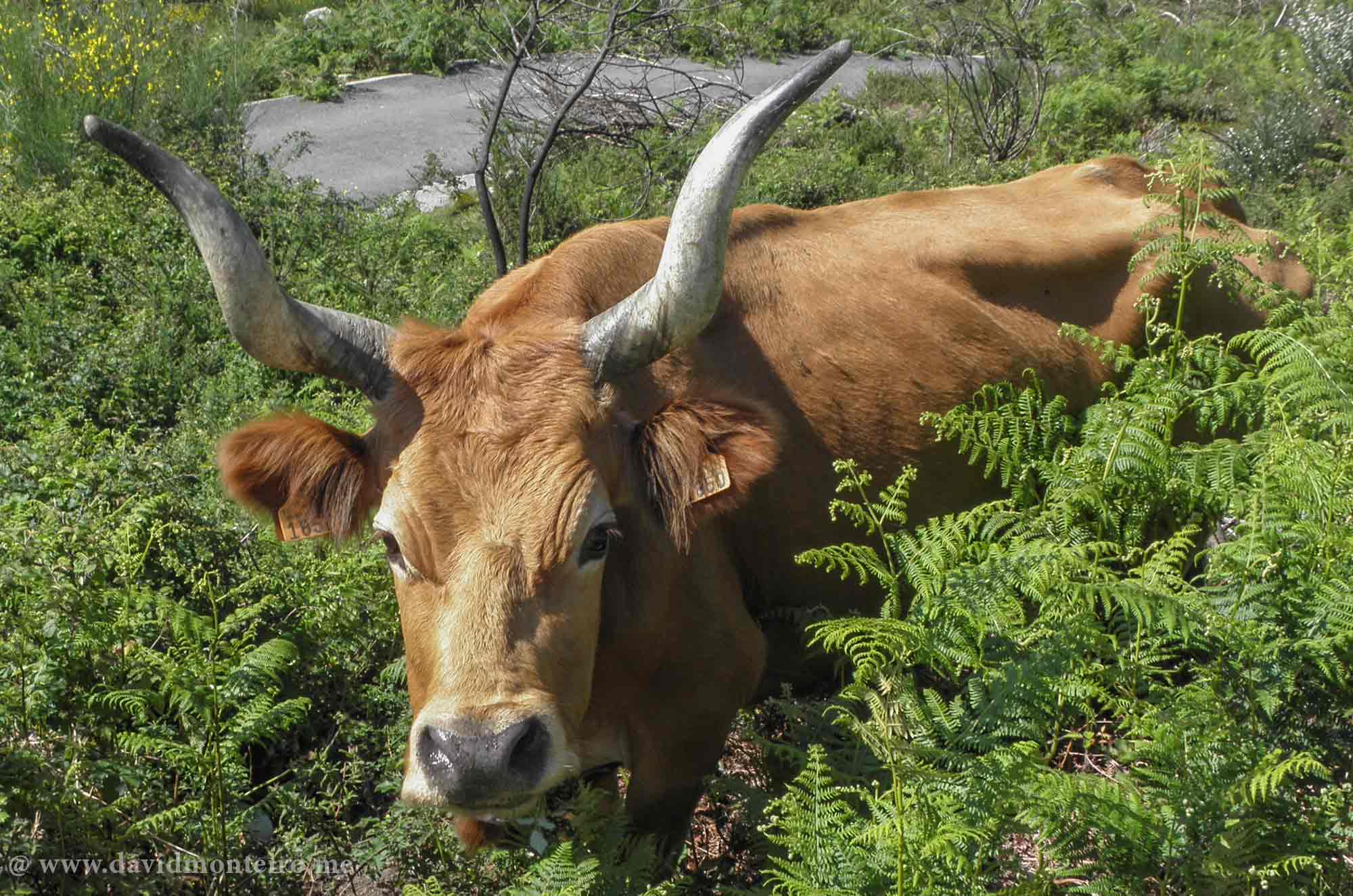
Cachena of the Barrosã familly - at the National Park
Cachena caw of the Barrosã family – at the National Park

Gerês: Safeguarding Memories Amidst Natural Majesty

Remember, the allure of Gerês lies not only in its natural splendor but also in the memories you create while exploring its wonders.

By prioritizing safety, you ensure a fulfilling and memorable experience for yourself and future adventurers.

So, embrace the adventure responsibly, and let Gerês’ majesty leave an indelible mark on your soul.

If you’re interested in experiencing this adventure or any other from my repertoire, feel free to contact me via my travel agency, Iberactive

Have fun,
David Monteiro

Note: You can be interested on this article Walking from Soajo to Peneda at Gerês National Park, Portugal

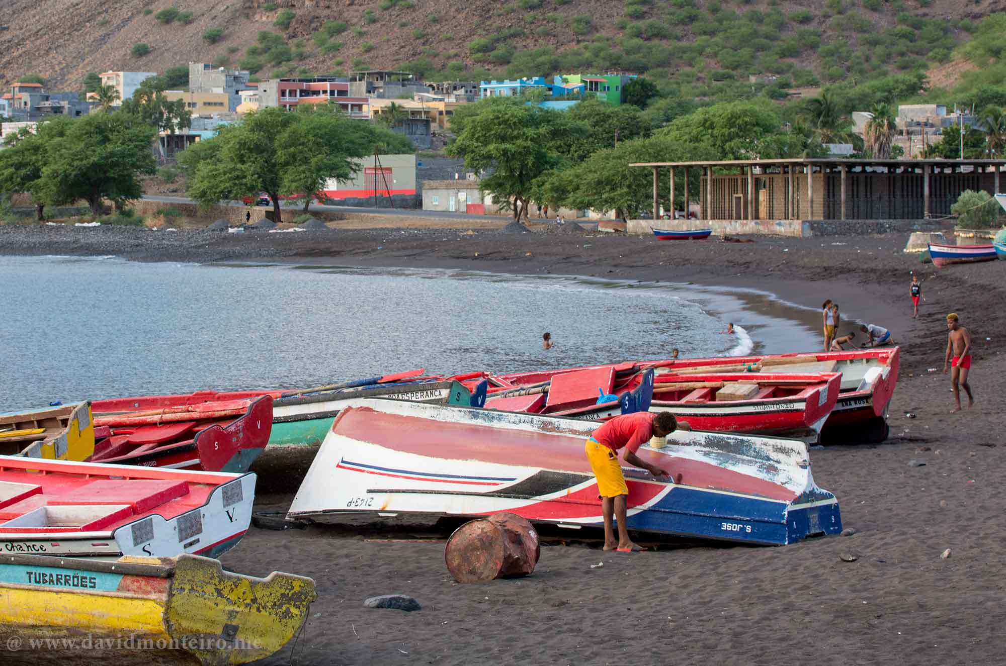
Tarrafal of São Nicolau, São Nicolau Island, Cape Verde

Tarrafal night view, São Nicolau Island, Cape Verde

Tarrafal of São Nicolau, São Nicolau Island, Cape Verde

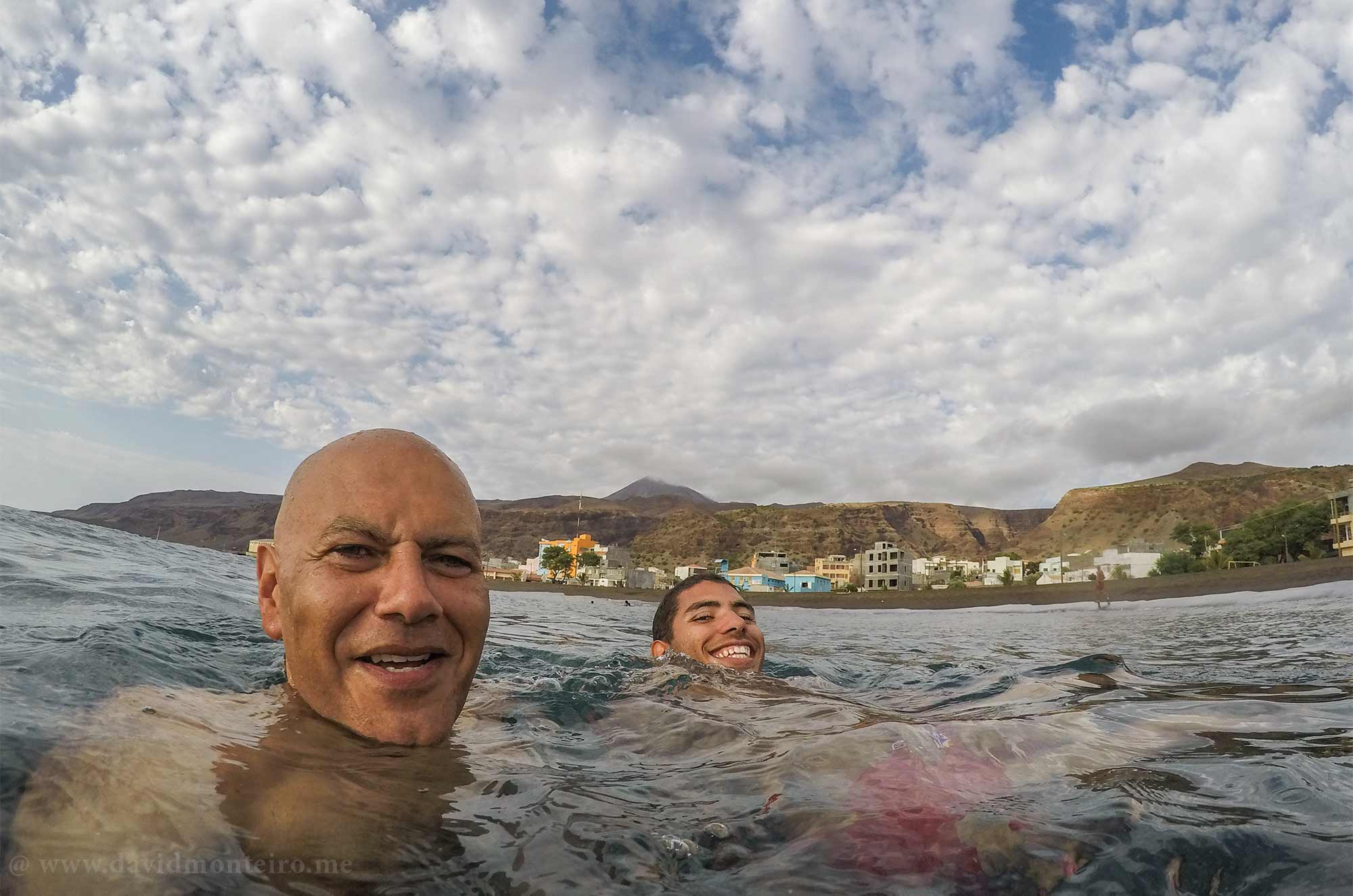
Tarrafal, situated on São Nicolau island in Cape Verde, boasts its bay that overlooks the sea.

The town is remarkably tranquil, with serene surroundings that offer a sense of peace and calm that envelop visitors upon arrival.

The soothing sound of waves crashing against the shore and the sun’s warm embrace contribute to its tranquil atmosphere.

Tarrafal: A Cursed Name

In the collective memory of the Portuguese, Tarrafal carries a cursed reputation.

However, it’s essential to distinguish this town from the infamous one on Santiago Island.

Although they share the same name, this Tarrafal is on a different island and offers a peaceful ambiance.

About this Tarrafal

Describing it as sweet and quiet would be apt.

What’s lesser known is that this town also served as a deportation site, albeit never experiencing the severity witnessed in Tarrafal on Santiago Island.

With a population estimated between 5000 and 6000 inhabitants, this town is the second most populous area on the island, following Ribeira Brava, the capital.

Life in Tarrafal moves at a leisurely pace, promoting a healthy lifestyle. 

Instead of rushing for tomorrow, people embrace the present, ensuring each hour consists of sixty minutes.

The town’s layout directs attention towards the sea, with its streets leading to the harbor and town center, which are nearby.

São Nicolau, Cape Verde

How to get there

Located at the opposite end of the island from Preguiça Airport and the capital, the journey from the airport to this town can be disorienting due to the lack of straight roads, resembling more of a meandering route.

One must traverse the surrounding mountains to reach Tarrafal from Ribeira Brava Village. 

The most efficient mode of transportation to Tarrafal, whether from the airport or Ribeira Brava, is via “Eace,” the local taxis.

“Eace,” or Hiace

The local name for the Toyota Hiace is Eace.

Tarrafal, São Nicolau, Cape Verde

Photography

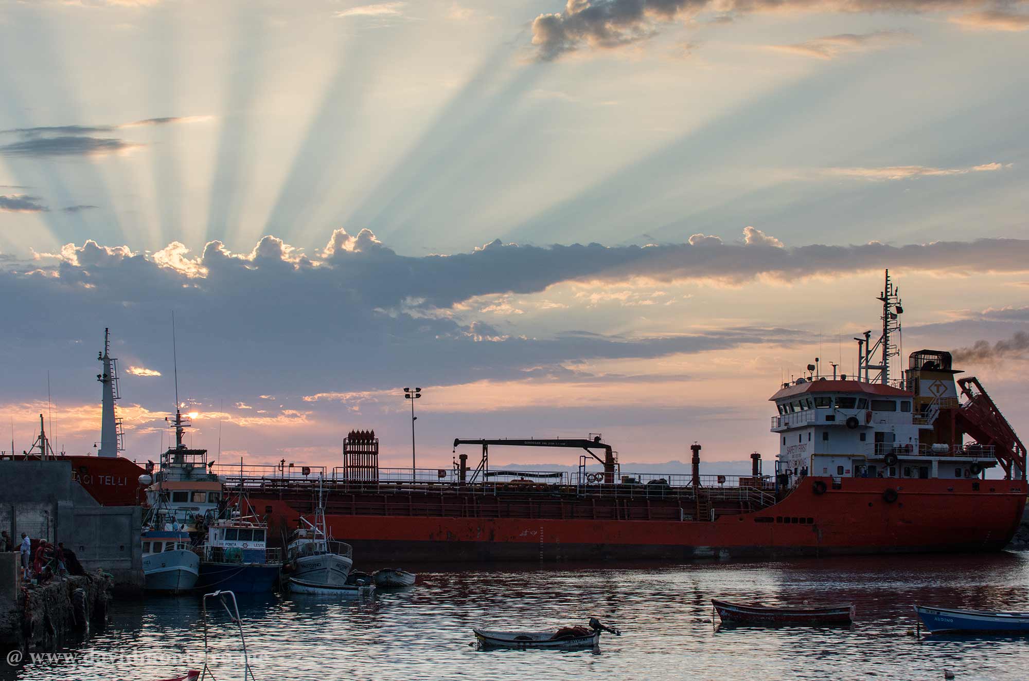
Approaching Tarrafal from these heights, I instantly realized I’d need to return to capture the village at sunset; it felt inevitable.

The town’s high temperatures lend its sunsets a reddish-blue to purplish-orange hue.

Also, the low velocity of the wind enables one to capture striking contrast photos.

São Nicolau, Cape Verde


Hidden jewel

Despite a black sand beach, it doesn’t seem to draw many visitors – in truth, there aren’t many people around.

However, there’s a sense that the town awaits the influx of tourists once they discover this hidden paradise. 

I hope that day remains far off. 

I intend to savor this place to the fullest extent possible.

Have fun,

David Monteiro
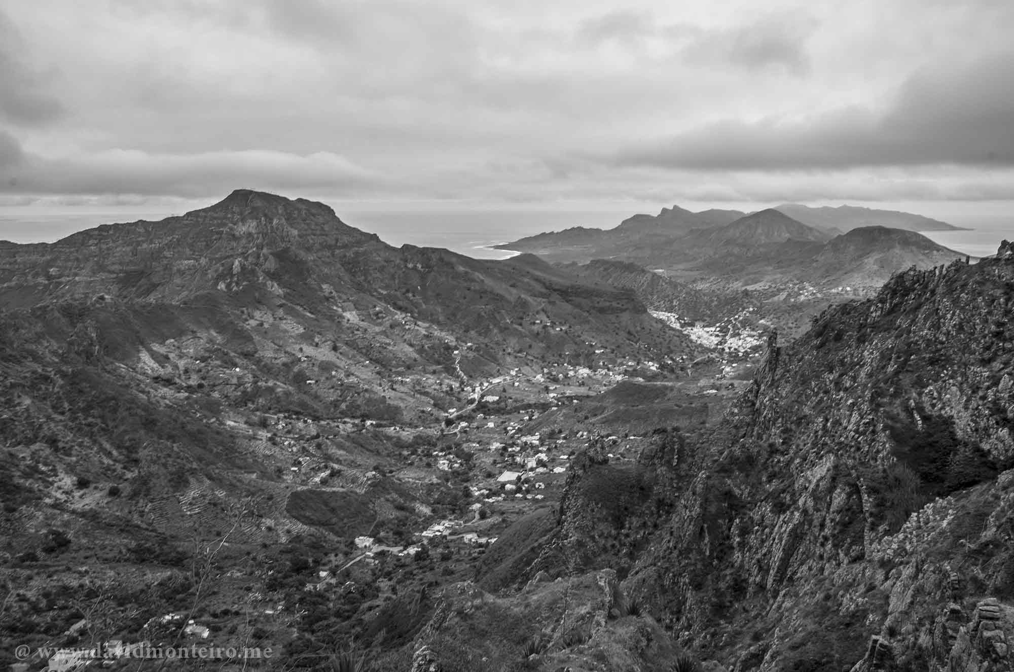
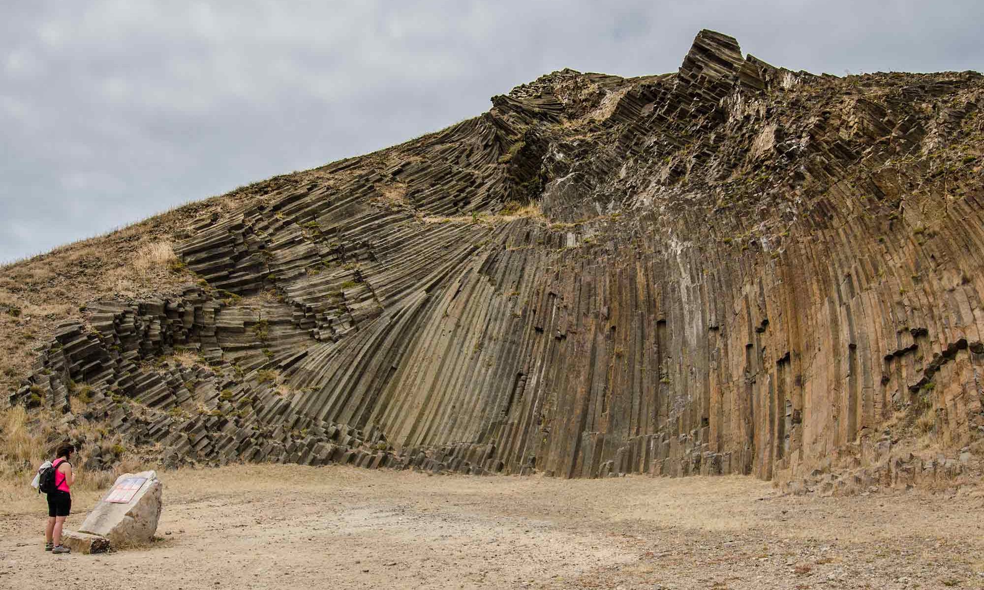
Ana Ferreira summit, at Porto Santo Island, Portugal

Ana Ferreira summit, Porto Santo, Madeira

Ana Ferreira summit, at Porto Santo Island, Portugal

Allow me to introduce you to Pico Ana Ferreira summit at Porto Santo, Madeira.

This summit captured my attention during a bus ride around the island and became a “must-go” destination before its official identification.

Porto Santo island offers more than just sun and beach, as advertisers often overlook. 

Upon arrival, I actively sought out single trails, finding them marked and easy to navigate without any ambiguity.

The walk entails minimal elevation changes yet provides an impressive panoramic view that captivates those with hiking and orienteering experience.

This summit, often overlooked in travel literature, invites geologists and photography enthusiasts to discover its hidden wonders firsthand.

Interesting rock formation at Ana Ferreira summit, Porto Santo, Madeira

How do you get there?

I boarded a bus from the center of Vila Baleira to Calheta.

The route to the summit became evident after disembarking near the São Pedro Chapel.

For geology enthusiasts, I recommend briefly explaining the area’s unique rock formations here.

Photography enthusiasts will appreciate the less commonly photographed view of Porto Santo from this vantage point. 

The descent followed a straightforward path, leading me to the opposite side of the ascent, towards Calheta.

In Calheta, I indulged in some photography, with the option of enjoying a swim at the lovely beach and relaxing on a beautiful terrace with a well-deserved beer and snacks.

The rock formation you will find at Ana Ferreira summit

The Ana Ferreira Peak is the highest point in the western part of Porto Santo island, standing at an altitude of 283 meters.

At its peak, a spectacular array of prismatic columns develops, formed by volcanic activities thousands of years ago.

the above text is from Wikipedia

The rock we will find there is called mugearite.

The mugearite formed from intermediate-composition magma that evolved through differentiation in a magma chamber located at a certain depth beneath the current crest.

The cooling of the magma occurred slowly within the conduit (dyke) that fed the volcano and primarily took place in two directions: sub-vertical and sub-horizontal. This resulted in a spectacular columnar (or prismatic) jointing with extensive pentagonal/hexagonal cross-section columns.

the above text can be found here.

Carpe Diem.

David Monteiro

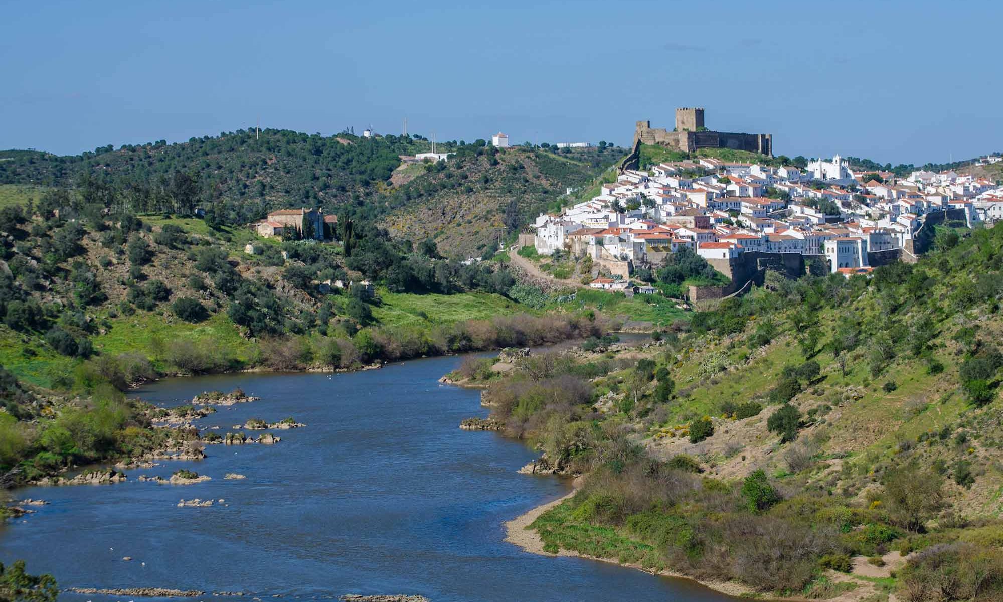
Mértola and its Moorish heritage, Portugal

Mértola, Alentejo, Portugal

Mértola and Its Moorish Heritage, Portugal

Mértola, a picturesque village near the Spanish border in southern Alentejo, is steeped in history and culture. Reflecting on Mértola brings to mind the vibrant Moorish occupation during the Dark Ages in Portugal.

Ten centuries before the Moors arrived, the Romans had left their mark at Minas de São Domingos, making Mértola a fascinating vacation destination.

A Journey Through Time

My memories of Mértola are intertwined with the beginning or end of many adventures. In the past, traveling from Lisbon to the Algarve was a daunting task due to heavy traffic.

Many travelers took the road through this town to avoid the most congested routes.

This detour made Mértola a crucial pit stop, and the Café Guadiana became a beloved tradition.

Although I don’t recall any specific specialties, stopping at Café Guadiana marked a significant milestone in the four-hour journey.

Today, Café Guadiana has transformed into a modern bar, offering a delightful experience that respects the nostalgia of the past.

Exploring Moorish Heritage

As a history enthusiast, the rich Arab heritage of this town sparks my imagination about the Reconquest period.

This village, with its narrow streets and white-washed houses, invites exploration.

Walking through Mértola’s alleys reveals a clean, organized, and visually pleasing environment, typical of many Alentejo localities.

I have visited Mértola countless times, yet I always felt I hadn’t truly discovered it.

Recently, I spent a few days there to photograph and immerse myself in its atmosphere.

The village’s charm and historical significance make it a destination worth revisiting.

The Guadiana River

The Guadiana River, flowing past Mértola, adds to the village’s allure.

Navigating the river about seven kilometers upstream brings you to Moinho dos Canais, accessible by car.

From here, an easy canoe descent to the village offers a unique perspective of the area.

For those seeking a longer adventure, you can load your gear onto the canoe and paddle downstream towards Vila Real de Santo António.

This two-day journey leads to the river’s mouth, providing a scenic and adventurous experience.

Embracing the Experience

Mértola is not just a stopover; it’s a destination filled with history, culture, and natural beauty.

Whether you stroll through its charming streets, explore its Moorish heritage, or embark on a canoeing adventure along the Guadiana River, Mértola promises a memorable experience.

While I’ll save the details of its gastronomy for another time, rest assured that Mértola offers plenty of reasons to visit.

I eagerly anticipate my next trip to Mértola, I encourage you to discover its unique charm, and I hope to guide you through this charming town shortly.

If you’re interested in experiencing this adventure or any other from my repertoire, feel free to contact me via my travel agency, Iberactive

Have fun exploring this historical gem.

David Monteiro

Mértola and its Moorish heritage, Portugal
Previous slide
Next slide

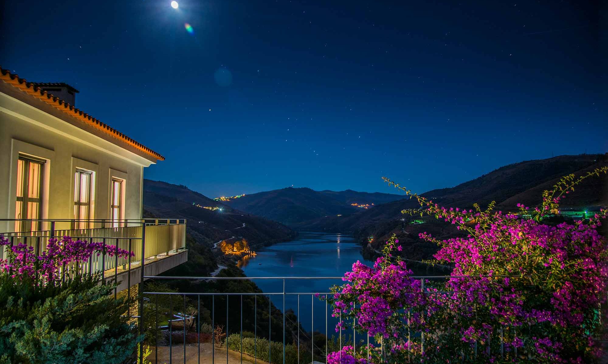
A cold night at Quinta da Marka, Douro Valley, Portugal

Quinta da Marka, Douro Valley, Portugal

A cold night at Quinta da Marka, Douro Valley, Portugal

At Quinta da Marka, in the Douro Valley, the chill in my arms hovered between desire and discomfort.

Yet, the serene night’s silence and tranquility held me captive on the balcony.

The wicker chair’s cozy cushions aided my endurance, but bougainvillea petals danced on the breeze, countering my solitude.

The day, now a distant memory, had been unusually warm for late March.

Alone at Quinta da Marka, I relished the solitude.

Despite the daytime warmth, the night embraced a pleasant chill.

The clear sky unveiled constellations, barely obscured by the moonlight. In the corner of my vision, dim lights hinted at the living room’s stillness.

Perhaps I should have turned off all the lights, but the distant dots of light, like Quinta Nova, lingered.

Quinta do Crasto, hidden behind me, remained unseen from the balcony, existing as a reassuring presence.

I pondered dimming the room lights, now imagining the beauty of the enveloping darkness.

The living room’s sparse lighting only hinted at its traditional, comforting decor.

Nestled into the cushioned haven, my eyes grew heavy, embracing the weight of impending sleep.

Earlier that day, upon reaching Quinta Nova with the complete group of guests, I yielded my room to accommodate an unexpected last-minute guest at Quinta Nova. Consequently, I arranged to stay at Quinta da Marka for the subsequent two nights.

Quinta Nova’s allure is undeniable. However, the isolation and possibility for some peace of mind, made Quinta da Marka an ideal alternative.

The day had unfolded spectacularly, with seamless walks, guided tours, and a lively dinner marked by passionate conversations.

Despite the usual and natural demands, positive customers, moderate weather, and flawless details marked the rare and harmonious alignment of stars.

Resisting thoughts of the upcoming day, I yearned only to drift into slumber beneath the stars’ watchful gaze.

Are you ready to join me on one of these tours?

Carpe diem.

David Monteiro

Quinta da Marka, Douro Valley, Portugal
Quinta da Marka’s Living room with traditional decor, comfortable, and very inspiring.

Discover Gaztelugatxe: The Game of Thrones Gem

Discover Gaztelugatxe: The Game of Thrones Gem

Discover Gaztelugatxe: The Game of Thrones Gem

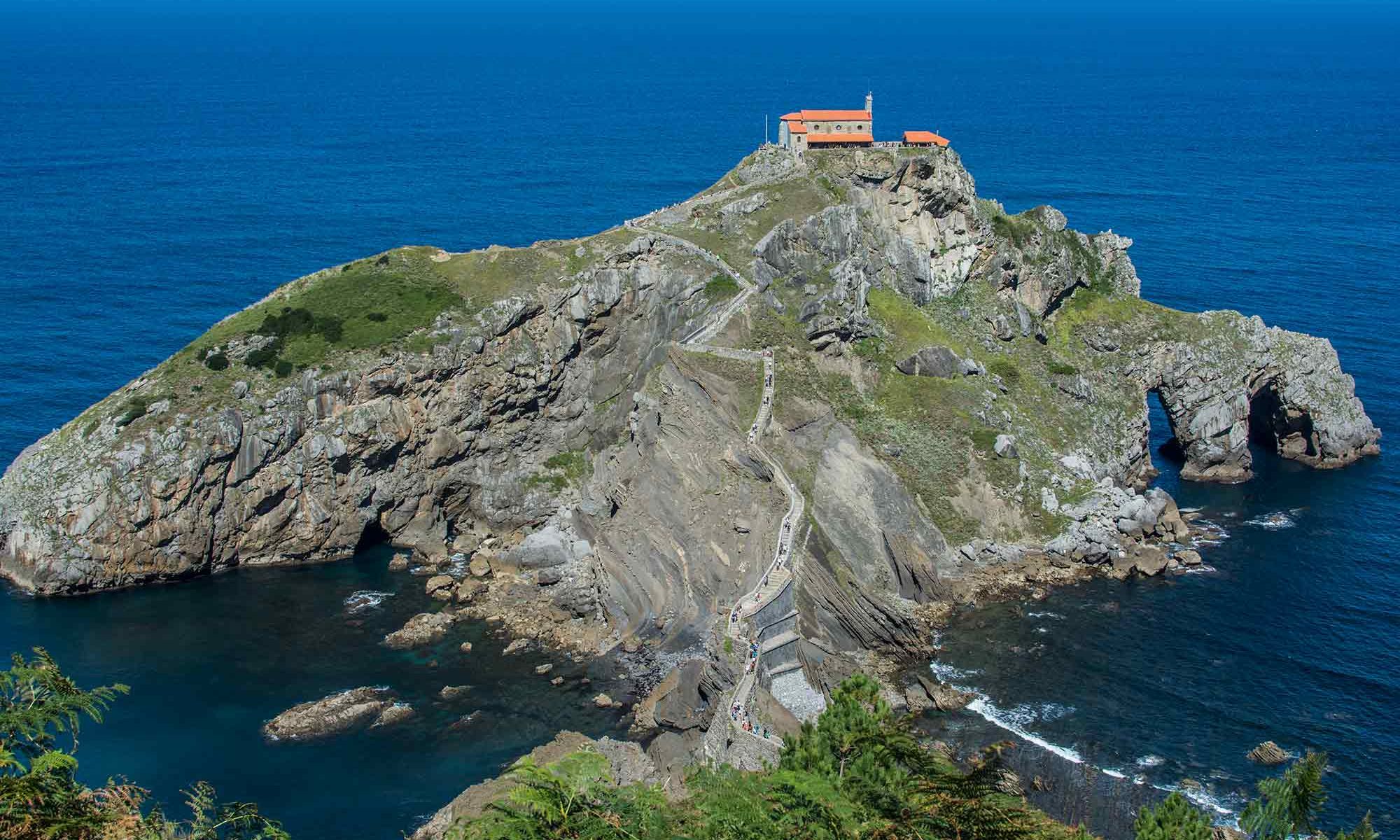
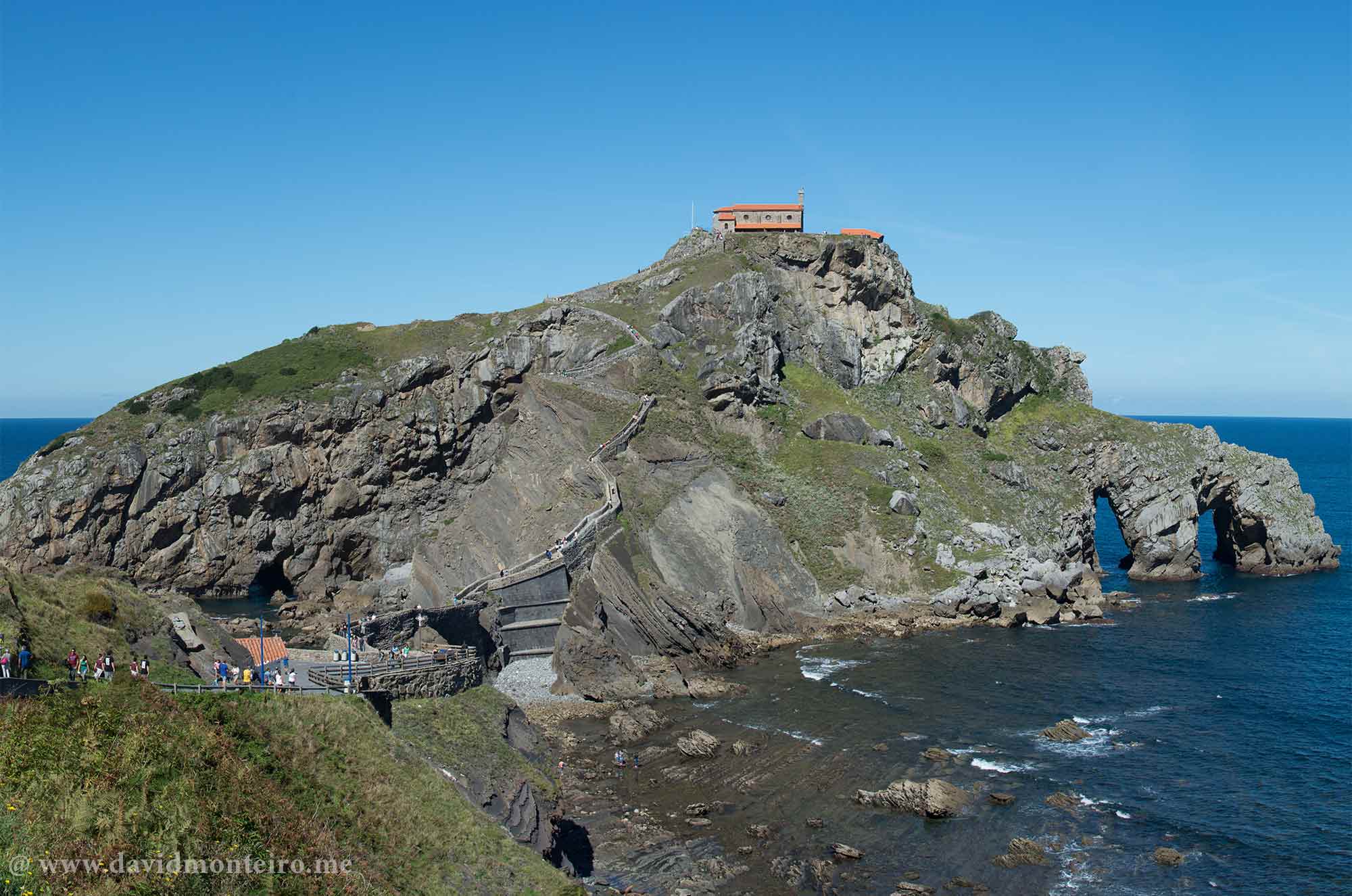
Experience the magic of Gaztelugatxe, a stunning island in the Spanish Basque Country.

Located in the municipality of Bermeo, this enchanting destination was one of the sets for the iconic television series Game of Thrones.


Gaztelugatxe, a Game of Thrones Gem's location

A Game of Thrones Location

Nestled atop the rugged island with the same name, it’s the hermitage of San Juan de Gaztelugatxe.

Connected to the mainland by a human-built stone bridge, this dramatic setting offers breathtaking views and an unforgettable adventure.

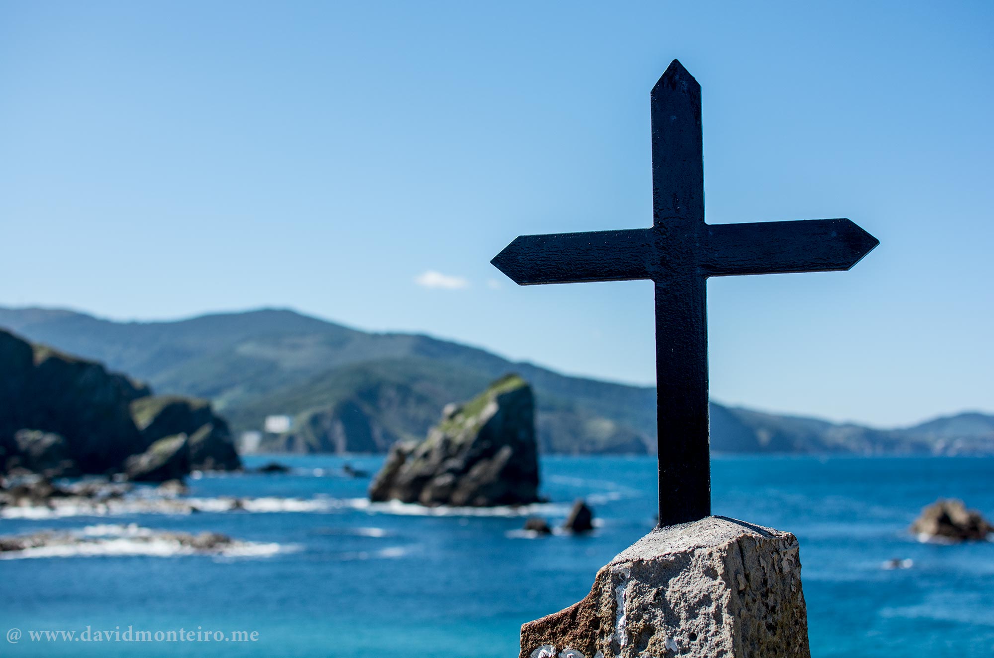
The violent sea and unique access to the chapel dedicated to St. John the Baptist makes this a cinematic dream, perfect for fantastic movies.

Climb the Steps to Gaztelugatxe

Upon arrival at San Juan de Gaztelugatxe, you’ll face a long staircase leading to the hermitage.

According to online sources, there are 231 steps up to the chapel. Although I didn’t count them myself, the climb is an adventure in itself.

Legend says that once you reach the top, you must ring the bell three times and make a wish. On busy days, the bell never stops tolling.

Gaztelugatxe, a Game of Thrones Gem's location

A Must-Visit Destination

Gaztelugatxe is a must-see destination for any traveler in the area.

Its unique charm and connection to Game of Thrones make it a captivating spot for fans and adventure seekers alike.

The Telegraph even features an article with more details about this iconic location.

So, if you find yourself in the Spanish Basque Country, don’t miss the chance to explore Gaztelugatxe.

Enjoy the journey, embrace the legend, and soak in the breathtaking views. This magical island is waiting to be discovered.

For this adventure or any other from my repertoire, you can contact me via my travel agency, Iberactive.

Stay safe, enjoy your adventures, and show respect for nature.

Have fun and take care,
David Monteiro
Pyrenees hiking trail: Overpass the Coll of Contraix

Pyrenees hiking trail: Coll of Contraix

Pyrenees hiking trail: Overpass the Coll of Contraix

Introduction to the Adventure

Overpass the Coll of Contraix is a Pyrenees hiking trail that allows you to achieve personal milestones and brings great satisfaction.

For many, overpassing the Coll of Contraix in Aigüestortes National Park, Pyrenees, Spain, stands as a remarkable goal.

This ascent highlights the trek between the Ventosa i Calvell and Estany Llong mountain huts.

Pyrenees hiking trail: Overpass the Coll of Contraix

Starting the Trek: Day Five of the Aiguestortes Tour

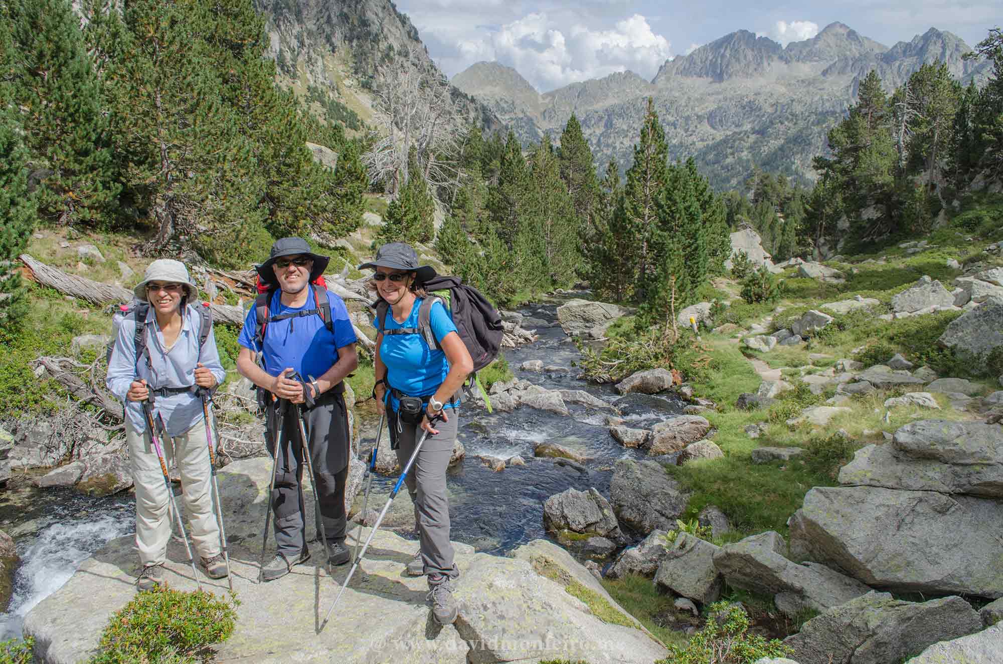
On the fifth day of my Aiguestortes hiking tour, I lead the group toward the Coll of Contraix. For more details, please access here.

Previous days are crucial for bonding with participants and assessing their readiness for this challenging climb.

Conversations often revolve around the mythical Coll of Contraix, especially from those we encounter who have trekked it before.

Early Morning at Refugio Ventosa

Our day starts early at Refugio Ventosa, which serves the best breakfast among the park’s huts.

This mountain hut sits at the valley’s start, and our journey begins by descending to the stream feeding Lac Negre.

Initially, it seems there’s no exit, but after walking about 3km, an ascent path becomes visible.

Best hikes in the Pyrenees - Aigüestortes National Park - Pyrenees hiking trail: Coll of Contraix

The Ascent to Coll of Contraix

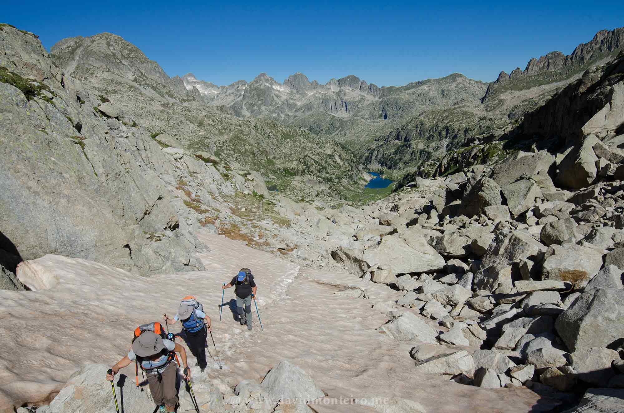
The direct ascent of 300m to the 2745m altitude of the Coll of Contraix is intense.

The hike from Ventosa i Calvell to the coll spans approximately 4km and involves a 600m elevation gain.

Along the way, we pass the trail to Punta Alta, the park’s highest peak at 3014m. One day, I hope to summit it with participants.

Hike up to Coll of Contraix

Navigating the Stone Blocks

The route is strewn with stone blocks, challenging our balance—a familiar scenario from previous days.

The trail steepens as we approach the coll. Walking uphill on gravel proves tricky, but soon, our steps become firmer, and we pull ourselves upward.

Hike up to Coll of Contraix

Reaching the Summit

Breathing intensifies as the coll draws nearer.

Finally, we reach the top, arms raised in triumph, celebrating a seemingly impossible achievement.

We enjoy a picnic, saving some for later after more challenges have passed.

Descending to Contraix Lake

The descent to Contraix Lake is no more straightforward than the ascent.

Carefully, we navigate the zigzagging path to the lake.

The remaining walk to our destination, the Estany Llong Refuge, is less demanding but equally picturesque.

The landscape resembles scenes from Swiss chocolate packages, with the constant sound of water and a majestic waterfall.

Encountering Tranquil Cows

As we descend, the clanging of cowbells replaces the waterfall’s sound.

Cows graze peacefully on the path, requiring us to navigate around them.

Their presence is a serene reminder of the area’s natural beauty.

Reaching Estany Llong Refuge

The Estany Llong refuge becomes visible half an hour before arrival, bringing mixed feelings of relief and irritation.

Yet, patience leads us there.

Completing the most challenging day of the Aiguestortes tour, covering 9.5km with 830m climbs and 1050m descents in 7 to 8 hours, feels triumphant.

Tired but satisfied, we toast to our success at dinner.

Conclusion: Celebrate Your Achievement

Overpassing the Coll of Contraix is an extraordinary accomplishment.

For those seeking adventure, consider staying at a hotel in San Sebastian to extend your Pyrenees experience.

This journey exemplifies living well, celebrating nature, and achieving personal goals.

Should this adventure or another from my lineup interest you, please contact me via my travel agency, Iberactive.

Stay safe, have a great time, and always respect nature.

Have fun,
David Monteiro