Hiking to Cape Roca, Europe’s mainland westernmost point, Portugal

Hiking to Cape Roca

Hiking to Cape Roca, Europe’s mainland westernmost point, Portugal

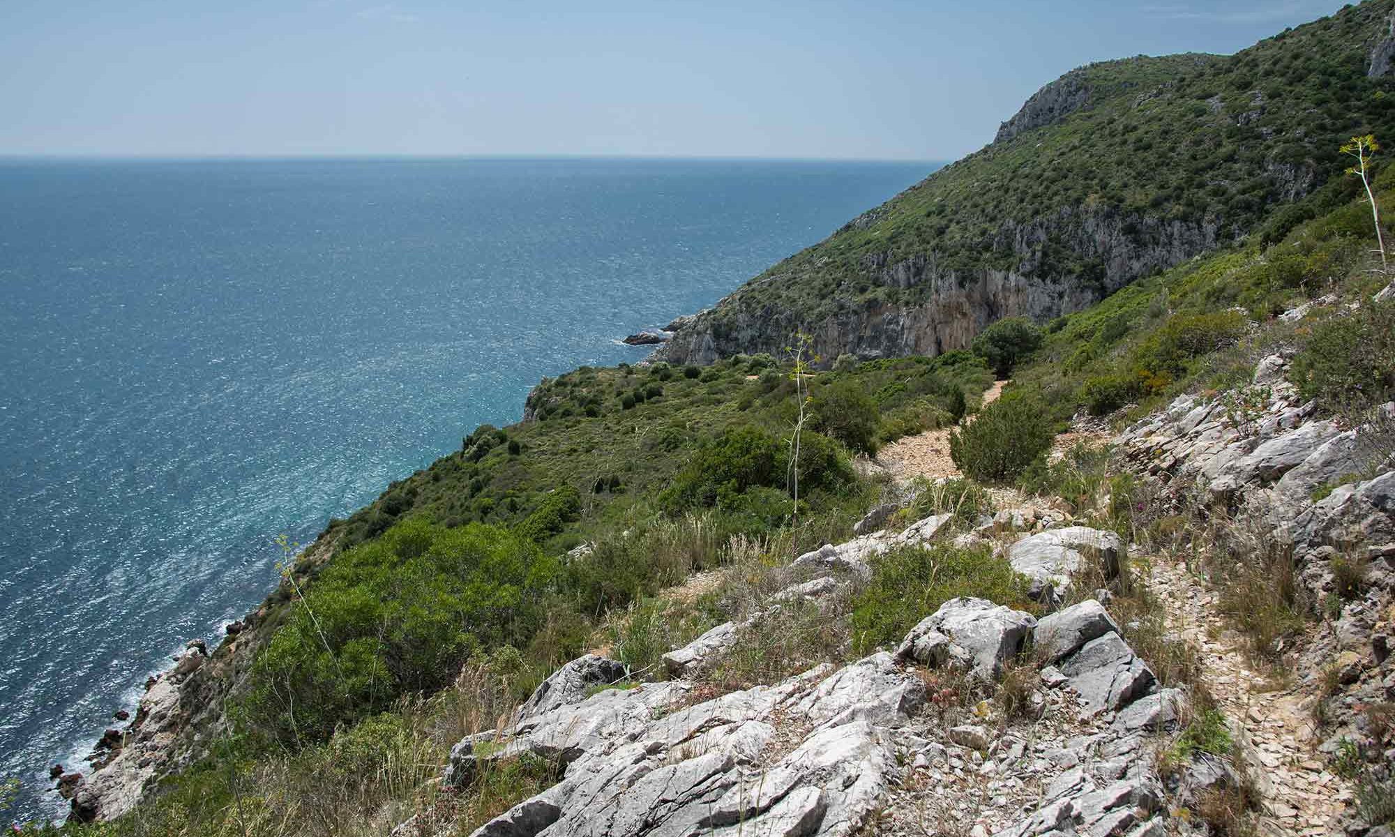
Hiking to Cape Roca offers a breathtaking trail and stunning views, perfect for those passionate about landscape photography.

Quite close to Lisbon lies Europe’s mainland westernmost point, Cape Roca.

The cape also sits near Sintra, and many Sintra, tours incorporate a visit there.

Please check our company’s tours here

Cape Roca’s coordinates are 38° 46’49.59″N 9° 29’56.19″W. As depicted in the featured photo of this article, it perches atop a high point and boasts impressive sea landscape views, naturally befitting its status as a cape.

Accessible by car, consider indulging in a spectacular walking experience if you love hikes and have the time. 

This hike is one of the most spectacular hikes near Lisbon.

You can explore both north and south from Cape Roca on foot.

Landscape coastal view

Two different walks, logistics

For a clearer breakdown, I’ll categorize the hikes into two sections:

1) Southward: From Forte do Guincho to Cape Roca

2) Northward: From Cape Roca to the Dinosaurs’ footprints

Please note: The concept is to hike south or north, passing Cape Roca. However, you can either reach Cape Roca and continue on one trail or something similar.

This isn’t a loop trail but a linear one, so there’s always the challenge of returning to the starting point or finding transportation from the endpoint. 

If you’re hiking with friends and have at least two vehicles, you can leave one car at the endpoint and, upon arrival, drive back to retrieve the vehicles left at the starting point.

 Alternatively, you can consider taking a bus back to the starting point.

Armeria pseudarmeria

Along the trails, you can try to find a rare flower, the Armeria pseudarmeria. 

This species is at risk of extinction because tourists pick it up due to its beauty during blooming and because it only grows along these cliffs, a somewhat restricted area.

Walker at Cape Roca, Portugal

Geology

If you are interested in geology, granite is king in this area. Along the coast, you will find magnificent cliffs, often higher than 150m/492ft (+/-) and high tall standalone rocks looking like coastal guardians searching for the enemy boats at the horizon.

Coastal walk, Portugal

About the walking trails

I use these trails to assess Portuguese guests’ fitness to the mountain tours I promote.

Walking these trails at a slow pace can be considered to have a moderate difficulty level.

However, by increasing the speed, just a little bit, the difficulty level of these trails will increase and become strenuous.

On the other hand, the terrain, on both paths, is uneven, with gravel and not suited for inexperienced walkers.

Be sure to wear walking boots and take walking poles with you. You might need them.

Also, at specific points, you will find some higher steps that will require you to grab on something, like a branch or a rock.

Although one can not consider these situations as rock climbing, they can represent an obstacle for less experienced people.
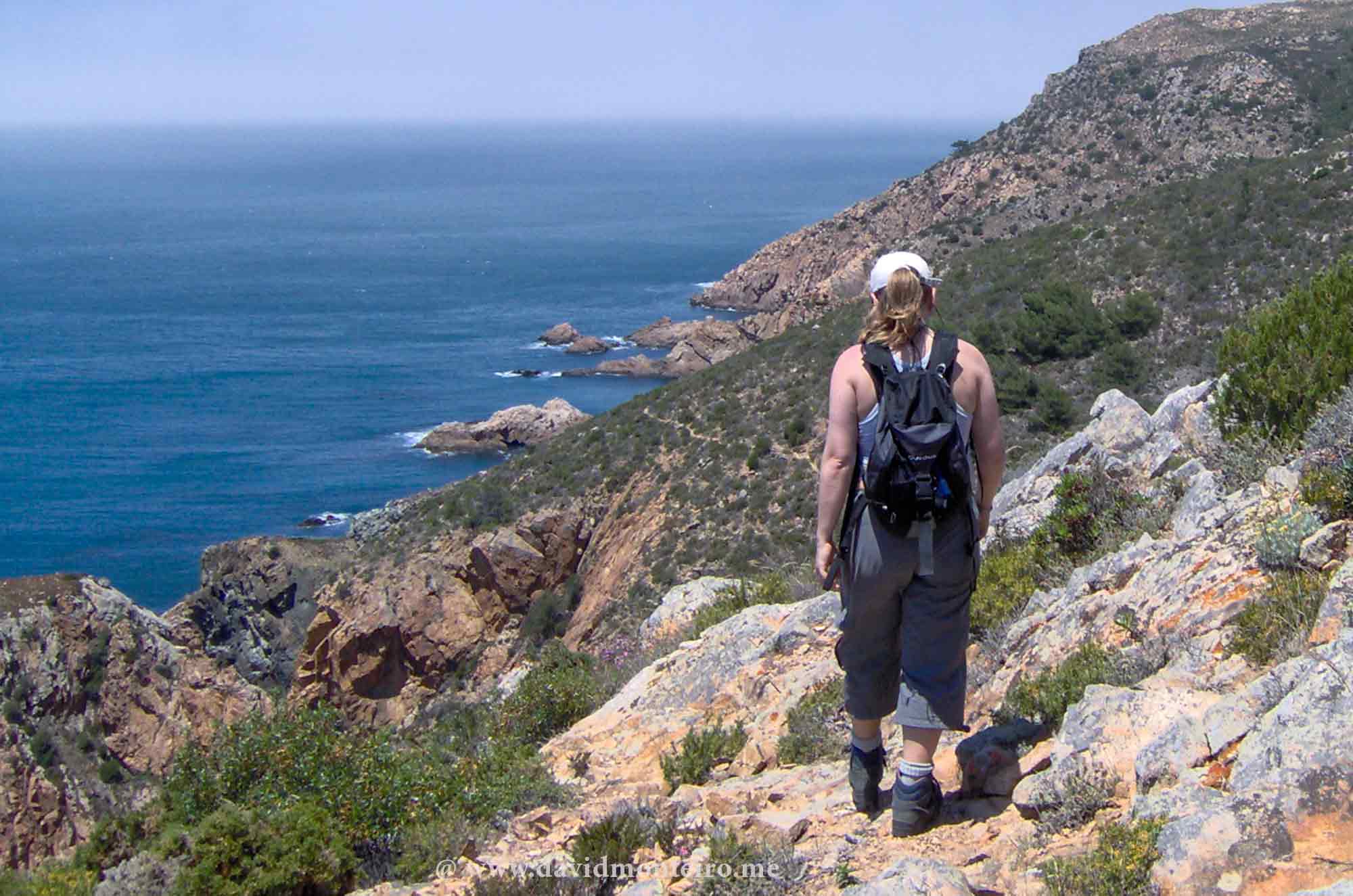
Walker at Cape Roca, Portugal
Group of walkers near Cape Roca in Portugal

Let’s check the two trails

1) South: Hiking to Cape Roca from Forte do Guincho

Hiking to Cape Roca from Forte do Guincho is a classic on Lisbon’s outskirts.

Nearly every adventure organization, whether a company, association, or informal group, has embarked on this journey.

It’s a captivating route, one I never tire of traversing, and it offers unique charms depending on the season.

I vividly recall my inaugural hike in June 2000, on what felt like the hottest day of the year.

The trail meanders through valleys, covering 8 kilometers and an elevation gain of 830 meters. It presents continuous ascents and descents.

Commencing at the 17th-century Forte do Guincho, part of Portugal’s coastal defense line established after the Dec’1640 revolution, the route offers various paths, creating length and terrain variances.

As it’s a linear trail, returning to the starting point poses a logistical challenge, but groups with two vehicles can strategically leave one at the endpoint.

Alternatively, one can explore bus options, though schedules may be limited.

For those seeking a return journey, the coastal walk offers captivating vistas in both directions.

However, it’s essential to consider the trail’s difficulty, as walking it one way is moderate, while covering it twice is strenuous.

Notable along the route are the ruins of Espinhaço Fortress, constructed during the 17th-century Restoration War.

2) North: from Cape Roca to Dinosaurs footprints

This walk closely resembles the one previously described but is shorter and features more Points of Interest (POIs).

Covering a distance of 6.1 km (3.8 mi) with a 600 m elevation gain, it commences at Cape Roca, near the parking lot, positioned on the left side of the road.

Once you embark on the right track, the route becomes predominantly clear.

However, attention is required when traversing Ursa Beach, the first beach encountered, as both the descent to and ascent from the beach are steep and potentially slippery.

En route to Adraga Beach, the trail leads to Fojo, a sizable hole providing a panoramic view of the sea—exercise caution in this area.

The journey culminates at the dinosaurs’ footprints if undertaken one-way.

During inclement weather, exercise caution on the wooden steps, as they may become slippery. Key POIs include Ursa Beach, ideal for long exposure photography,

Fojo, a notable geological feature, Adraga Beach, boasting white sands and a sea-view restaurant offering fresh seafood, and the dinosaurs’ footprints, featuring 66 imprints dating back 110 to 115 million years; note that ongoing restoration efforts are underway due to a wall collapse.

Note: The end of this trail lacks coffee shops, restaurants, or any other infrastructure, only featuring some houses. If you require dining options, either backtrack to Adraga Beach, approximately 1.5 km from the trail’s end, or continue along the path for an additional 1 km to reach Praia Grande. At Praia Grande, several restaurants and bars are available, and you can also access bus services from there.
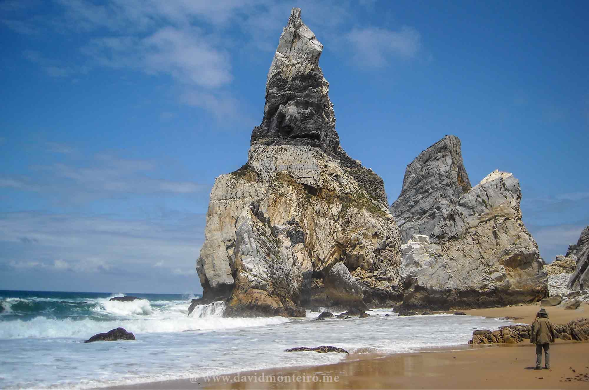
Praia da Ursa, Ursa Beach, Portugal

To conclude

Well, I hope you enjoy the walks as much as I do.

If you want to embark on this adventure or others like it, please contact me.

Have fun.

Carpe diem,

David Monteiro

Hiking from Vau to Alvor, Algarve, Portugal

Hiking from Vau to Alvor

Hiking from Vau to Alvor, Algarve, Portugal

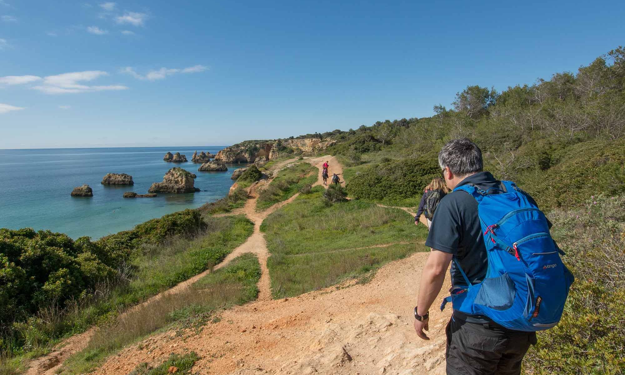
In the captivating Algarve, where breathtaking sea vistas command your gaze and vibrant orange walls compose the quintessential tourist postcard scene, hiking from Vau to Alvor is no less attractive.

This picturesque hike is ideal for exploring the Algarve’s walks between March and April when the weather is pleasantly mild.

Summer in the Algarve is too hot for exploring these paths.

Instead, we revel in the springtime ambiance, relishing the gentle breeze and the vibrant hues of blossoming flora adorn our path.

Each step unveils a new facet of this coastal paradise, inviting us to immerse ourselves fully in its natural beauty and cultural charm.

Walking from Vau to Alvor, Algarve, Portugal

Coastal Odyssey: Exploring Algarve’s Enchanting Hiking Trail from Vau to Alvor

Embarking on hiking from Vau Beach, our journey begins amidst curious gazes from patrons lounging on the bar terraces, intrigued by our chosen path.

Eager to explore further, we swiftly depart, tracing a trail along the rugged cliffs that fringe the coastline.

This scenic route meanders through enchanting caves, whose captivating formations are frequently immortalized in photographs, epitomizing the allure of this coastal enclave.

Undeterred by challenges, we press onward towards the western horizon, each step revealing new wonders of the Algarve’s coastal splendor.

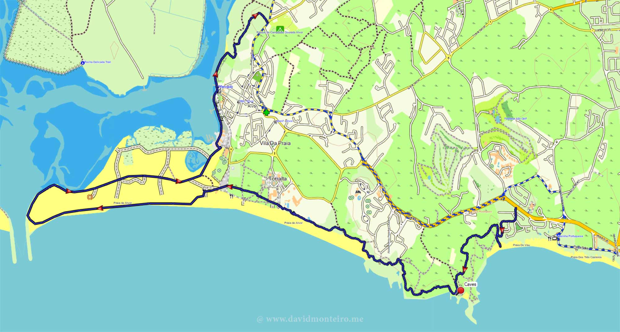
We end at Alvor Beach, crossing wooden walkways through marshlands at Ribeira de Odiaxere’s mouth.

We enjoy the peaceful marshes on the boardwalks.

Marshlands at Alvor
Marshlands at Alvor

Exploring Alvor’s Marshlands in Active Style

The mouth of this stream teems with birdlife feasting on the abundant species of small fish inhabiting these waters.

Whether you stroll at sunrise or sunset, photographic opportunities continuously present themselves.

Birds dart hastily towards the water, creating captivating scenes ripe for photography.

Capturing these winged creatures in mid-flight poses a unique challenge.

Yet, the allure of this spectacle urges you to continue your exploration.

Your journey doesn’t have to conclude here.

Marshlands at Alvor
Marshlands at Alvor

Expand Your Exploration: Extending Your Walk

Adjacent to the port area in Alvor, you can proceed along the waterfront of this stream.

At the terminus of the port avenue, a trail emerges, guiding you towards the Alvor camping park.

Following this trail, you can navigate your way back through the village.

Spanning approximately 12 kilometers, this walk poses no notable challenges and can be savored as a leisurely excursion.

Hiking from Vau to Alvor, Algarve, Portugal

Numerous bars and restaurants beckon along the route, offering ample opportunities to pause and indulge in a refreshing drink … or two.

David Monteiro

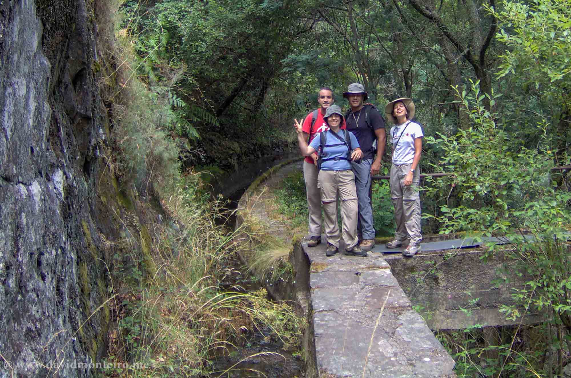
Hiking on the Lousã’s aqueduct, Portugal

Walking on the Lousã's aqueduct

Hiking on the Lousã’s aqueduct, Portugal

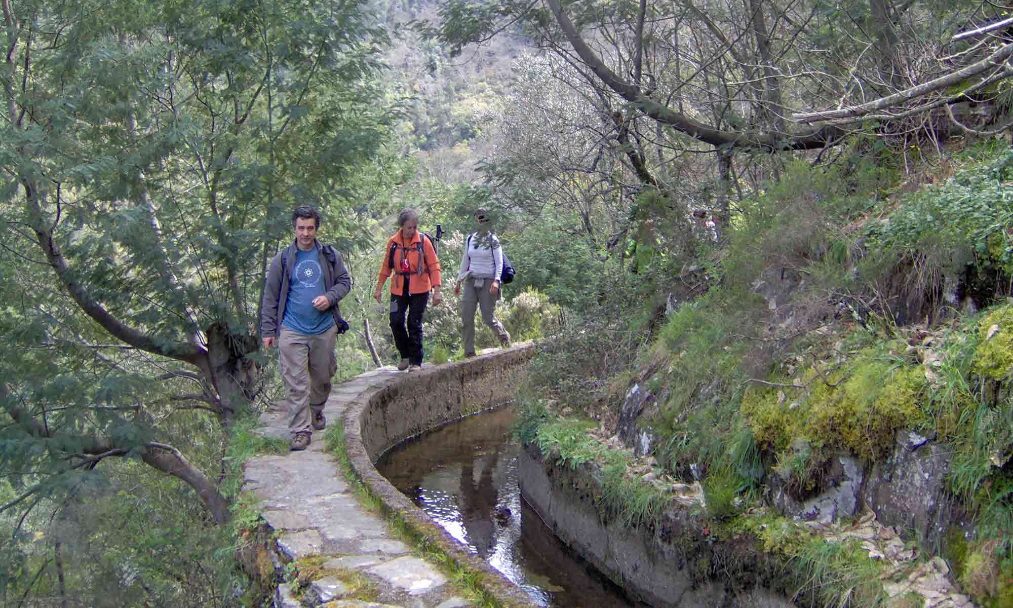
Near the town with the same name, while hiking on the Lousã’s aqueduct, you can enjoy yourself along a gorgeous valley.

Walking on the Lousã's aqueduct
Walking on the Lousã’s aqueduct

About the Lousã’s aqueduct

The Lousã Aqueduct, located in Portugal, has a rich history dating back to the 17th century.

It was constructed to supply water to the nearby city of Coimbra, serving as a vital resource for the local population.

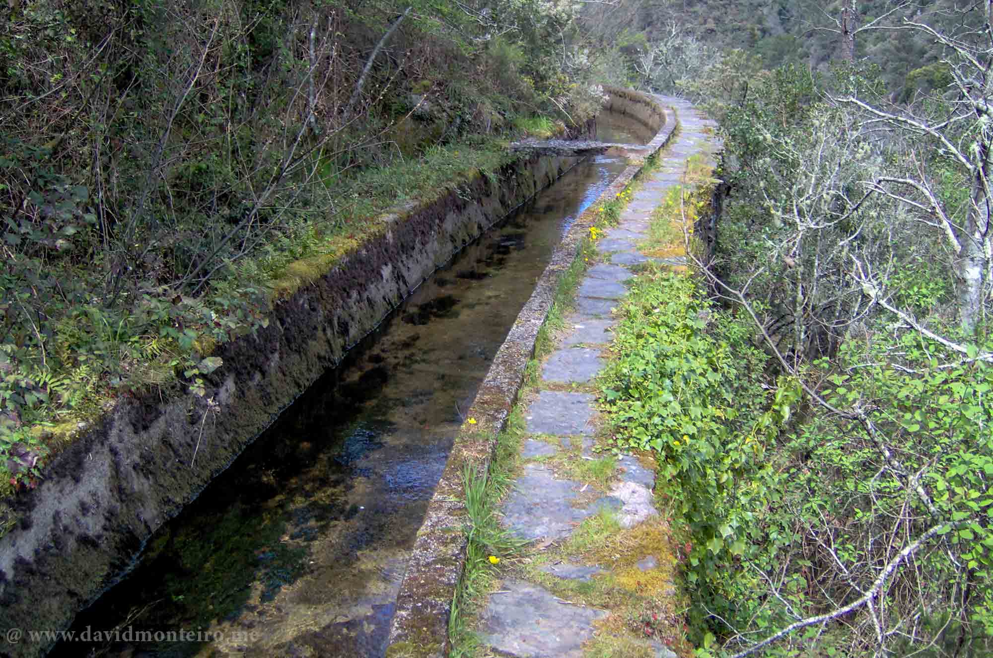
The aqueduct features an impressive channel spanning across the picturesque Lousã hills.

Over the years, it has undergone various renovations and maintenance efforts to preserve its historical significance and functionality.

Today, the aqueduct not only serves as a testament to the engineering prowess of its creators but also stands as a popular tourist attraction, offering visitors the opportunity to admire its architectural beauty and explore the surrounding landscape.

Lousã's aqueduct
Lousã’s aqueduct

About the walk

Enjoy a stroll along this picturesque two-mile aqueduct in the valley, immersing yourself in its scenic charm.

Accessing the aqueduct may pose some difficulty, but there are two potential ways to reach it:

      • From Senhora da Piedade (Lousã), you can embark on a single trail leading to the quaint village of Talasnal.
      • Upon arrival, indulge in the local delicacy, Talasnico cake, before descending the valley towards the aqueduct.
      • After a brief 150-meter trek, the path meanders through the bushes.
      • Continue downhill until the aqueduct comes into view, then follow it until reaching the trail leading back to the starting point.
      • You can access the aqueduct from the EN236 road at N40° 05.470′ W8° 12.814′.
      • Take a cab from Lousã to this location, locate the aqueduct entrance, and begin your walk back.

If you want to embark on this adventure or others like it, don’t hesitate to contact me.

Have fun.

David Monteiro

Hiking to Baleeira Beach, Sesimbra, Portugal

Hiking to Baleeira Beach

Hiking to Baleeira Beach, Sesimbra, Portugal

With a sea landscape as my backdrop, hiking to Baleeira Beach, offering the possibility of a swim in the ocean – it couldn’t be better.

This stroll provided me with an excellent photo opportunity and a much-needed distraction from my usual affairs.

Praia da Baleeira, situated between Sesimbra and Cabo Espichel, Portugal, is often touted as one of the secret beaches in the area.

While not exactly a secret, its somewhat elusive access means it remains relatively uncrowded.

Although the hike described here could be considerably shortened, the aim was also to propose a morning walk option.

Hiking to Baleeira Beach

Start at Espiga coffee shop

Park your car near the Espiga coffee shop at the entrance of Casais da Azóia.

Here, you can indulge in regional delicacies alongside the traditional Farinha Torrada cake. 

Fresh bread is always available, making it an ideal spot for a pre-walk coffee.

The suggested trail to and from the beach forms a semi-circle, utilizing both circular paths and the initial trail for the return journey.

Initially, you’ll traverse a dirt road passing by houses before encountering a footpath and denser vegetation as you approach the sloping beach access.

Be cautious: the trail becomes steeper in this area, requiring careful footing due to its technical nature.

It’s strongly advised to wear boots for better ankle support, as downhill sections feature gravel that can be challenging with walking shoes.

Additionally, bring sandals for swimming, as the beach consists of pebbles rather than sand.

One of the beach’s notable advantages is its southern orientation, providing shelter from northern winds.

Hiking to Baleeira Beach details

– Length: 5,5Km
– Elevation gain/loss: 220m (to both ways)
– Kind of terrain: dirt and gravel
– Average duration: 2 hours non-stop

Baleeira Beach walk map
Baleeira Beach hike map

If you want to embark on this adventure or others like it, don’t hesitate to contact me.

Have fun,
David Monteiro
Hike from Castelo de Vide to Marvão, Portugal

Walk from Castelo de Vide to Marvão

Hike from Castelo de Vide to Marvão: A Journey Through Portugal’s Scenic Alentejo

The hike from Castelo de Vide to Marvão is one of the most popular trails in Portugal’s Alentejo region.

This 11-kilometer route offers breathtaking landscapes, historical landmarks, and a glimpse into local traditions.

As you traverse ancient paths, you’ll connect with the area’s rich culture and natural beauty.

Here’s why this hike deserves a spot on your travel bucket list.

Walk from Castelo de Vide to Marvão

Where Does the Hike Begin?

The well-marked trail between Castelo de Vide and Marvão is straightforward to find, even for first-timers.

Starting in the charming village of Castelo de Vide, the route quickly transitions from cobbled streets to rural trails.

From there, the adventure unfolds across dirt paths, single tracks, and stone walkways that have endured for centuries.

Walking from Castelo de Vide to Marvão

Immersed in Nature Along the Trail

As you hike from Castelo de Vide, you’ll traverse fields, woodlands, and rolling hills that showcase the region’s pastoral charm.

Olive trees dominate the landscape, their silvery leaves shimmering in the sunlight.

Depending on the season, ripe black olives, a key ingredient in Alentejo’s renowned cuisine, may be available.

Persimmon trees are also abundant, their bright orange fruits adding color to the journey.

In the cooler months, arbutus trees—commonly known as madrones—decorate the path with striking red berries.

For those hiking in late December, wild mushrooms might surprise you along the way.

While their edibility is uncertain, they certainly add a magical touch to the scenery.

Fruit trees on the way from Castelo de Vide to Marvão

Captivating Views and Photography Opportunities

This hike offers some of the best views in Alentejo.

As you ascend from Castelo de Vide, the village and its iconic castle shrink into the distance, creating postcard-worthy panoramas.

The approach to Marvão is equally impressive, with its fortress perched dramatically atop a quartzite monolith.

Throughout the trail, rural homes and rustic scenes beckon photographers.

From the gentle play of light on olive groves to picturesque chapels, every turn offers a frame-worthy moment.

Mushrooms
Mushrooms

A Chapel Worth a Stop

Near the end of your hike, as you draw closer to Marvão, you’ll find the Chapel of Santa Maria de Marvão.

This quaint and peaceful spot is ideal for taking a break and enjoying a snack.

It’s a perfect moment to pause, reflect, and soak in the serene surroundings before continuing to Marvão’s castle.

A Taste of Local Culture: Don’t Forget Your Snack

It’s essential to pack snacks and water before embarking on the hike, as there are no stores along the route.

A popular local treat to bring is boleima, a simple yet delicious cake native to the region.

Traditionally made with leftover bread dough, olive oil, sugar, and cinnamon, boleima is a satisfying way to fuel your journey.

Boleima
Boleima

Discovering Cork Oaks

As you hike through this part of Alentejo, you’ll notice majestic cork oaks dotting the landscape.

These remarkable trees are a vital part of Portugal’s heritage, providing the cork for everything from wine stoppers to eco-friendly products.

Trail Details: What to Expect

The hike from Castelo de Vide to Marvão spans approximately 11 kilometers.

With 570 meters of ascent and 320 meters of descent, the trail offers moderate challenges suitable for most hikers.

It is well-signposted, making navigation straightforward, even for those new to the area.

Why Hike from Castelo de Vide to Marvão?

This hike combines natural beauty, cultural discovery, and historical intrigue.

From the olive groves and cork oaks to the medieval allure of Castelo de Vide and Marvão, every step immerses you deeper into the Alentejo’s soul.

Ready for the Adventure?

If you’re seeking an unforgettable hiking experience, this trail is an excellent choice.

For guided tours and expert tips, feel free to contact me.

Let’s explore the magic of the Alentejo together!

Embark on the hike from Castelo de Vide to Marvão and create lasting memories in one of Portugal’s most scenic regions.

Have a good time.

David Monteiro

Hiking in Belver, Portugal

Belver, Alentejo, Portugal

Hiking in Belver, Portugal

Hiking in Belver is an enjoyable experience. It offers a chance to explore a lesser-known path that feels like a hidden gem.

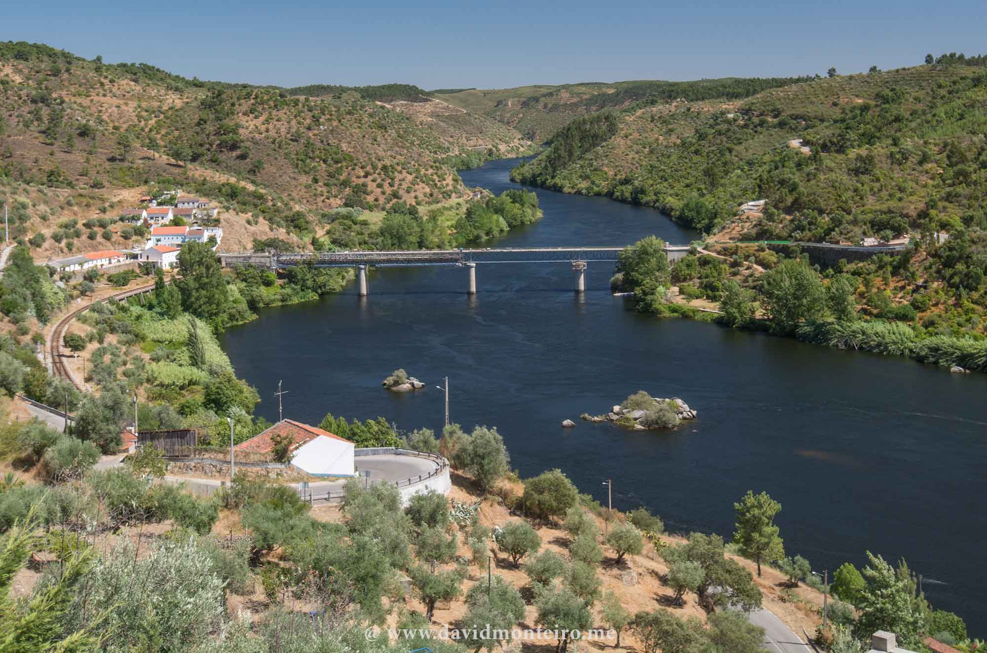
Belver, situated on the right bank of the Tagus River, is a small parish in Alentejo, falling under the jurisdiction of the District of Portalegre.

Belver with a view over the River Tagus

Despite its numerous attractions, Belver receives minimal promotion and is seldom mentioned on social networks.

This lack of recognition perplexes me, as I believe it holds the potential to become a more frequented destination.

The town boasts a variety of attractions that should garner more attention and visitors.

Alamal river beach
Alamal river beach

Some reasons to visit Belver:

While I aim not to exhaust the reasons to visit Belver with this list, I do wish to highlight several compelling points that justify at least a day trip:

    1. Proximity to Lisbon:
      • Belver is a mere 1 hour and 30 minutes drive from Lisbon, making it easily accessible for a day excursion.
      • Overnight stays are great for a more immersive experience.
    2. Scenic Train Journey: Although the train journey from Lisbon takes three or more hours, the picturesque route along the Tagus River makes it worth the trip.
    3. Photogenic Setting: Belver boasts captivating scenery, offering ample opportunities for stunning photography.
    4. Points of Interest: Notable attractions include Belver’s Castle and the Penedo Gordo’s cromlech, adding historical and cultural depth to the visit.
    5. Loop Hiking Trail: A 17 km loop trail allows exploration of various points of interest in Belver’s vicinity, ideal for outdoor enthusiasts.
    6. Alentejo Gastronomy: Indulge in the rich culinary delights of Alentejo, reflecting the region’s gastronomic heritage.
    7. Alamal River Beach: Relax and enjoy the tranquil waters of the Tagus River at Alamal River Beach.
    8. Vulture Colony Visit: Explore the opportunity to observe a vulture colony residing along the banks of the Tagus River.
    9. Authentic Accommodations: Experience the charm of typical Alentejo accommodations, immersing yourself in the local culture and hospitality.

These are undoubtedly sufficient reasons for visiting Belver.

Belver's castel
Belver’s Castel

Feel free to contact me if you’re interested in experiencing this adventure or any other from my repertoire.

Enjoy your day.

David Monteiro

Douro Valley hiking trail between Pinhão and Provesende, Portugal

Treveling to the Douro Valley during the fall.

Douro Valley hiking trail between Pinhão and Provesende, Portugal

Contrary to our initial expectations, the task of locating a predefined hiking trail in the Douro Valley proves to be a notably challenging endeavor.

Two significant factors contribute significantly to this challenge:

    • Firstly, the majority of these spectacular areas are privately owned, limiting accessibility.
    • Secondly, the breathtaking steep terrains, though aesthetically pleasing, prove to be unsuitable for leisurely walks.

Nevertheless, a fortuitous alignment of circumstances has fortuitously led to the creation of an enchanting hiking trail connecting Provesende to Pinhão via São Cristóvão.

Embark on this captivating trail for an intimate and up-close stroll through the renowned vineyards, representing a true highlight of the Douro Valley.

As you traverse this mesmerizing landscape, seize the opportunity to capture breathtaking photographs reminiscent of those prominently featured in tourist catalogs, showcasing the UNESCO-designated World Heritage Site.

Adding further allure to this scenic journey, various fruit trees, particularly fig and quince, strategically adorn different points along the way, enhancing the overall experience.

As you approach Pinhão from Provesende, the upper part of São Cristovão unfolds, with majestic almond trees gracefully lining the route.

Casa do Santo and phylloxera 

While local brochures meticulously detail the points of interest in Provesende and Pinhão, one standout gem is Casa do Santo.

Casa do Santo, an 18th-century marvel owned by Joaquim Pinheiro de Azevedo Leite Pereira, carries profound historical significance.

In the 1870s and 1880s, Pereira played a pivotal role in a group of researchers who ingeniously discovered a method to combat the spread of phylloxera in Europe.

The Casa stands as a testament to both architectural grandeur and a pivotal chapter in viticulture history.

In a nutshell, phylloxera wreaked havoc on European wine production in the late 19th century, marking a critical turning point in viticultural history.

The walking trail

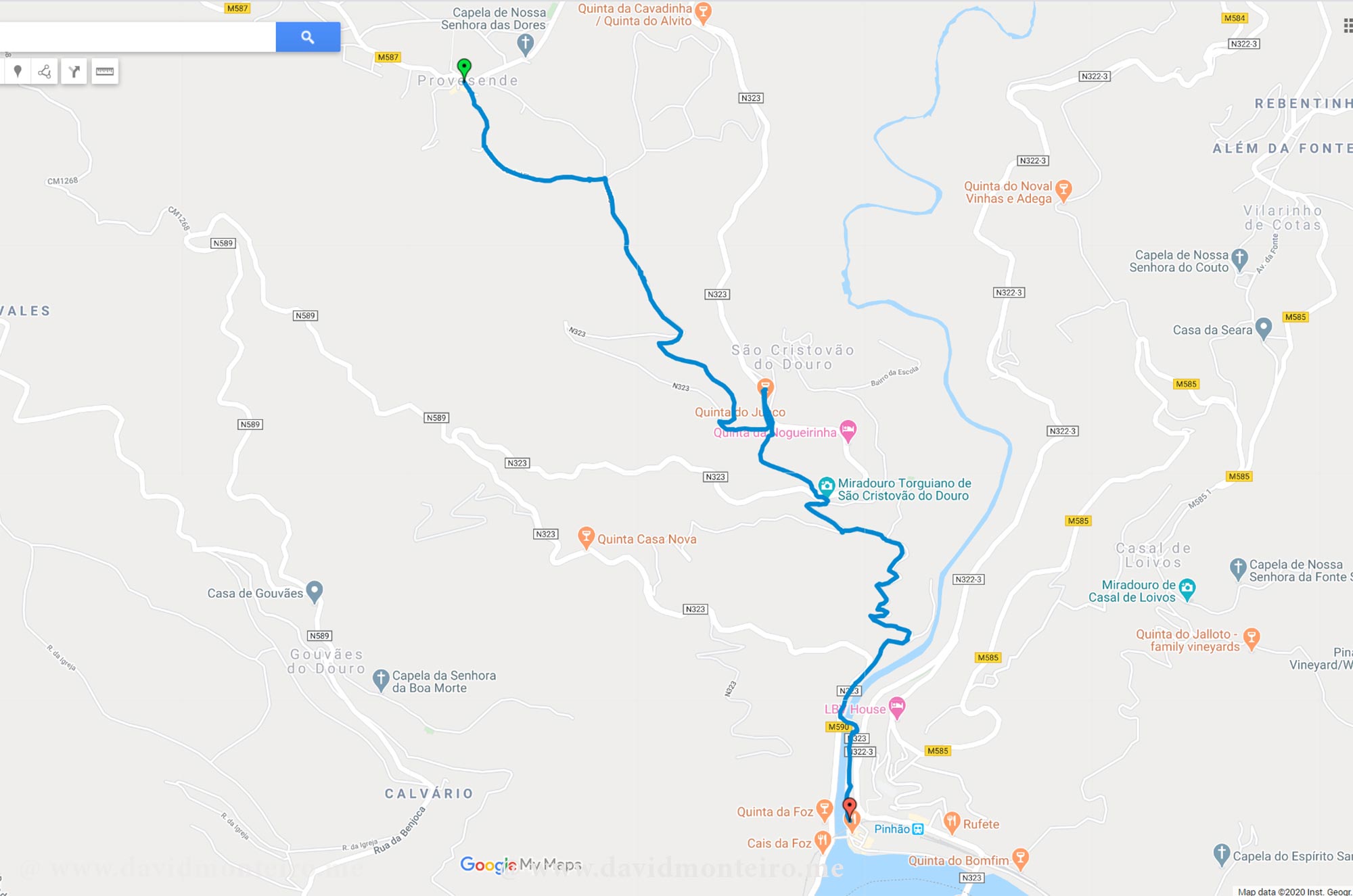
The trail, categorized as a crossing, facilitates traversal from Provesende to Pinhão or vice versa, providing a flexible exploration option.

Despite my inclination towards uphill walks, in this particular case, descending from Provesende to Pinhão offers a visually stunning experience, with the majestic Douro River in constant view.

Commence your trail exploration in Provesende, starting on the right side facing the church.

For those seeking more detailed information, it is highly advisable to consult the Provesende tourist information office.

Exercise caution, particularly in São Cristóvão after rain, as surfaces may become slippery.

Walk attentively and consider using walking poles for added stability during your enchanting journey.

Hiking trail from Provesende to Pinhão, Douro Valley, Portugal

Douro wine villages

Provesende is one of six wine villages in the Douro, potentially appealing for future visits.

For more information about the Douro Wine Villages, press here.

Have fun,

David Monteiro

Please check here for more information and check the map bellow.

Hiking from Minas de São Domingos to Pomarão, Portugal

Walking from Minas de São Domingos to Pomarão

Hiking from Minas de São Domingos to Pomarão, Portugal

To experience hiking from Minas de São Domingos to Pomarão is an unforgettable moment. 

Please access here to learn more about Minas de São Domingos.

Hiking from Minas de São Domingos to Pomarão
Hiking from Minas de São Domingos to Pomarão is an unforgettable experience

Mina de São Domingos’s railroad

They constructed the railway to help transport goods from Minas de São Domingos to Pomarão, a village situated on the banks of the Guadiana River, where ships could easily dock.

The method of transporting the immense production of the mines using animals had become impractical.

The builders constructed the railway line known as the “Ramal de São Domingos,” which may have been the second railway line ever built in Portugal.

However, it always remained isolated from the rest of the Portuguese train network.

In 1862, the Minas de São Domingos railway line was inaugurated, but it was closed in 1965 when the production of the mines ceased.

Minas de São Domingos hiking trail
Minas de São Domingos hiking t trail

Hiking t from Minas de São Domingos to Pomarão

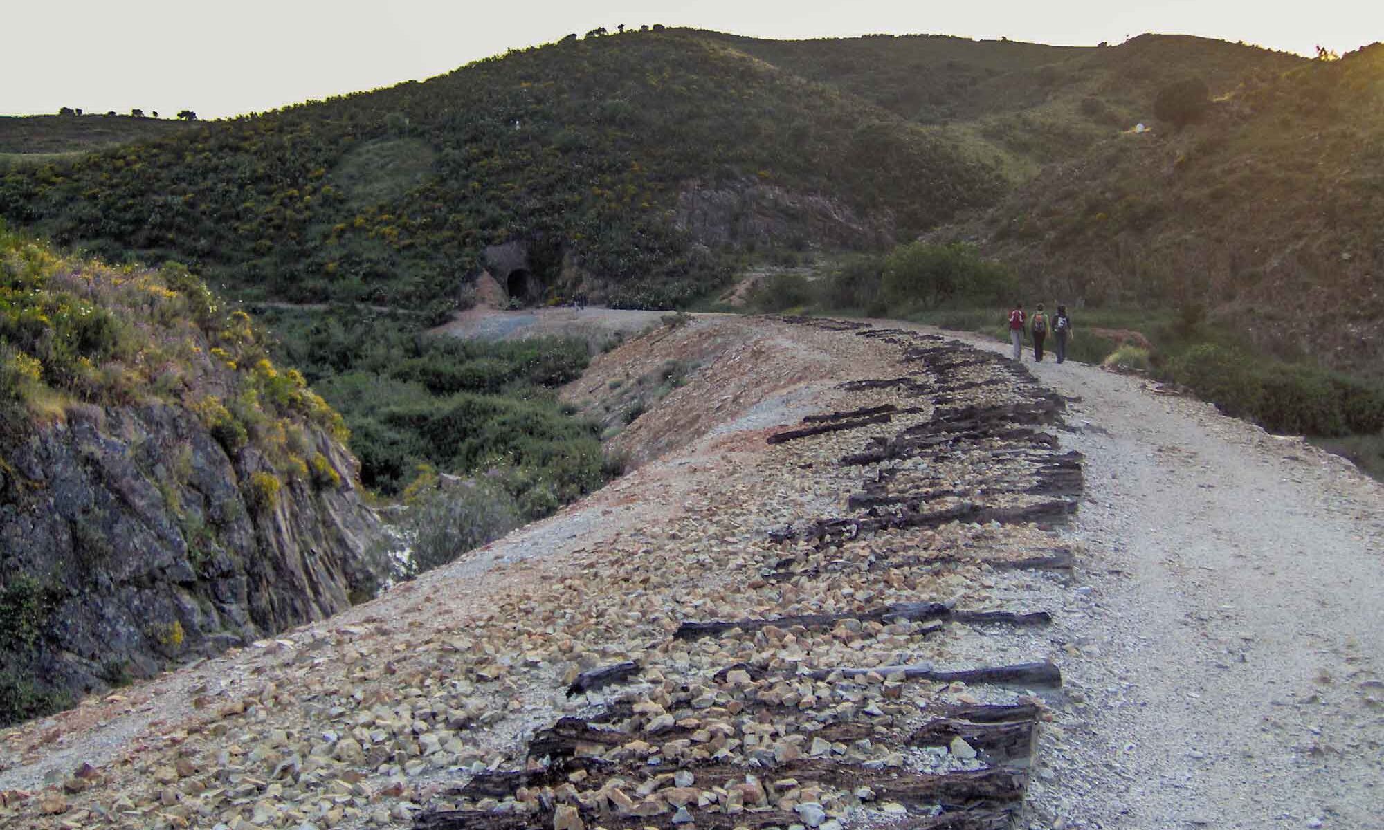
Later, authorities removed the railway lines and the “sulipas” (the wooden parts connecting the train lines), leaving behind an excellent hiking trail.

For security reasons, they dynamited various small bridges, creating the only minimum difficulty of this journey.

To overcome these obstacles, hikers must descend and then ascend short slopes.

The walk, which always follows the old railway line route, passes through various tunnels.

The exact number of tunnels escapes my memory.

The last tunnel is the longest, necessitating the use of personal light sources such as flashlights or headlamps.

While many descriptions of this path typically identify it as approximately 17 km long, my experience differs.

I typically add another 3.5 km to this figure as I explore the village before embarking on the hike, making the total distance 20.5 km.

With an elevation gain of 180m and a loss of 320m, it can be described as an almost flat or slightly descending route towards Pomarão.

Some precautions

Please avoid hiking this path during the summer as the temperatures can become excessively high.

My preferred times of the year are spring or autumn, almost reaching winter.

It’s advisable to bring water and some food with you as there are no places to resupply along the route.

Come along for an unforgettable hike with me

Feel free to contact me if you’re interested in experiencing this adventure or any other from my repertoire.

Have fun.

David Monteiro

Hiking the Peneda Trail at Geres National Park

Hiking the Peneda Trail at Geres National Park, Portugal

Hiking the Peneda Trail: A Journey Through Wild Beauty

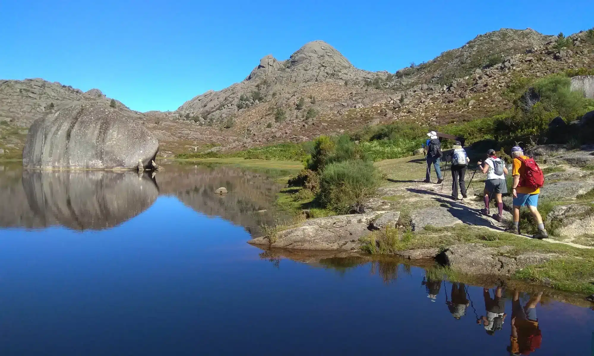
The Peneda Trail is an extraordinary representation of the hiking routes within the Peneda-Gerês National Park.

Its circular path makes it convenient to begin at any point, but starting and ending in Peneda is the most popular choice.

This 9 km trail (or 10 km with an extended option) boasts a cumulative elevation gain of 900 meters, offering hikers a mix of challenge, stunning views, and untamed nature.

Hiking the Peneda Trail at Geres National Park, Portugal

Start Strong: Facing the Trail’s Toughest Climb

Beginning the hike in Peneda means tackling the most demanding section right away.

This steep ascent covers roughly 300 meters of elevation gain early in the route.

Experienced hikers will find this climb rewarding, especially when done steadily. As the saying goes, “Every step takes you closer to the view.”

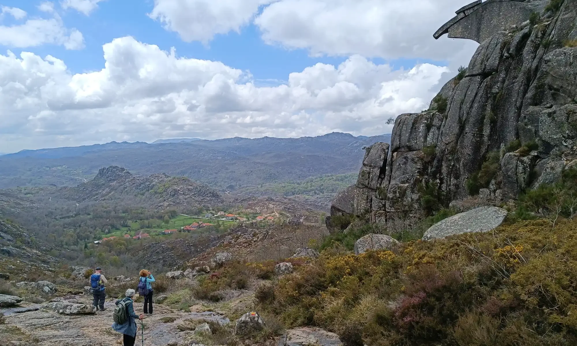
The reward for conquering this challenging section is unparalleled: a panoramic vista of the Penedo River Valley.

Tiny villages dot the landscape, appearing like mere specks on a map from this vantage point.

Hiking the Peneda Trail at Geres National Park, Portugal

The Plateau: A World of Isolation and Untamed Beauty

The trail transitions to a plateau once the climb is behind you, offering a profound sense of solitude. 

This wild expanse is home to grazing livestock, including freely roaming wild horses and mountain goats. 

The plateau encapsulates the raw beauty of the Peneda-Gerês National Park, a place where nature rules with striking force.

A vivid memory from this area highlights its untamed nature. 

While hiking here, one might encounter evidence of the circle of life, such as the remains of a foal likely hunted by wolves—the park’s only apex predators capable of challenging horses. This raw encounter reminds hikers of the park’s wild and untamed spirit.

Hiking the Peneda Trail at Geres National Park, Portugal

Unmissable Highlights Along the Peneda Trail

Hiking the Peneda Trail rewards adventurers with breathtaking sights. Here are some of the must-see features:

    1. The Spectacular View During the Climb: The initial ascent offers unmatched vistas of the valley below.
    2. The Stone Bridge: Found shortly after the challenging climb, this single stone structure adds charm to the journey.
    3. Chã do Monte Dam: This tranquil spot invites hikers to pause and soak in the serene atmosphere.
    4. The Penameda Summit: The trail doesn’t pass directly through this spot, but you can enjoy a close-up view from nearby.
Hiking the Peneda Trail at Geres National Park, Portugal

Shortcuts and Accessible Sections

While the complete trail is a thrilling adventure, not all hikers may wish to complete the full circuit.

Luckily, a few sections of the Peneda Trail run near roads accessible by car.

These shortcuts allow one to experience the trail’s highlights without committing to the entire journey.

These access points are particularly useful for those looking to adapt the hike to their abilities.

Hiking the Peneda Trail at Geres National Park, Portugal

Essential Tips for Hiking the Peneda Trail

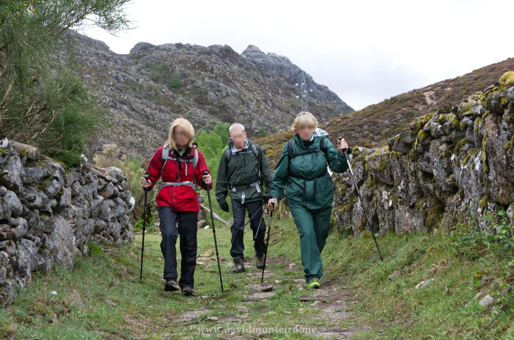
This is a true mountain hike, whether you cover the full distance or explore only a portion. To ensure a safe and enjoyable experience, keep these essential tips in mind:

    • Wear sturdy, comfortable hiking boots suitable for uneven terrain.
    • Use Hiking Poles: They’ll help with balance and reduce strain on steep inclines.
    • Carry sufficient water and snacks, as the trail traverses remote areas without facilities.
    • Check the weather forecast before setting out, as conditions can change rapidly in the mountains.
    • Pack essentials such as a map, compass, or GPS device to stay on track.
    • Start early to allow plenty of daylight for completing the trail at a relaxed pace.
    • Inform Someone of Your Plans: Always let someone know your itinerary before setting out.
    • Respect Nature: Leave no trace to preserve the trail’s pristine beauty.

Hiking the Peneda Trail: A Wild Adventure Awaits

The Peneda Trail offers a rare combination of challenge, beauty, and wilderness.

Whether you’re an experienced hiker seeking an exhilarating ascent or a nature enthusiast eager to connect with untouched landscapes, this trail has something for everyone.

From the breathtaking climb to the plateau’s isolation and the unforgettable sights along the way, hiking the Peneda Trail promises an experience that stays with you long after you’ve returned home.

Prepare well, embrace the adventure, and discover the untamed heart of the Peneda-Gerês National Park!

David Monteiro
Hiking in Castro Laboreiro: Discover the Hidden Gem of Gerês National Park

Hiking in Castro Laboreiro - Peneda Geres National Park - Portugal

Hiking in Castro Laboreiro: Discover the Hidden Gem of Gerês National Park

Experience the Charm of Hiking in Castro Laboreiro
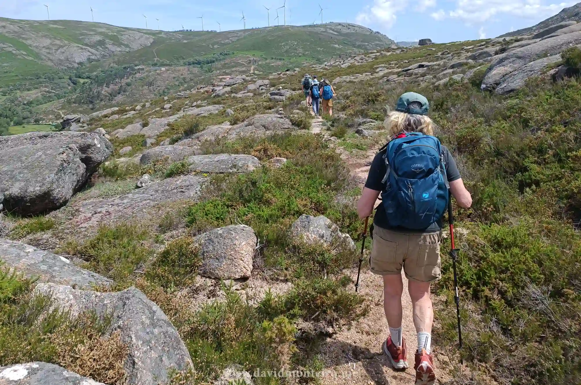
Hiking in Castro Laboreiro takes you into one of Portugal’s most remote and well-preserved regions. 
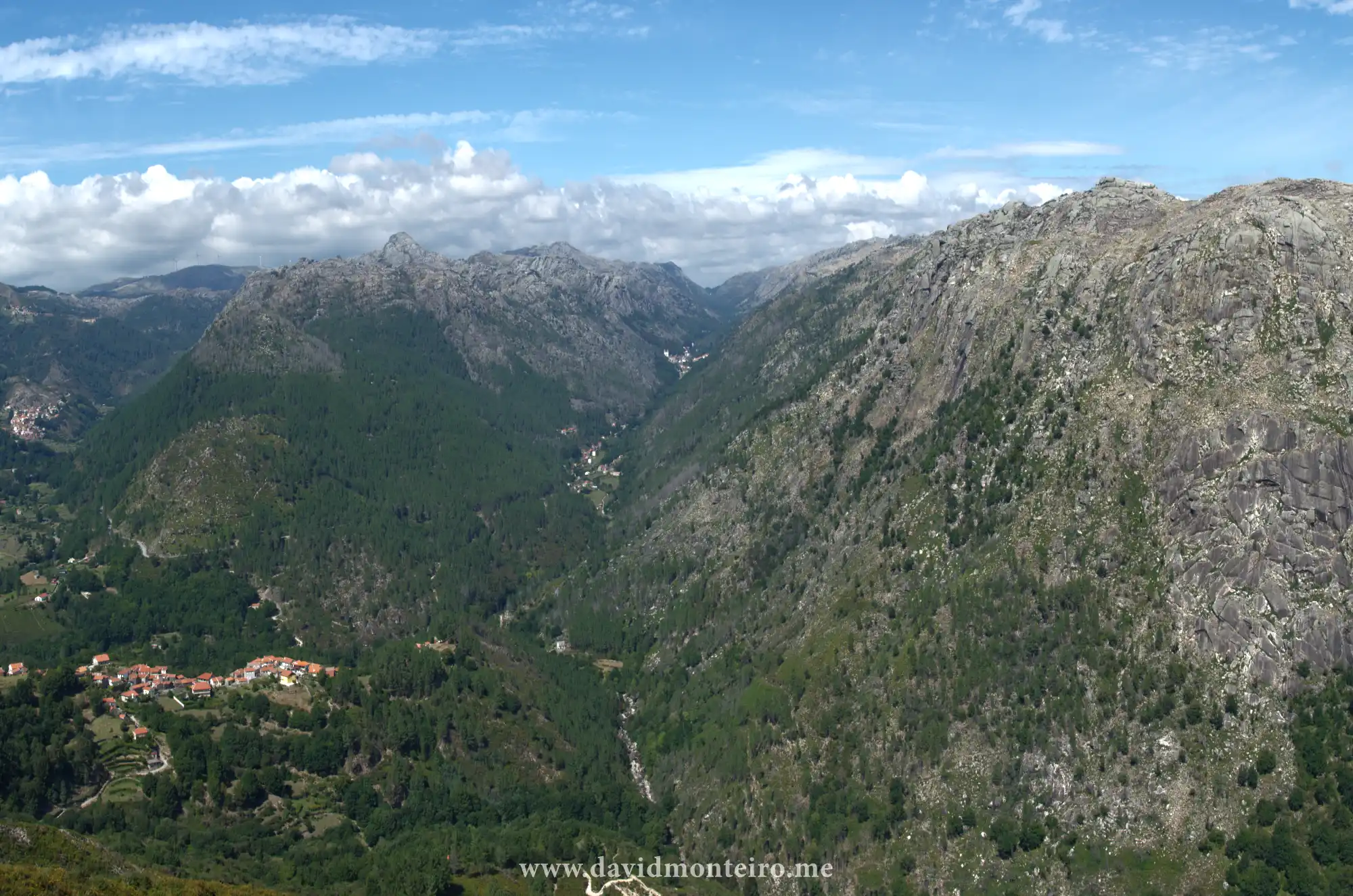
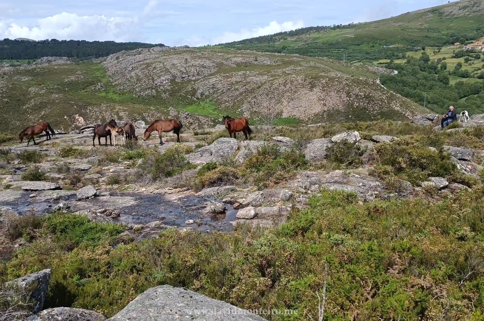
Nestled within the Peneda-Gerês National Park, this quaint village and its surroundings offer an extraordinary blend of natural beauty, cultural heritage, and challenging trails. 

Whether you’re an avid hiker or a curious traveler, Castro Laboreiro promises an unforgettable experience.

Hiking in Castro Laboreiro - Peneda Geres National Park - Portugal
Hiking in Castro Laboreiro – Peneda Geres National Park – Portugal

A Village Steeped in Tradition

Located on the Peneda side of the Peneda-Gerês National Park, Castro Laboreiro is a rural community with just over 500 residents. 

Known for their warmth and hospitality, the locals are always eager to share stories about their land. 

Although the village feels like the end of the road, its allure lies precisely in its remoteness and authentic charm.

Despite being within a national park, Castro Laboreiro includes private properties and historical monuments. 

This unique coexistence reflects the area’s deep-rooted history and adherence to regulations that protect its natural and cultural heritage.

Conquer the Castrejo Trail: A Hiker’s Dream

The Castrejo Trail, marked as PR3 MLG, is a must for adventure seekers. 

Spanning approximately 17 kilometers, or 10,5 miles, with a cumulative elevation gain of 900 meters (2950 feet), this trail presents a challenging but rewarding hike.

On a difficulty scale of 1 to 5, it earns a solid 4, thanks to its mix of rocky, slippery, and muddy terrain combined with steep ascents and descents.

If the entire route feels daunting, don’t worry! Many sections of the trail are accessible by car, allowing you to tailor the hike to your fitness level or time constraints. 

The path primarily follows ancient shepherds’ tracks, offering stunning views of Castro Laboreiro and its surrounding landscapes.

Hiking in Castro Laboreiro - Peneda Geres National Park - Portugal
Hiking in Castro Laboreiro – Peneda Geres National Park – Portugal

Highlights of the Castrejo Trail

Hiking in Castro Laboreiro is enriched by its many scenic and cultural landmarks, including:

    • Castro Laboreiro Village: A picturesque stop to immerse yourself in local life.
    • Charco de Gontamil: A serene natural pond perfect for reflection.
    • Cava da Velha’s bridge or New Bridge: Historic stone bridges that exude old-world charm.
    • Ponte de Assureira and Ermida de São Brás: A beautiful blend of natural and spiritual significance.
    • Bico do Patelo: An extraordinary rock formation.
    • Castro Laboreiro Castle: A medieval fortress steeped in history, rewarding your climb with panoramic views.

Tips for a Safe and Enjoyable Hike

To make the most of your hiking adventure, follow these practical suggestions:

    • Wear Sturdy Hiking Boots: The trail’s rocky and uneven surfaces demand proper footwear.
    • Use Hiking Poles: They’ll help with balance and reduce strain on steep inclines.
    • Bring Weather Gear: The mountain climate is unpredictable, so carry a jacket or raincoat.
    • Pack Essentials: Water, snacks, and a fully charged mobile phone are vital.
    • Inform Someone of Your Plans: Always let someone know your itinerary before setting out.
    • Respect Nature: Leave no trace to preserve the trail’s pristine beauty.

Why You’ll Love Hiking in Castro Laboreiro

The Castrejo Trail stands out not only for its rugged beauty but also for the warmth of its people and the sense of stepping into a simpler, untouched world.

The juxtaposition of serene mountain landscapes and the vibrant local culture creates a unique hiking experience that lingers in your heart long after you leave.

Embark on an adventure that combines natural splendor, historical intrigue, and heartfelt hospitality. 

Hiking in Castro Laboreiro offers all this and more, making it a top destination for nature lovers and thrill-seekers alike. 

Plan your journey today and experience the magic of Gerês National Park like never before!

David Monteiro