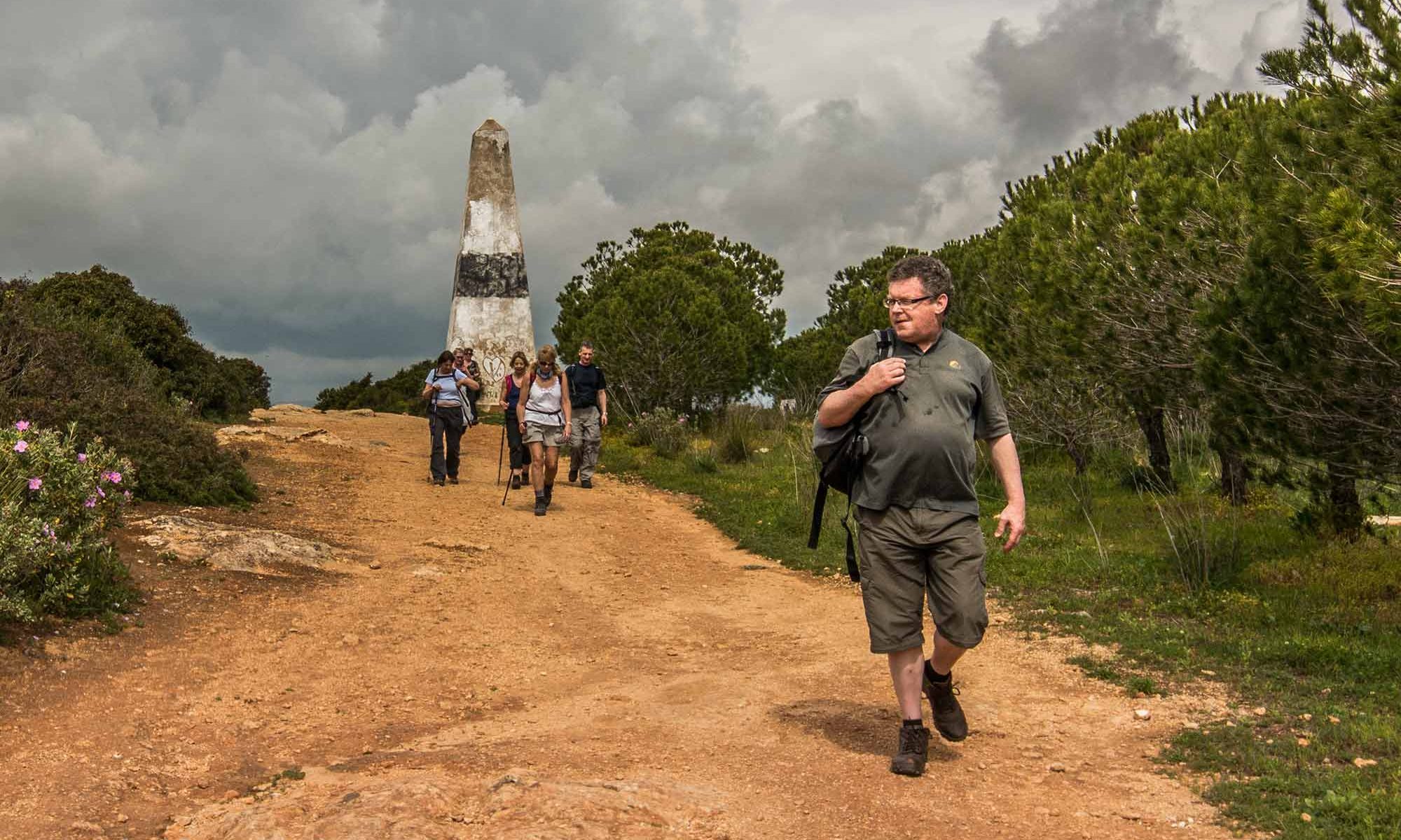
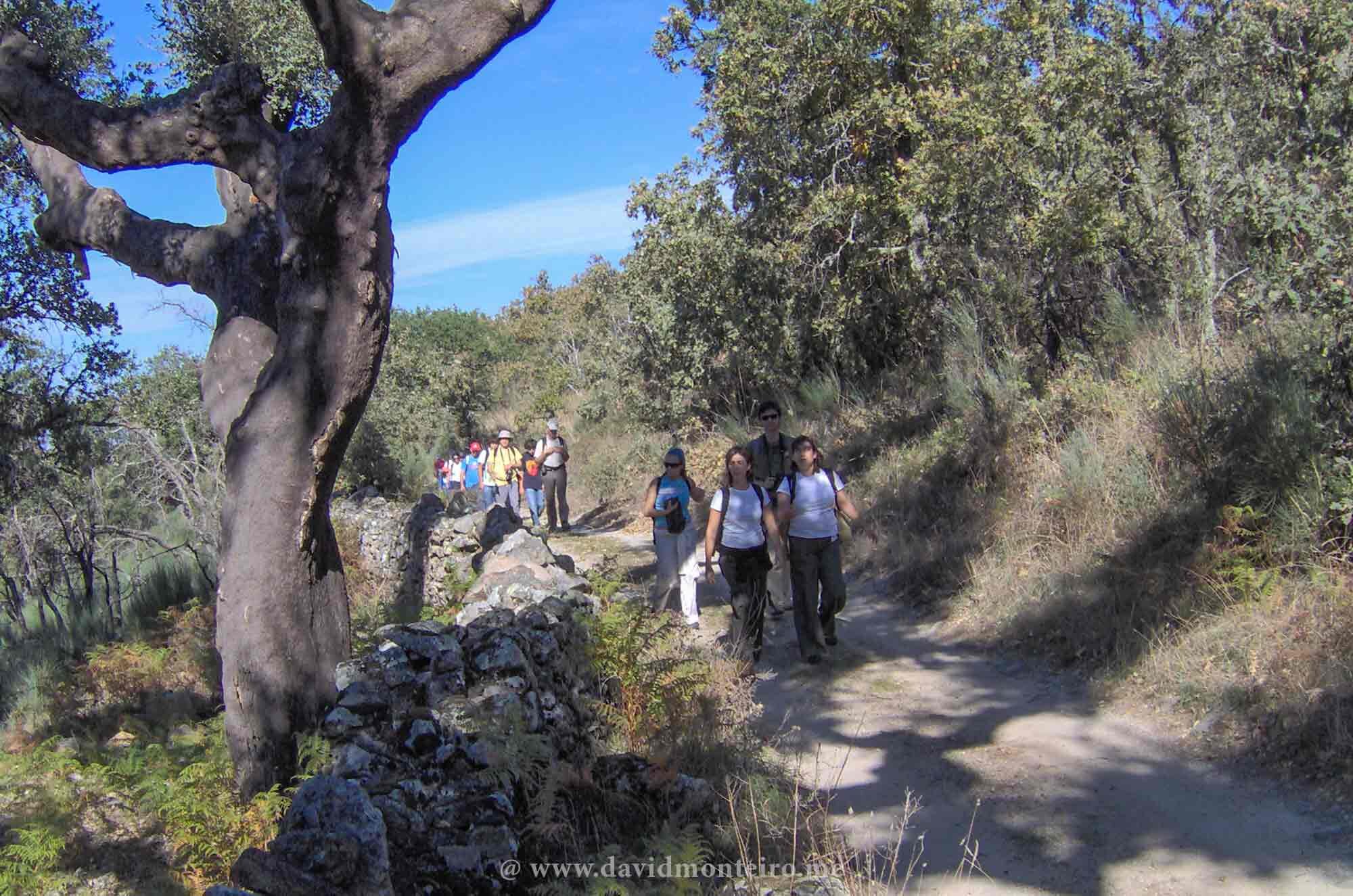
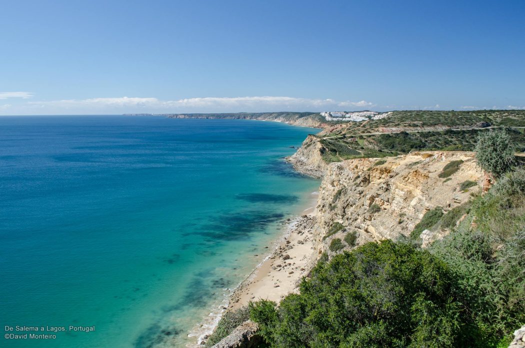
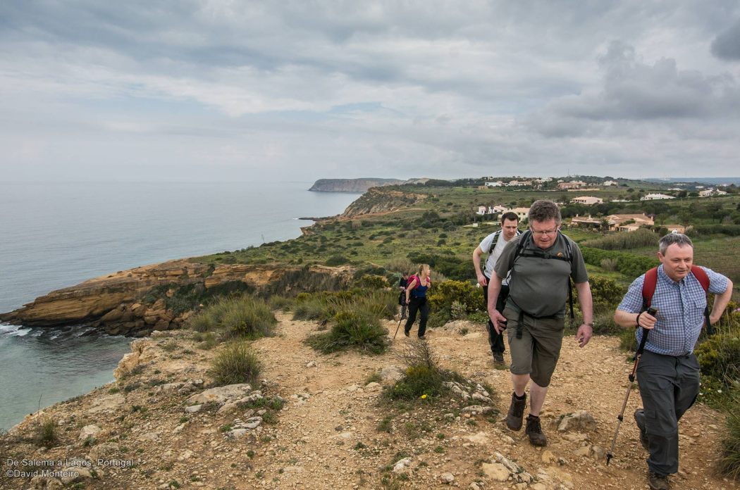
A perfect hiking trail runs from Burgau to Salema along the coast, which can be combined with the Lagos/Burgau trail described here.
The terrain resembles that detailed in the above article, with the sea forming the backdrop.
Why opt for this route?
The reasons are straightforward:
Burgau Beach
A small fishing beach boasts magnificent white sand.
Within the boundaries of the Natural Park of Southwest Alentejo and Costa Vicentina, it experiences less urban pressure, resulting in greater vegetation cover.
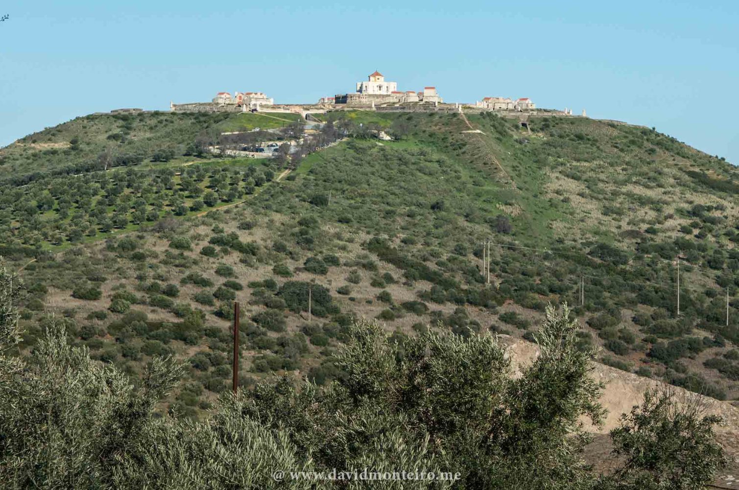
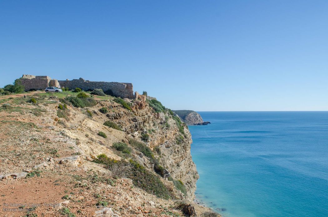
We have the photographic landscape of Ponta da Almadena
While not constituting a cape, it extends as an arm of land into the sea, affording us a broad, unobstructed view.
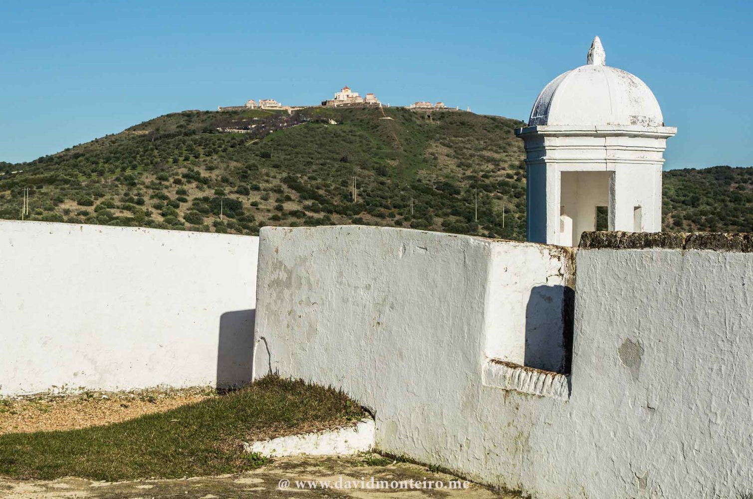
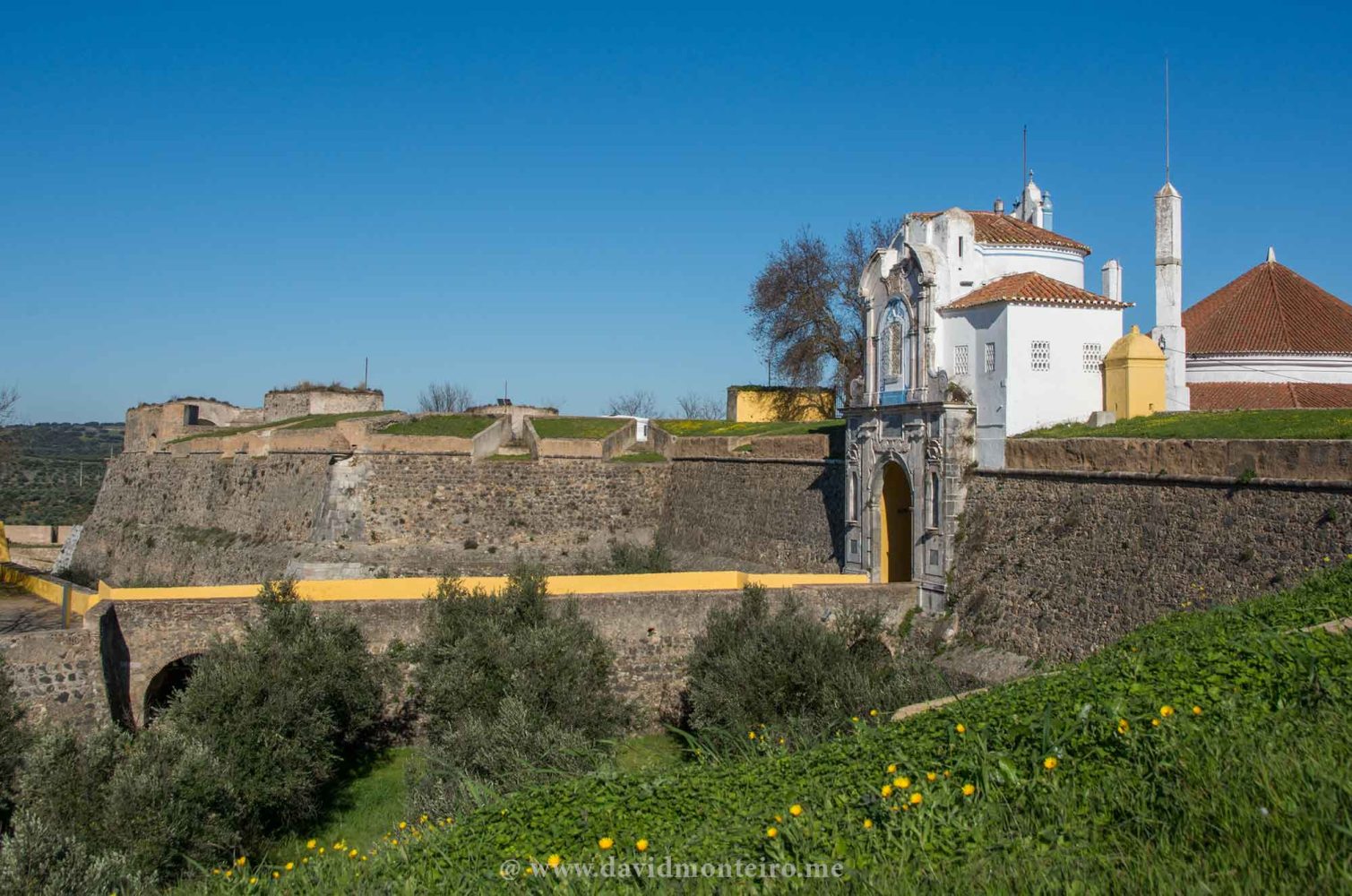
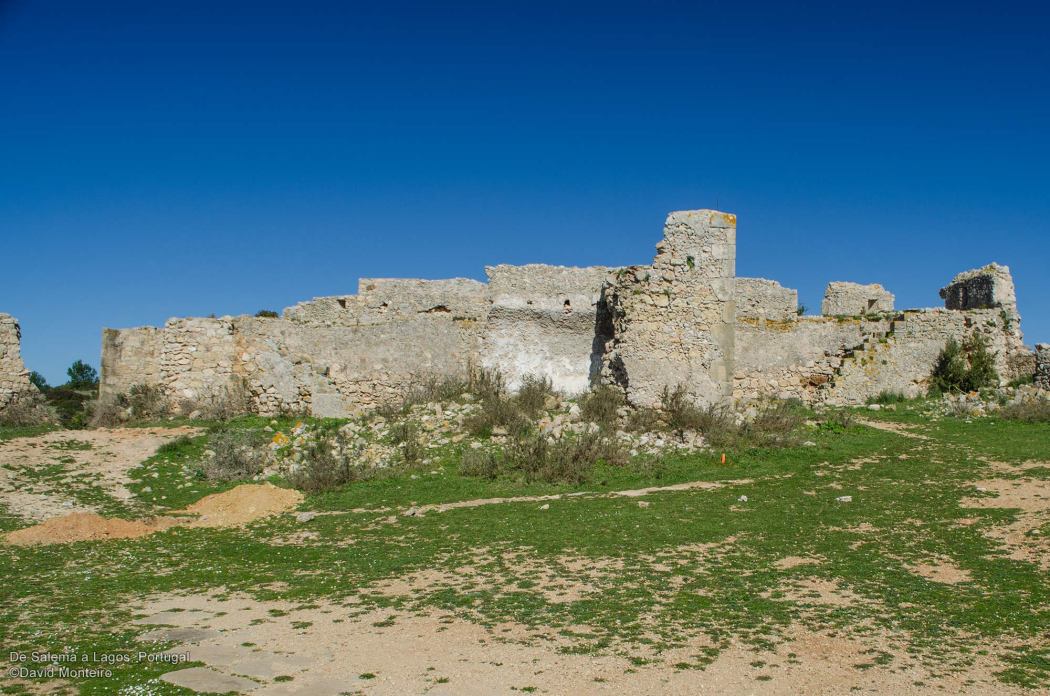
Almadena Fort
It extends as an arm of land into the sea, providing us with a wide-open view, despite not being a cape.
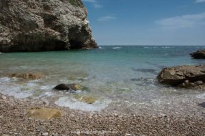
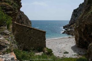
Boca do Rio
Today, it remains a quiet beach, yet it once served as a “Roman villa,” and traces of this ancient settlement still linger there.
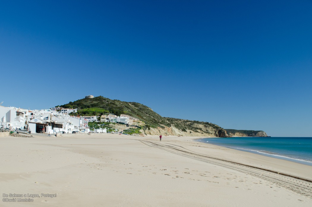
Salema beach
A very family-friendly ambiance characterizes this typical small fishing beach.
As mentioned earlier, this trail is suitable for those unaccustomed to hiking.
When combined with the Lagos/Burgau trail, it becomes an excellent option for those who regularly engage in hiking.
Hiking from Cape Girao to Lido, passing through Câmara de Lobos, enables us to explore various locations in Madeira with the tranquility afforded only by hiking.
Cape Girão, Madeira, Portugal
Hiking from Cape Girao
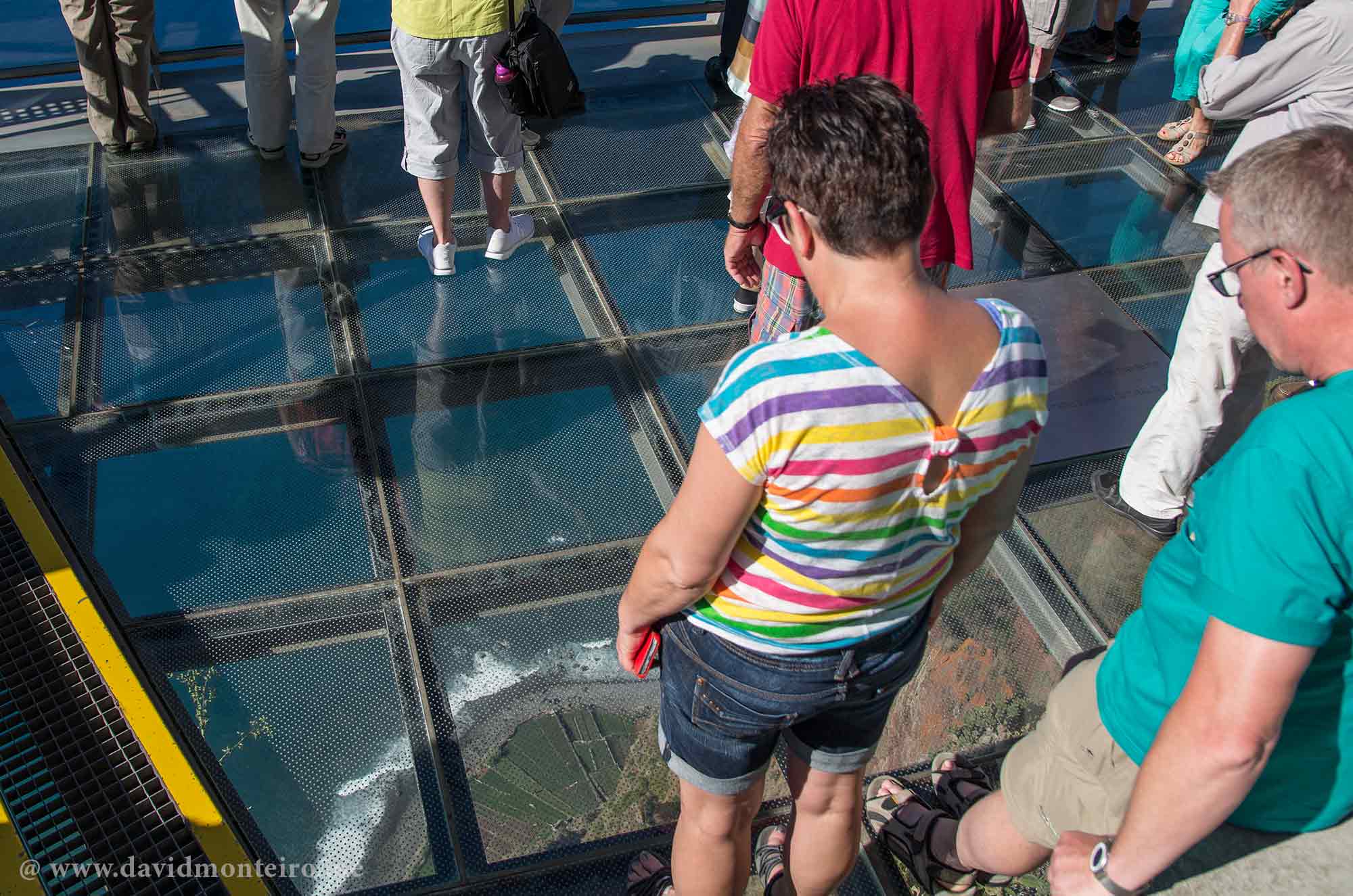
Some sites claim that Cabo Girão stands about 580m high, making it the tallest cape in Europe.
Being there, I can readily believe it.
On the glass platform, as we peer down at the small fajãs below, we feel as though we’re hovering—except for the set of dots printed on the glass, which completely spoils that sensation.
Okay, I understand; many people need those dots to alleviate their vertigo.
While these dots exist to mitigate the feeling of vertigo, I believe they also detract from the platform’s intended purpose.
Nevertheless, a visit is still worthwhile.
Hiking from Cape Girao starts here
Right here is where this walk begins, leading us down to the bathing area of the Lido.
It’s a 9.5 km trek, primarily downhill, quite demanding on the legs.
Following the coastline mainly, this route entails a 650m elevation loss.
The journey commences by guiding us along the Caminho Velho do Rancho, as mentioned in another text.
While it provides an excellent start, the remainder of the walk is no less appealing.
Câmara de Lobos
If Câmara de Lobos is on your list of places to visit in Madeira, then this hike offers an excellent means to accomplish that goal.
During this walk, you’ll traverse through Câmara de Lobos on foot, and like myself, you may choose to pause there for lunch.
Explaining the origin of the name Câmara de Lobos, we can refer to the town’s website:
“In 1419, precisely on July 1st, João Gonçalves Zarco and Tritão Vaz Teixeira anchored at Madeira Island, in the Machico area. Upon their arrival on Madeira Island, they began exploring the southern region. On the first day of exploration, they reached this land, which they named Câmara de Lobos due to the abundant presence of sea lions on the south coast.”
In Portuguese, “Câmara de Lobos” translates to an area, bay, or chamber with wolves.
Also in Portuguese, sea lions are called sea wolves, hence the idea of a sea lion chamber.
The numerous bars and restaurants in Câmara de Lobos offer us the opportunity for lunch, with a variety of options to choose from.
You can indulge in your meal at one of these establishments.
Additionally, a wooded area near the fishing port provides a chance for a brief respite in the shade, perhaps enjoying your sandwich while gazing out at the sea. You’ll find a water faucet there, and the water is potable.
Walkway along the sea, near Câmara de Lobos
Towards Formosa Beach
A pathway stretches along the coastline from here to the Formosa Beach area, offering a peaceful and highly picturesque stroll with the sea always to our right.
Praia Formosa, Madeira, Portugal
At the onset of Praia Formosa (Formosa Beach), public restrooms are available.
Given its status as a beach area, if you’ve brought bathing gear, you might also enjoy some time on the beach.
Available restaurants
Immediately beyond this point, you’ll encounter an area with several excellent beachside restaurants.
To cater to all tastes, as we say in Portugal, there are two very distinct restaurants available.
One of the restaurants boasts a more sophisticated appearance, featuring modern design and meticulously presented dishes.
In contrast, the other restaurant offers a more approachable atmosphere, with ample terrace seating and, in my opinion, a selection of more authentic options.
Honestly, the first restaurant failed to impress me. Its menu seemed contrived, overly geared towards tourists… not my cup of tea.
The second restaurant, while somewhat modest, exuded a clean and sincere charm.
Upon perusing its menu, I was pleased to find a range of local options tailored to the tastes of the community.
Can you guess which option I chose? I bet you can.
Limpets at Madeira
A plate of limpets, a bifana in Bolo do Caco, and a couple of beers were my choices to start… Bingo! Everything was delicious and authentic.
Not familiar with bifana? It’s a pork steak sandwich, highly esteemed in Portugal.
After unwinding at the beach, enjoying a snack, or perhaps both, you can continue your journey by passing through the Bathing Area of Ponta Gorda or Poças do Governador.
Poças do Governador offers paid access to sea swimming pools, making it an excellent spot to while away some time.
The walk concludes at the Lido, an area known for its resorts.
Certainly, one could make less flattering remarks about this bustling hub of tourism activity.
Nevertheless, it’s a relatively small area compared to the expanse of the island, and it’s where the island’s tourism industry initially flourished.
It’s all about finding the right balance, and for me, it seems to strike just that.
From here, you have the option to catch a bus or hail a taxi to Funchal, if need be.
Hiking from Cape Girão to Lido, Madeira, offers an opportunity to spend your day actively without exerting yourself too strenuously.
Many of the adventures featured on this website can be arranged through my travel agency at Iberactive.com.
Ponta da Piedade’s lighthouse stands proudly atop the cliffs, guiding ships with its beacon.
Visitors can ascend the tower, enjoying panoramic views of the surrounding coastline.
The lighthouse’s architecture showcases its maritime importance, while its light is a vital navigational aid for seafarers traversing the waters below.
Explore caves by the sea level near the lighthouse.
Visitors can navigate these caves by boat, marveling at their natural formations sculpted by the sea.
The caves provide a glimpse into the region’s geological history, offering an unforgettable adventure along the Algarve’s stunning coastline.
Discover Roman ruins at Luz Beach.
Enjoy panoramic views of the sea and cliffs.
Furthermore, it’s worth noting that you won’t encounter many Portuguese people walking around, adding a unique aspect to the experience.
Why? Well, walking isn’t quite the “thing” around here yet.
Have a nice walk.
David Monteiro
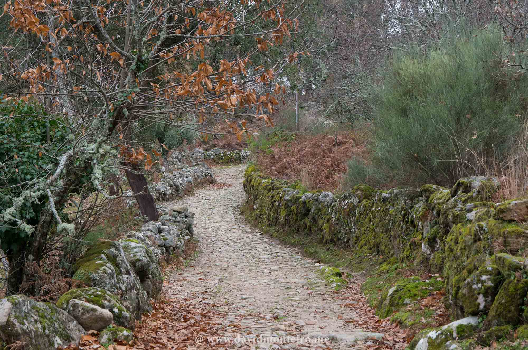
Walking from Lagos to Burgau
A 16km’s (10mi) long trail connecting Lagos to Burgau
Easy walking with no relevant ascents
A 16km’s (10mi) long trail connecting Lagos to Burgau always walking along the coast.
Hiking Portugal Trip – A 12-Day Journey Through Nature, History, and Culture
Get ready for a life-changing adventure across Portugal’s most breathtaking landscapes with the Hiking Portugal Trip.
The Hiking Portugal Trip is a 12-day small group experience, specially crafted to blend scenic hikes, cultural encounters, and authentic local flavors.
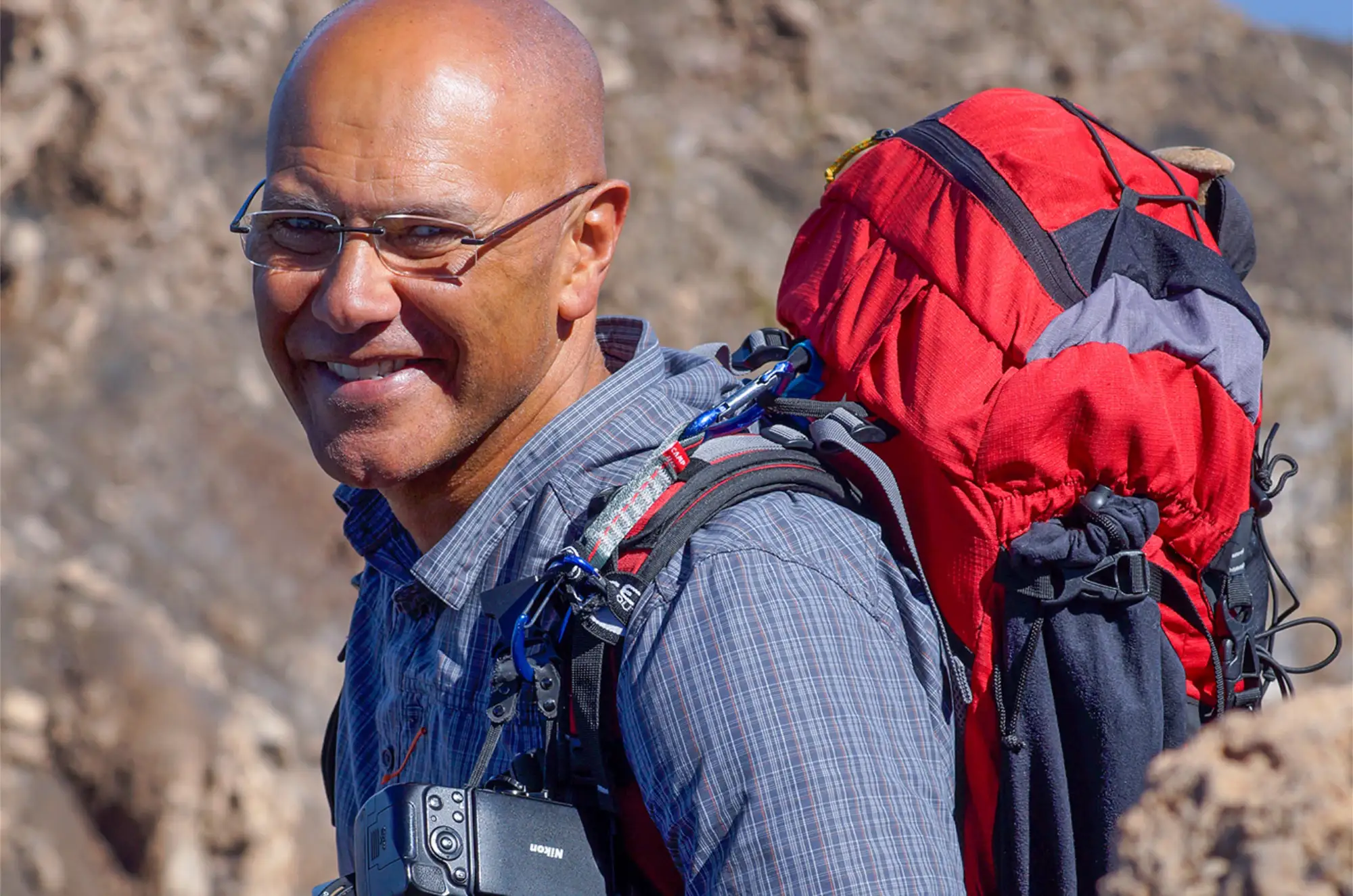
Led by expert guide David Monteiro, this tour promises unforgettable moments and deeper connections with nature, with history, and with yourself.
From June 15 to 26, 2027
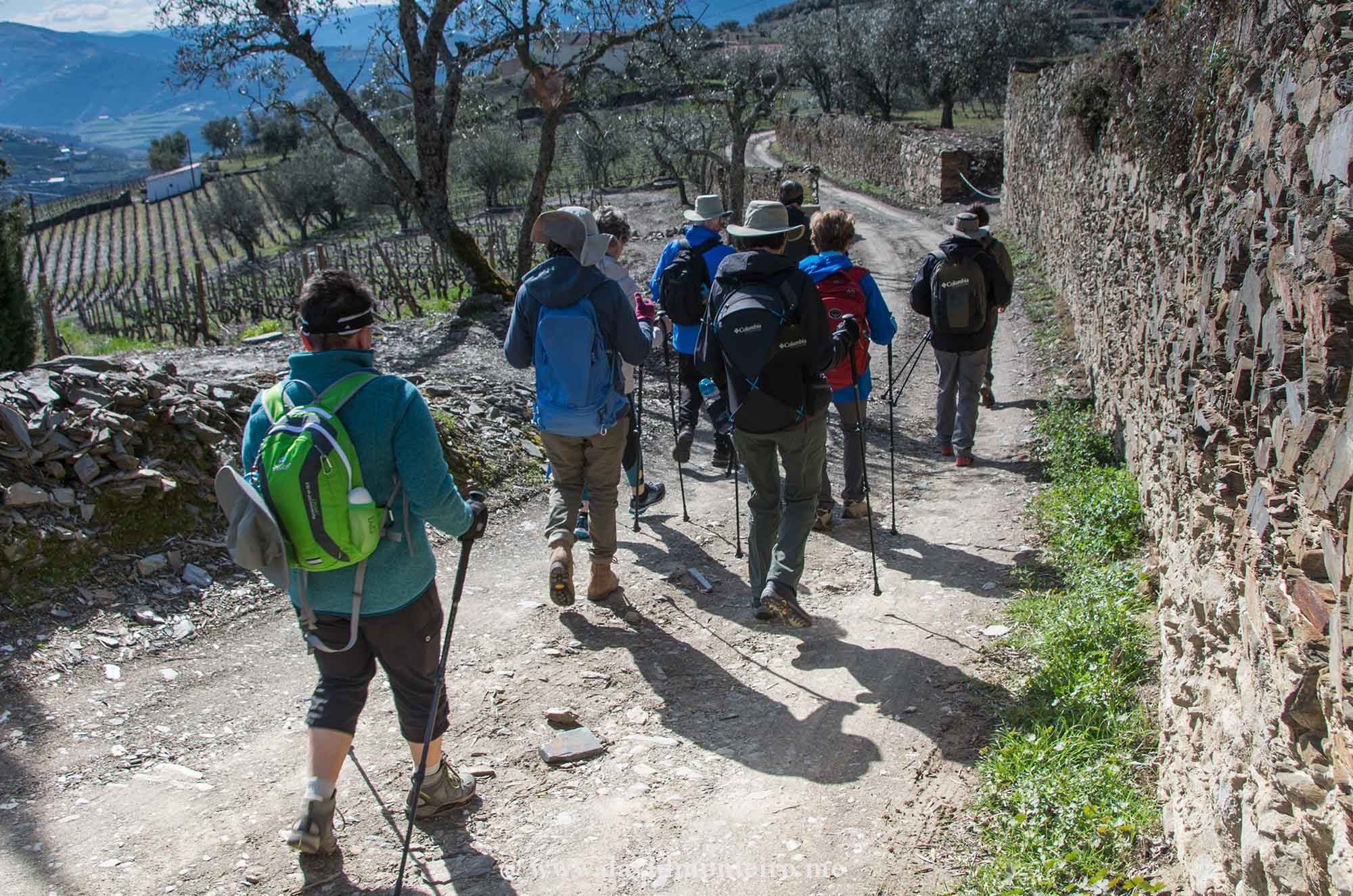
From June 15 to 26, 2027, join a like-minded group of travelers and hike through Portugal’s most stunning regions, including the Douro Valley, Peneda-Gerês National Park, the Camino de Santiago, and the majestic Serra da Estrela.
Along the way, explore medieval villages, UNESCO World Heritage sites, and charming cities like Porto, Coimbra, and Lisbon.
What to Expect on Your Hiking Portugal Trip
Each day brings a new destination and a new story.
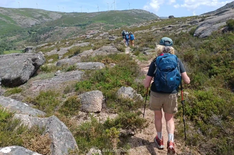
Designed at an intermediate activity level (2+), this trip is perfect for both seasoned walkers and those new to hiking.
With carefully selected trails averaging 8.4 km (or 5.2 mi) per day and 230 meters (or 755 ft) in elevation gain, you’ll enjoy a comfortable pace that leaves room to take in every view.
Hike Highlights Include:
The Camino de Santiago: Walk a portion of this iconic pilgrimage route.
Peneda-Gerês National Park: Experience solitude and serenity in Portugal’s only national park.
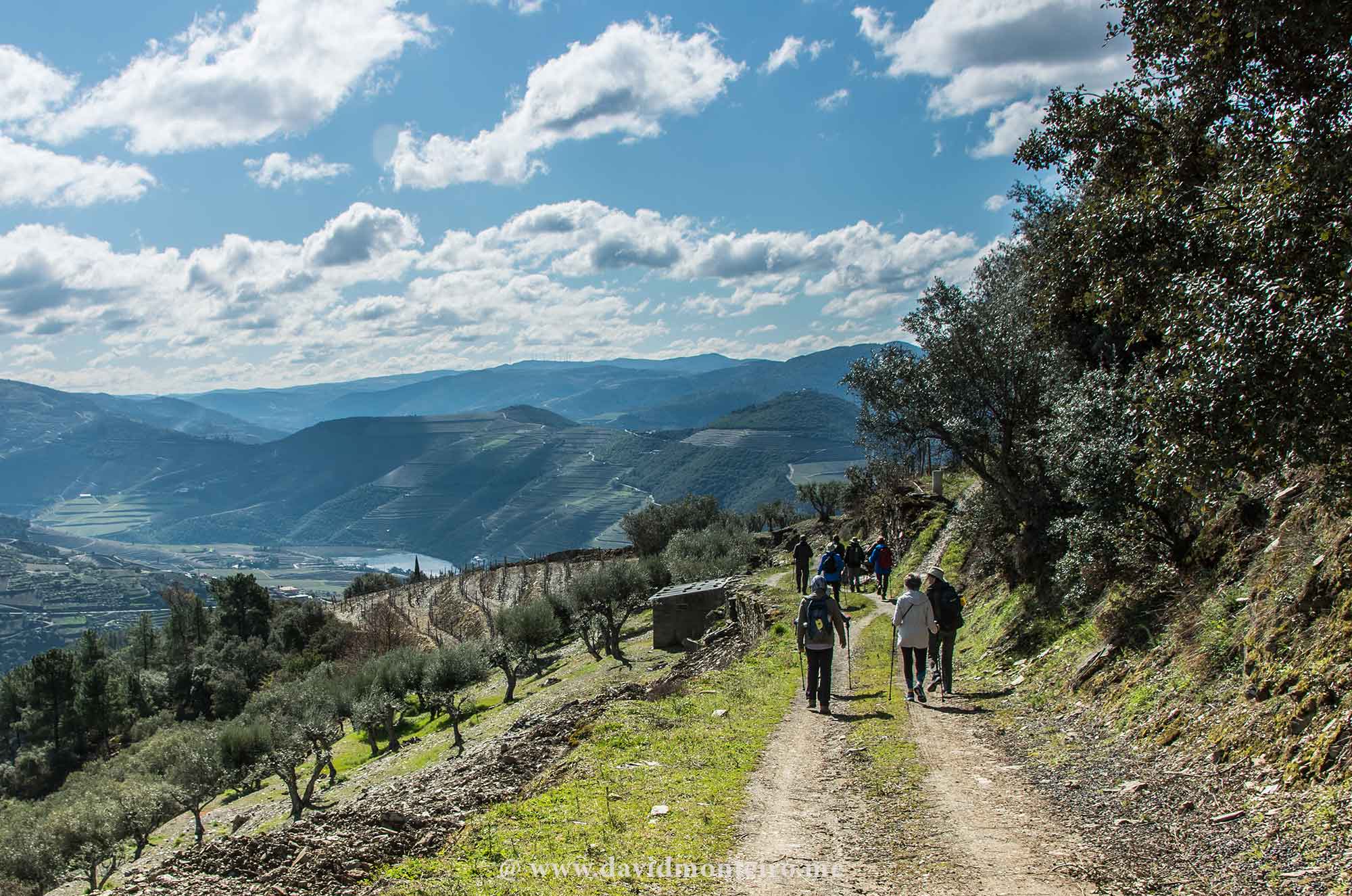
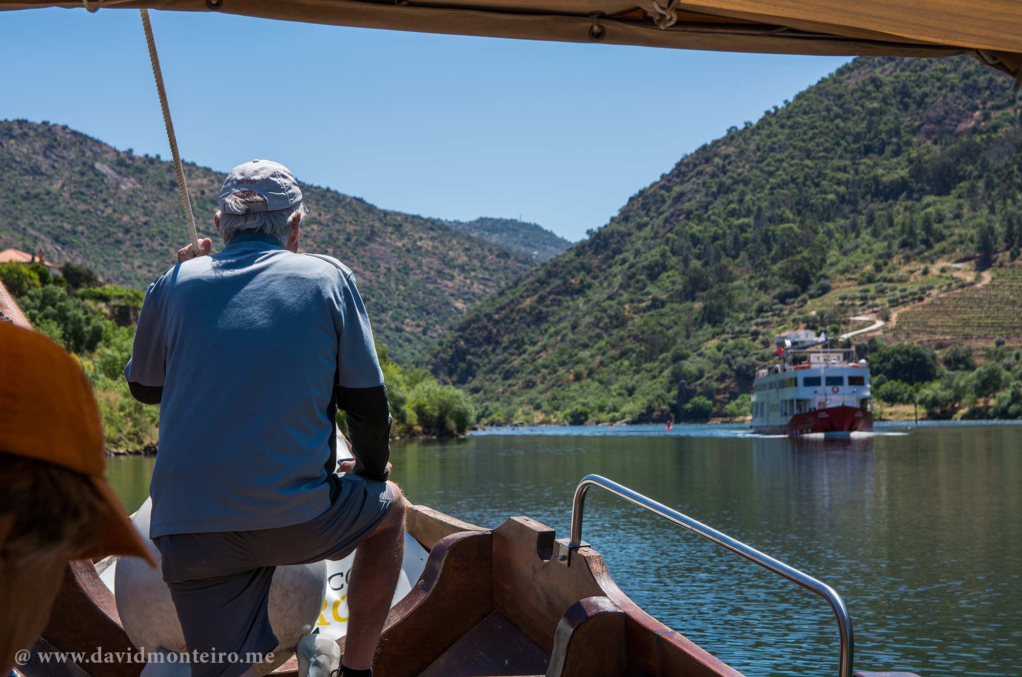
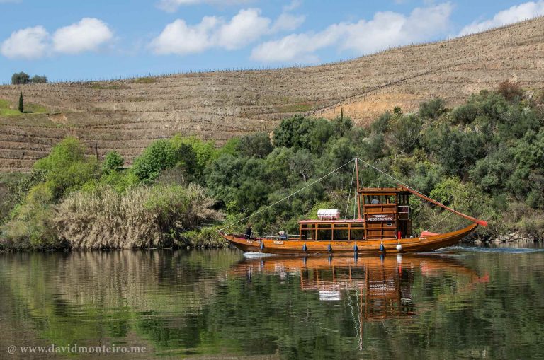
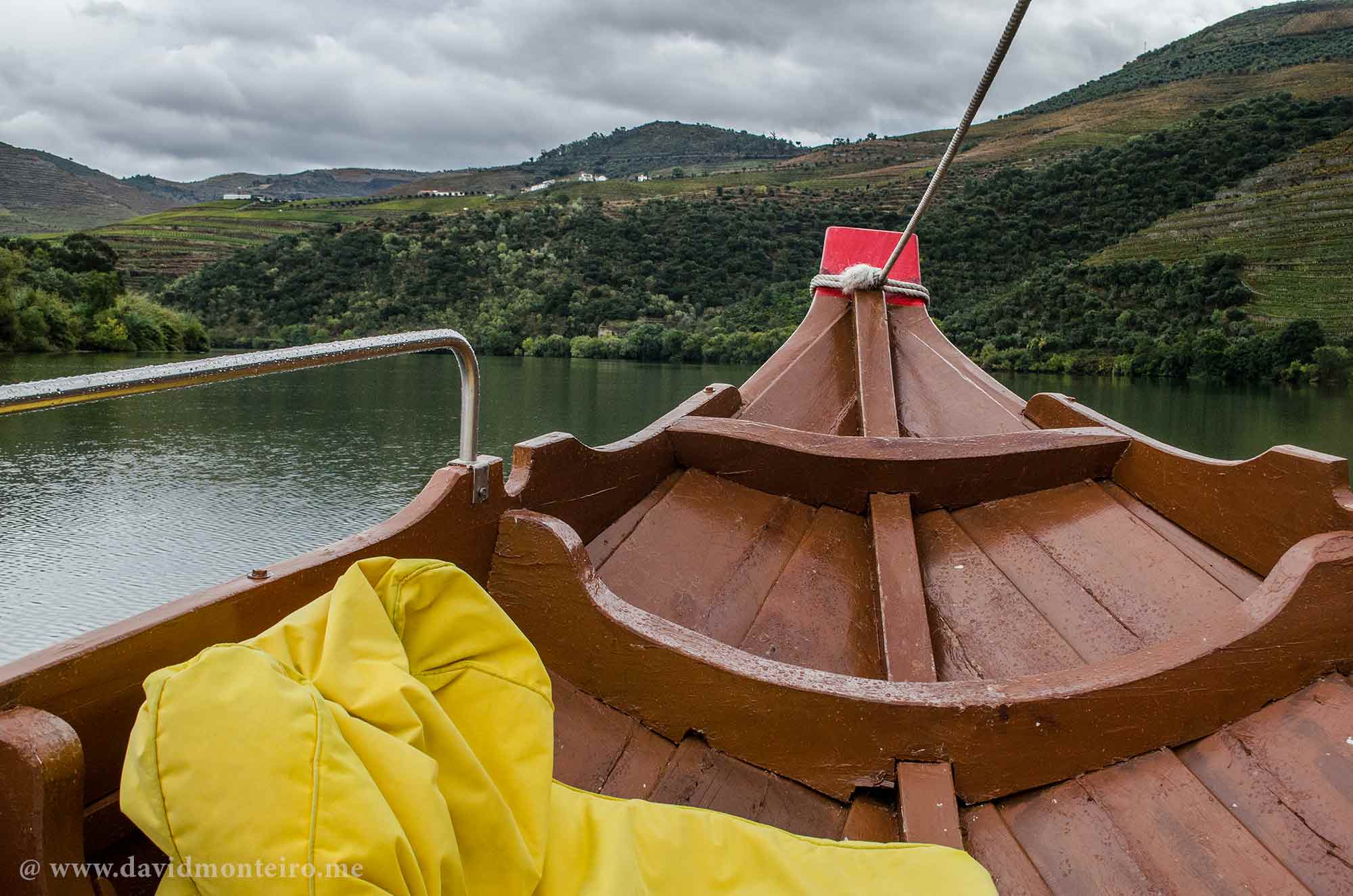
Douro Valley: Hike through terraced vineyards and cruise the Douro River.
Foz Côa: Discover 25,000-year-old prehistoric rock engravings.
Serra da Estrela: Explore Portugal’s highest mountain range.
Guimarães & Coimbra: Walk through cities that shaped the nation’s identity.
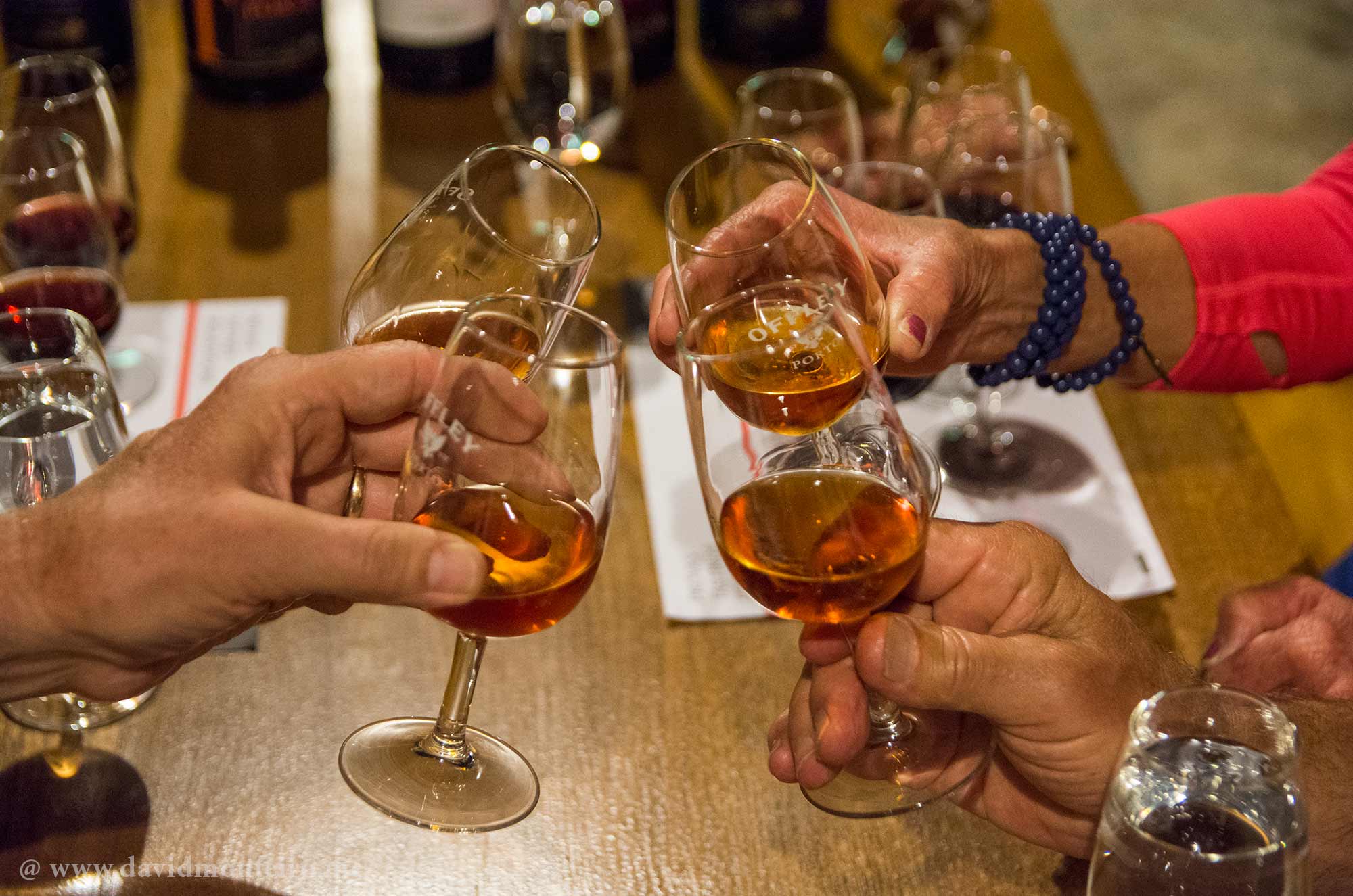
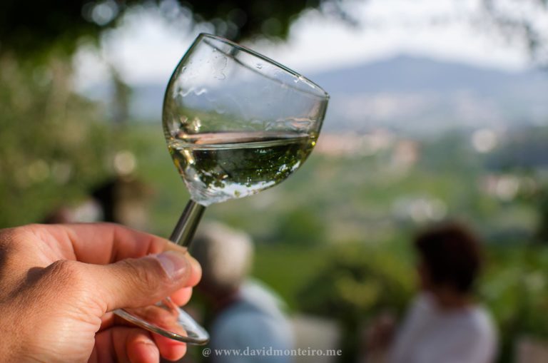
Taste Portugal: Wine, Cuisine, and Hospitality
This journey is not just about hiking; it’s also about savoring Portugal’s unique gastronomy and wine.
You’ll enjoy 11 included lunches (including restaurant meals and scenic picnics), and 8 exceptional dinners, such as a Fado dinner in Lisbon and a gourmet experience at Casas do Côro.
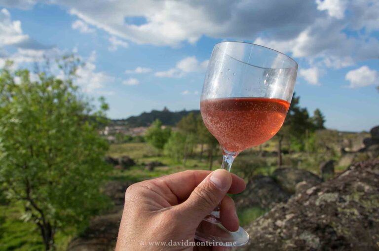
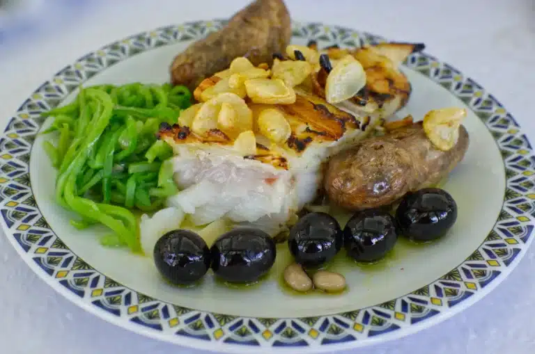
Taste regional delights like mountain cheeses in Serra da Estrela, fresh seafood in Cascais, and world-renowned Port and Vinho Verde wines.
Vegetarian options are available, and dietary preferences can be accommodated.
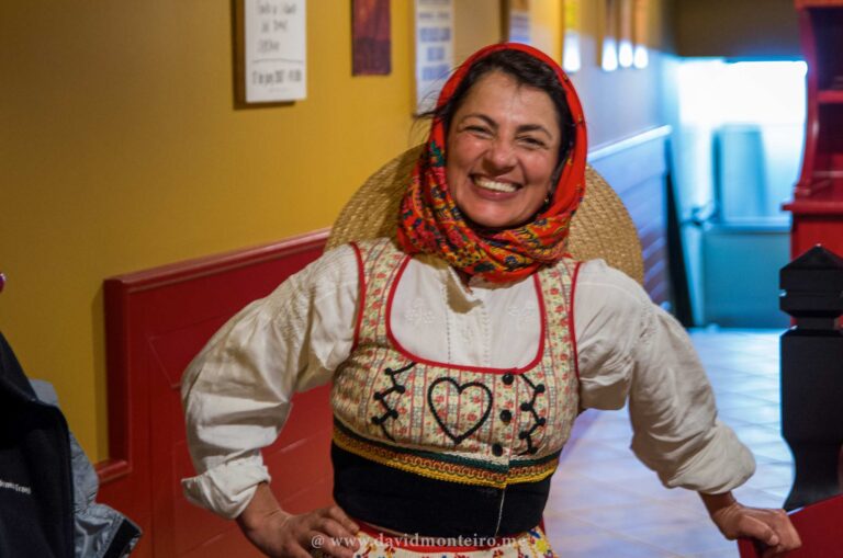
Immerse in Local Culture and History
Throughout your Hiking Portugal Trip, you’ll explore UNESCO World Heritage sites and vibrant cultural landmarks.
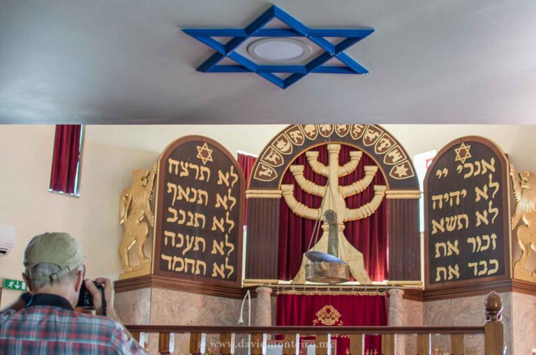
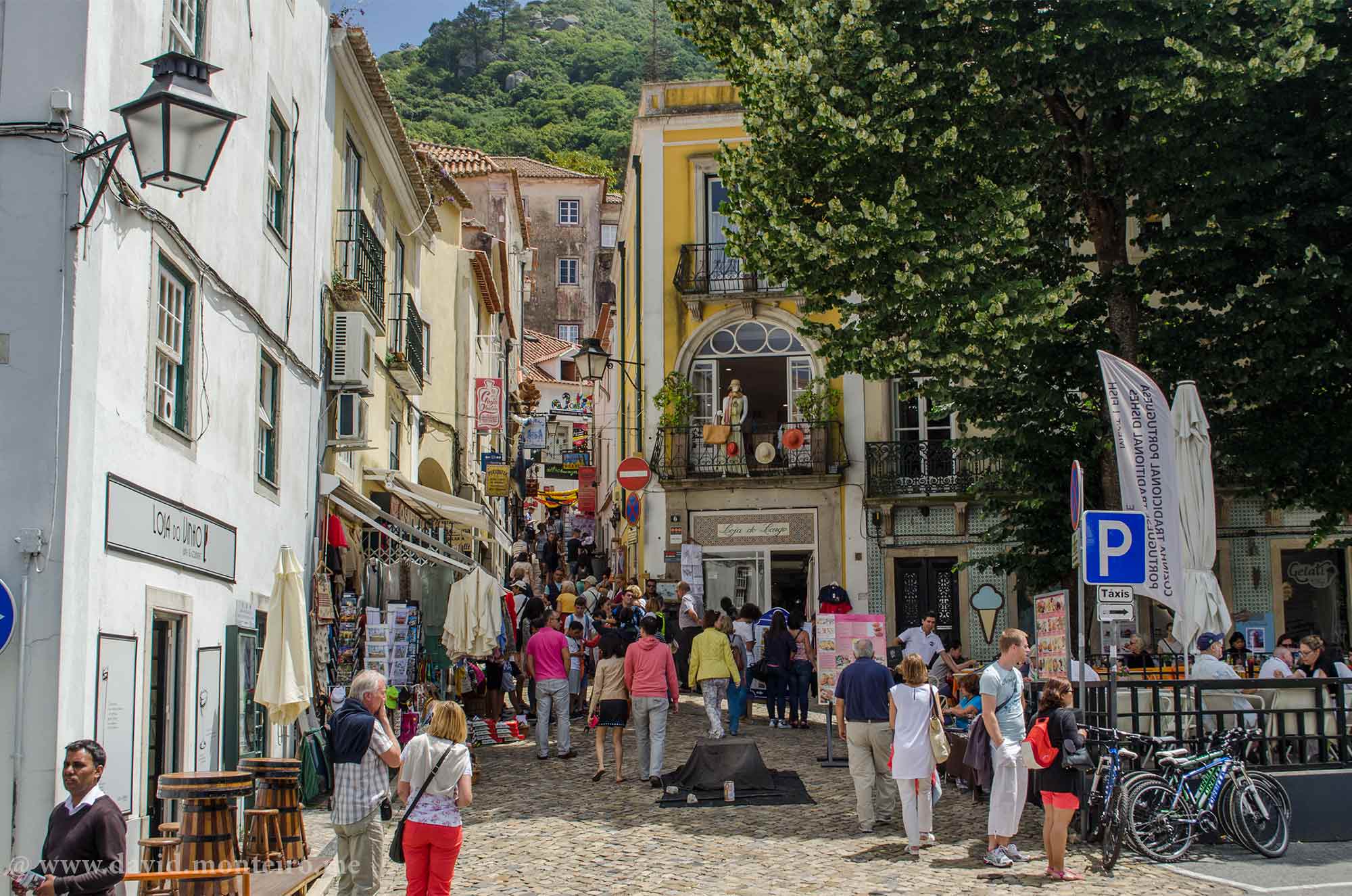
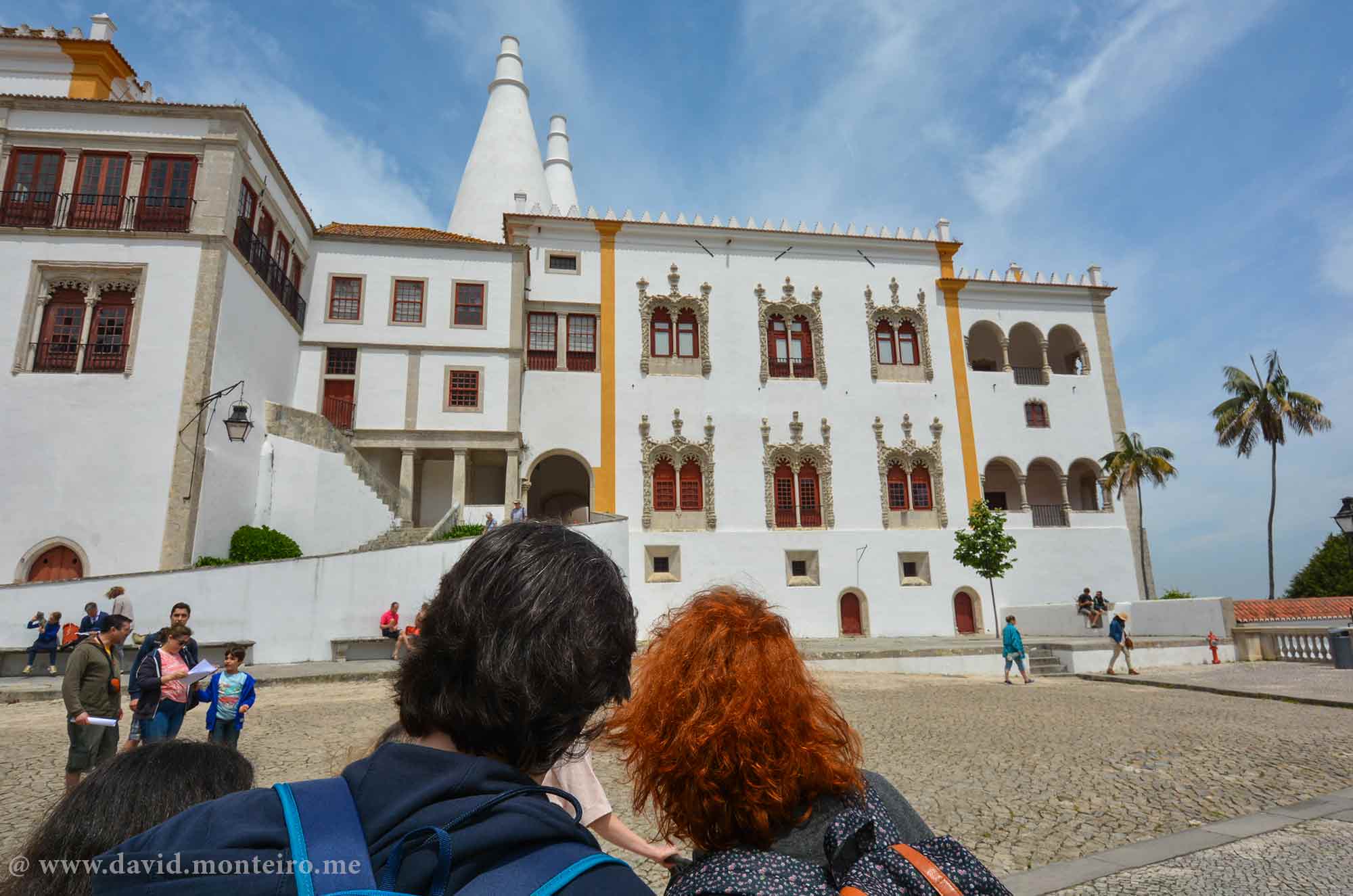
From the romantic palaces of Sintra to the Jewish heritage of Belmonte and the buzzing streets of Lisbon, each destination adds another layer to your journey.
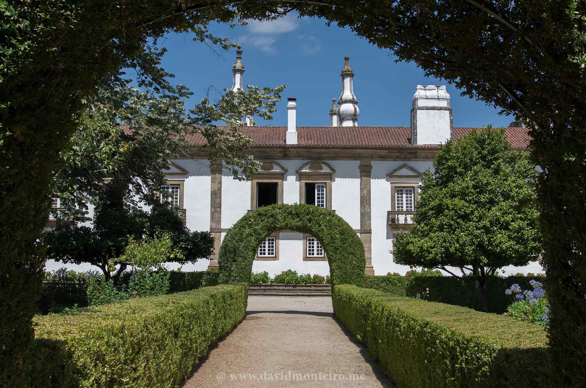
You’ll also visit Mateus Palace, the inspiration behind the famous rosé wine, and you’ll see the stunning coastlines of Cabo da Roca, the westernmost point of mainland Europe.
Stay in Handpicked Boutique Hotels
Each night, unwind in charming, locally owned accommodations carefully selected for their comfort, character, and exceptional service.
These aren’t just places to sleep, they’re part of the experience. All hotels offer private en-suite rooms and locally sourced breakfasts that start each day right.
What’s Included
11 nights in double/twin room accommodations
Dedicated guide and driver from Day 1 to Day 11
11 breakfasts, 11 lunches, 8 dinners
All entrance fees, tastings, workshops, and guided visits
All in-tour transportation
Snacks and water during transfers
Train ride, river cruise, and more
Dates & Pricing
June 15–26, 2027
€9,150 per person (4 guests)
€8,350 per person (5–6 guests)
€7,450 per person (7–10 guests)
The price basis is twin sharing room. Single supplement: 1.950Eur
Deposit: €1000 per person
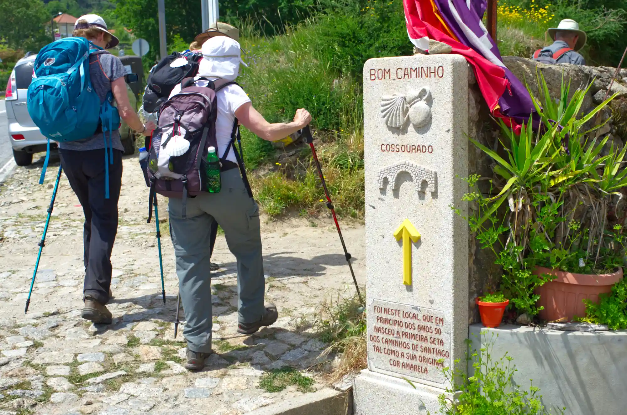
The Camino – Caminho de Santiago
Book Your Spot
David Monteiro – Tour Leader
Hi,
Spaces are limited on this intimate, small-group tour.
Don’t miss your chance to experience Portugal in the most immersive and inspiring way possible.
If this journey speaks to you, I’d love to hear from you!
Just send a quick email to david@davidmonteiro.me letting me know you’d like to join the Hiking Portugal Trip. I’ll personally send you the detailed program so you can explore everything this adventure has to offer.
And if you’d like to connect face-to-face before making a decision, I’m happy to set up a video call. It’s a great way to answer your questions and help you feel confident about taking this step.
Looking forward to welcoming you on the trail!
David Monteiro
PS:
About me: Click here to learn more about me and my journey as a tour leader.
Reviews: Check out some reviews from past travelers I’ve had the pleasure of guiding, just click here.
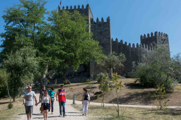
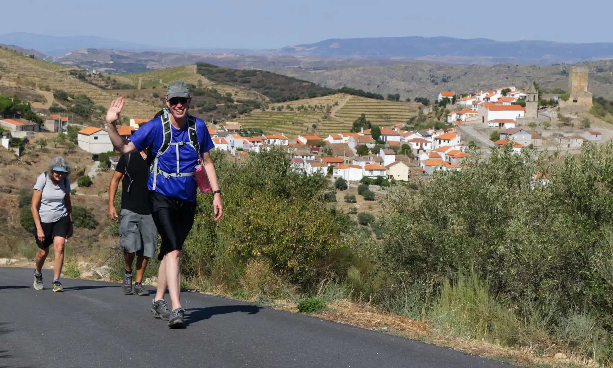
Hiking from Longroiva to Marialva: A Scenic Castle-to-Castle Trail
Discover the Charm of Hiking from Longroiva
Hiking from Longroiva to Marialva is a breathtaking journey that connects two historic castles through stunning landscapes.
This unique trail takes you through rural paths, vast farmlands, and panoramic viewpoints, making it an unforgettable experience for nature lovers and history enthusiasts.
Most of the hiking trail is on dirt. However, some short sections are on tarmac.
Longroiva, a small village in the municipality of Mêda, boasts a rich history dating back to prehistoric times.
Over the centuries, Romans, Visigoths, Arabs, and other civilizations have left their mark on this charming village today with just over 200 residents.
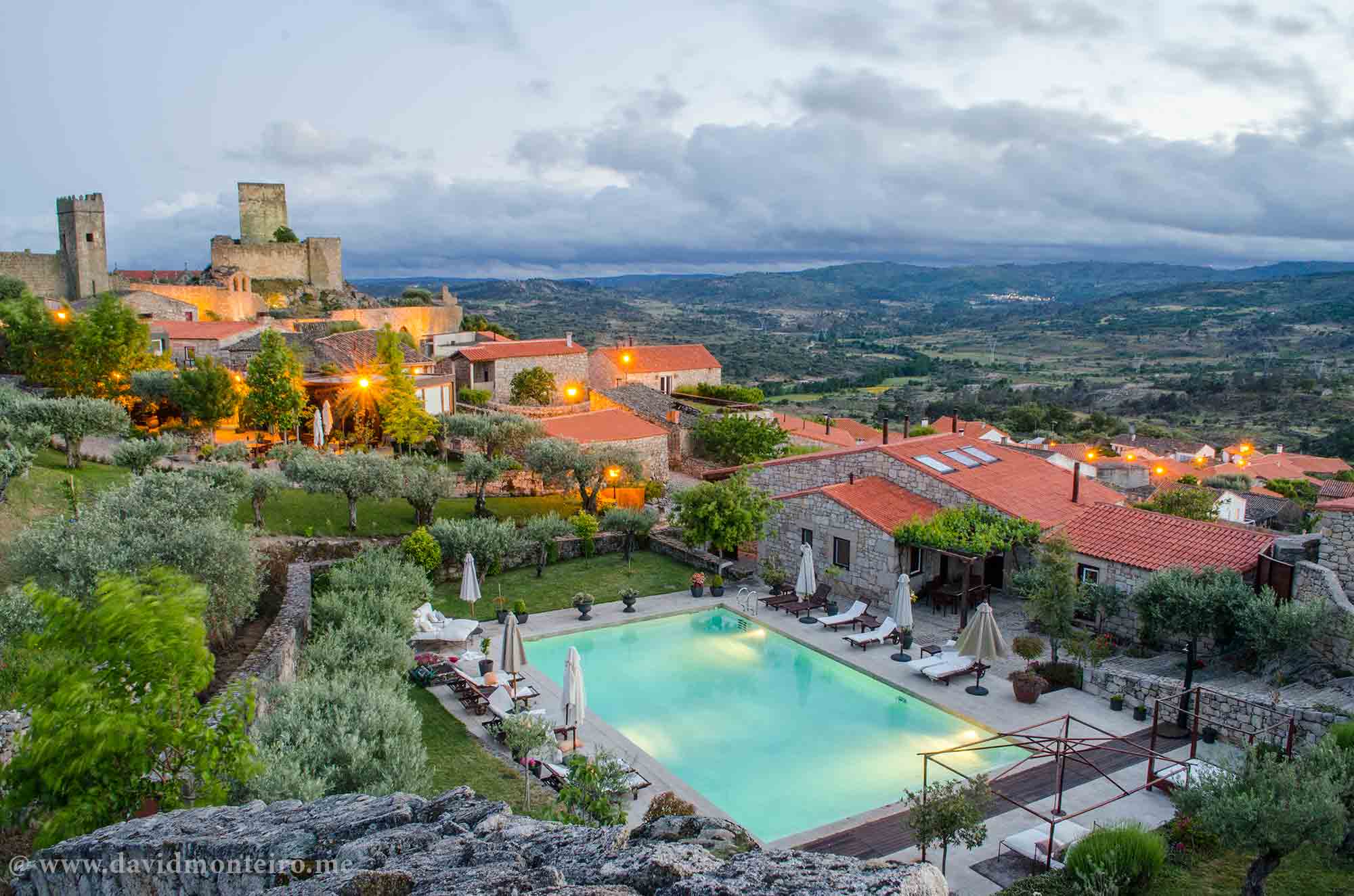
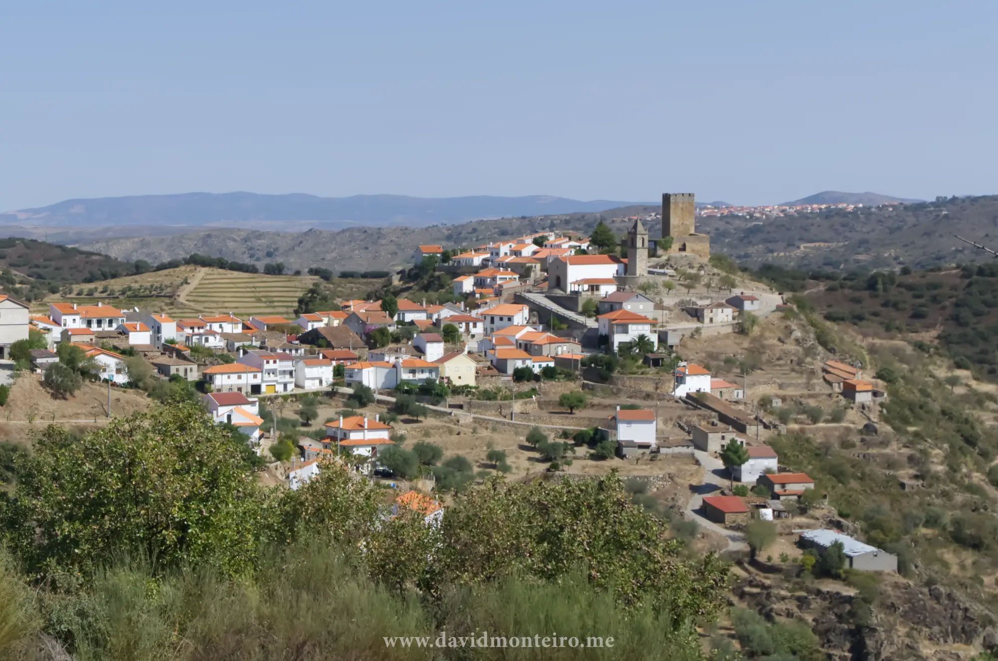
Marialva, on the other hand, is part of the Historic Villages of Portugal Network and is known for its well-preserved medieval atmosphere.
This hike is not part of the official walking routes in the region but was carefully designed to complement existing trails, offering a unique way to explore the countryside.
Longroiva view
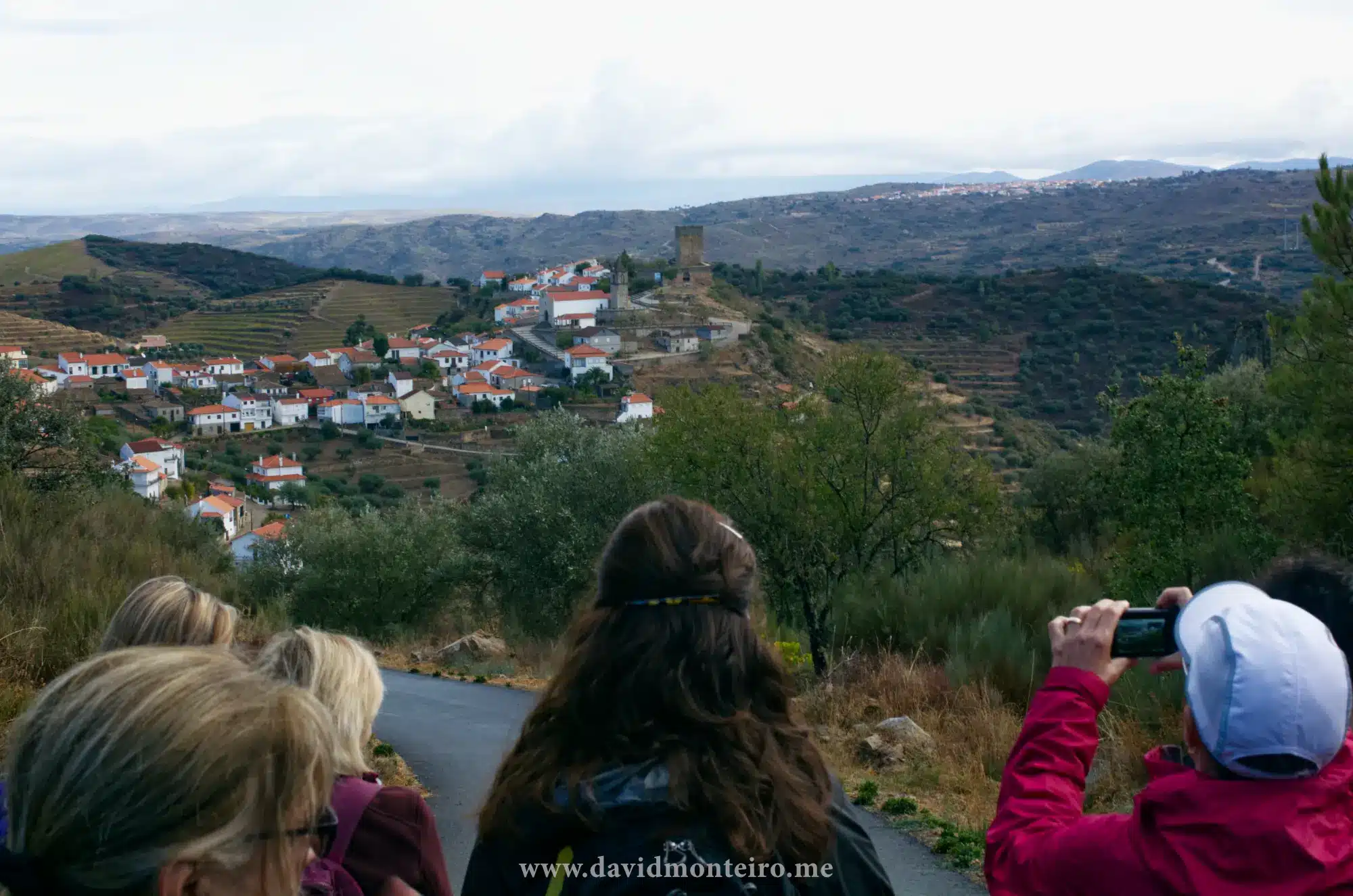
A Journey Through Scenic Landscapes
As you leave Longroiva, the trail leads you through a small valley before gradually ascending.
At the top, you are rewarded with a breathtaking view of Longroiva’s castle, standing majestically over the village.
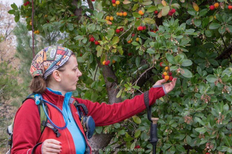
Along the way, you’ll pass through a diverse agricultural landscape.
Expect to see almond trees, wheat fields, olive groves, vineyards, and an abundance of fruit trees, including quinces, persimmons, and pomegranates.
The open views of the valley, dominated by vineyards, add to the trail’s charm.
Longroiva, Portugal
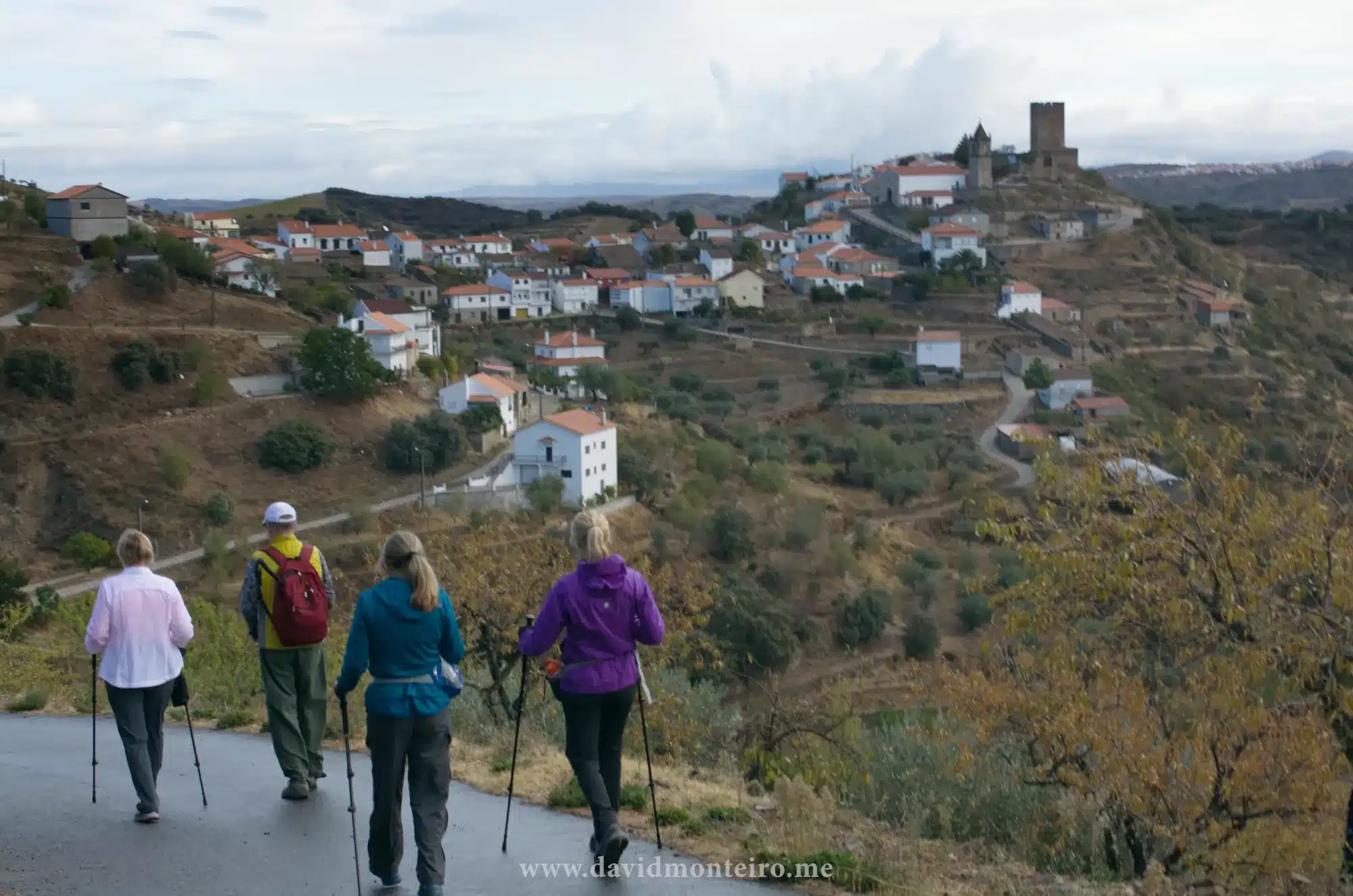
Approaching Marialva: A Step Back in Time
As you get closer to Marialva, the scenery changes, making the final stretch of the hike even more fascinating.
You can enter this historic village in two different ways:
Eastern Route – Walk around the ancient castle walls, soaking in the medieval atmosphere before stepping into the village.
Western Route – Pass through the heart of the village, giving you the opportunity to explore its narrow streets before reaching the castle or nearby accommodations.
Whichever path you choose, the experience is equally rewarding.
Hiking from Longroiva to Marialva
Hiking Trail Details
Distance: 7.6 km (4.7 mi)
Total Ascent: 296 m (971 ft)
Total Descent: 149 m (489 ft)
Difficulty: Moderate
Estimated Duration: 2 to 3 hours
Trail Type: Point-to-point
Why Choose This Hike?
Moderate Difficulty – Accessible to most hikers, offering a balance of challenge and enjoyment.
Cape Roca’s coordinates are 38° 46’49.59″N 9° 29’56.19″W. As depicted in the featured photo of this article, it perches atop a high point and boasts impressive sea landscape views, naturally befitting its status as a cape.
Accessible by car, consider indulging in a spectacular walking experience if you love hikes and have the time.
This hike is one of the most spectacular hikes near Lisbon.
You can explore both north and south from Cape Roca on foot.
Landscape coastal view
Two different walks, logistics
For a clearer breakdown, I’ll categorize the hikes into two sections:
1) Southward: From Forte do Guincho to Cape Roca
2) Northward: From Cape Roca to the Dinosaurs’ footprints
Please note: The concept is to hike south or north, passing Cape Roca. However, you can either reach Cape Roca and continue on one trail or something similar.
This isn’t a loop trail but a linear one, so there’s always the challenge of returning to the starting point or finding transportation from the endpoint.
If you’re hiking with friends and have at least two vehicles, you can leave one car at the endpoint and, upon arrival, drive back to retrieve the vehicles left at the starting point.
Alternatively, you can consider taking a bus back to the starting point.
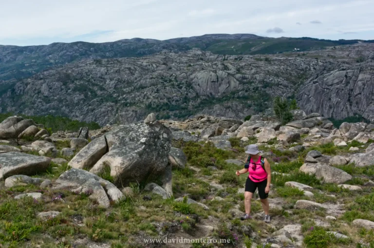
Armeria pseudarmeria
Along the trails, you can try to find a rare flower, the Armeria pseudarmeria.
This species is at risk of extinction because tourists pick it up due to its beauty during blooming and because it only grows along these cliffs, a somewhat restricted area.
Walker at Cape Roca, Portugal
Geology
If you are interested in geology, granite is king in this area. Along the coast, you will find magnificent cliffs, often higher than 150m/492ft (+/-) and high tall standalone rocks looking like coastal guardians searching for the enemy boats at the horizon.
Coastal walk, Portugal
About the walking trails
I use these trails to assess Portuguese guests’ fitness to the mountain tours I promote.
Walking these trails at a slow pace can be considered to have a moderate difficulty level.
However, by increasing the speed, just a little bit, the difficulty level of these trails will increase and become strenuous.
On the other hand, the terrain, on both paths, is uneven, with gravel and not suited for inexperienced walkers.
Be sure to wear walking boots and take walking poles with you. You might need them.
Also, at specific points, you will find some higher steps that will require you to grab on something, like a branch or a rock.
Although one can not consider these situations as rock climbing, they can represent an obstacle for less experienced people.
Group of walkers near Cape Roca in Portugal
Let’s check the two trails
1) South: Hiking to Cape Roca from Forte do Guincho
Hiking to Cape Roca from Forte do Guincho is a classic on Lisbon’s outskirts.
Nearly every adventure organization, whether a company, association, or informal group, has embarked on this journey.
It’s a captivating route, one I never tire of traversing, and it offers unique charms depending on the season.
I vividly recall my inaugural hike in June 2000, on what felt like the hottest day of the year.
The trail meanders through valleys, covering 8 kilometers and an elevation gain of 830 meters. It presents continuous ascents and descents.
Commencing at the 17th-century Forte do Guincho, part of Portugal’s coastal defense line established after the Dec’1640 revolution, the route offers various paths, creating length and terrain variances.
As it’s a linear trail, returning to the starting point poses a logistical challenge, but groups with two vehicles can strategically leave one at the endpoint.
Alternatively, one can explore bus options, though schedules may be limited.
For those seeking a return journey, the coastal walk offers captivating vistas in both directions.
However, it’s essential to consider the trail’s difficulty, as walking it one way is moderate, while covering it twice is strenuous.
Notable along the route are the ruins of Espinhaço Fortress, constructed during the 17th-century Restoration War.
2) North: from Cape Roca to Dinosaurs footprints
This walk closely resembles the one previously described but is shorter and features more Points of Interest (POIs).
Covering a distance of 6.1 km (3.8 mi) with a 600 m elevation gain, it commences at Cape Roca, near the parking lot, positioned on the left side of the road.
Once you embark on the right track, the route becomes predominantly clear.
However, attention is required when traversing Ursa Beach, the first beach encountered, as both the descent to and ascent from the beach are steep and potentially slippery.
En route to Adraga Beach, the trail leads to Fojo, a sizable hole providing a panoramic view of the sea—exercise caution in this area.
The journey culminates at the dinosaurs’ footprints if undertaken one-way.
During inclement weather, exercise caution on the wooden steps, as they may become slippery. Key POIs include Ursa Beach, ideal for long exposure photography,
Fojo, a notable geological feature, Adraga Beach, boasting white sands and a sea-view restaurant offering fresh seafood, and the dinosaurs’ footprints, featuring 66 imprints dating back 110 to 115 million years; note that ongoing restoration efforts are underway due to a wall collapse.
Note: The end of this trail lacks coffee shops, restaurants, or any other infrastructure, only featuring some houses. If you require dining options, either backtrack to Adraga Beach, approximately 1.5 km from the trail’s end, or continue along the path for an additional 1 km to reach Praia Grande. At Praia Grande, several restaurants and bars are available, and you can also access bus services from there.
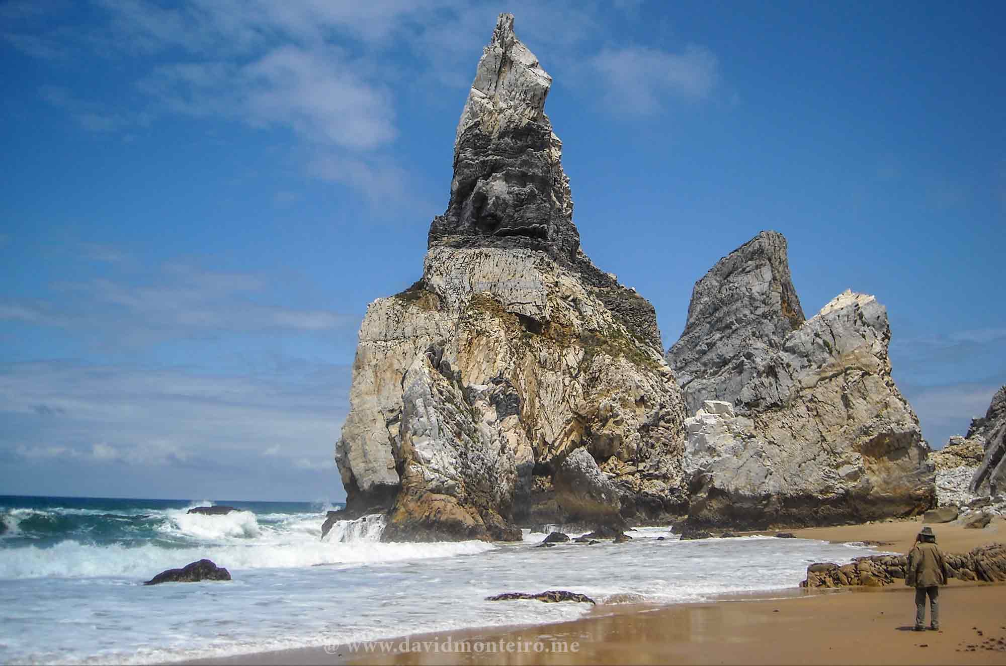
Praia da Ursa, Ursa Beach, Portugal
To conclude
Well, I hope you enjoy the walks as much as I do.
If you want to embark on this adventure or others like it, please contact me.
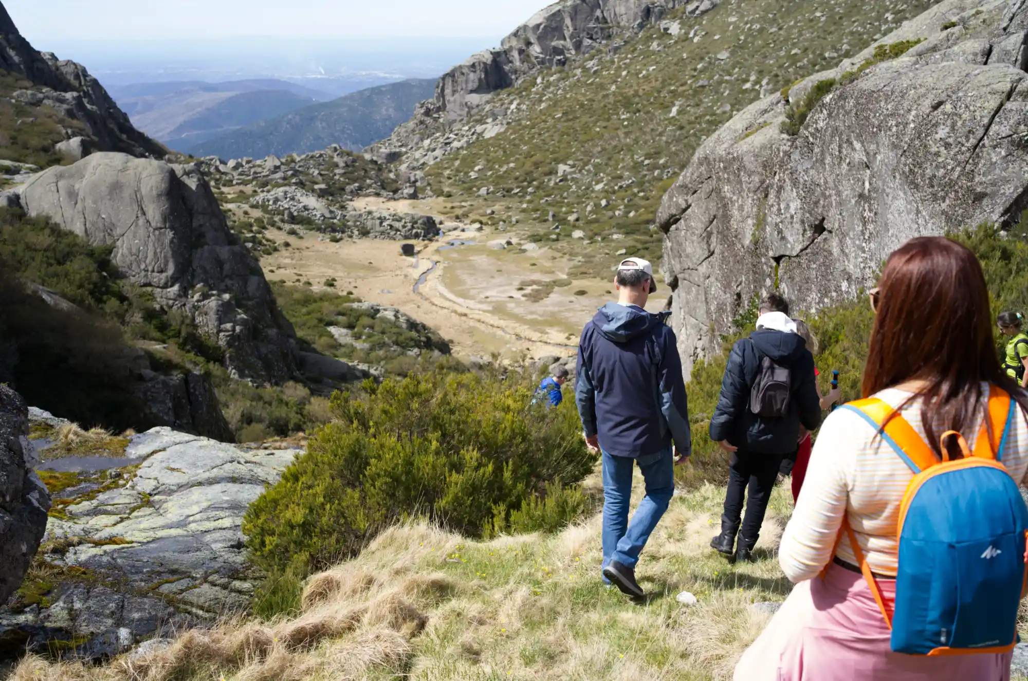
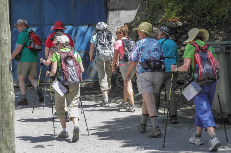
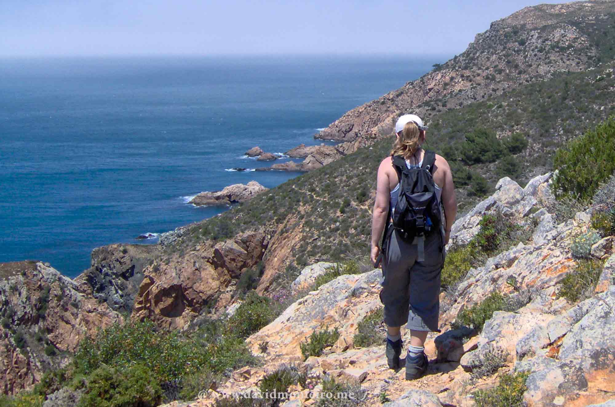
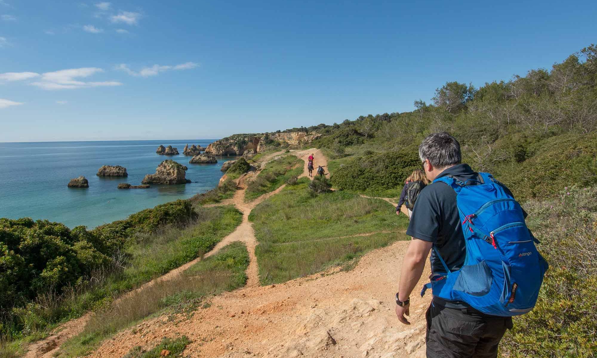
In the captivating Algarve, where breathtaking sea vistas command your gaze and vibrant orange walls compose the quintessential tourist postcard scene, hiking from Vau to Alvor is no less attractive.
This picturesque hike is ideal for exploring the Algarve’s walks between March and April when the weather is pleasantly mild.
Summer in the Algarve is too hot for exploring these paths.
Instead, we revel in the springtime ambiance, relishing the gentle breeze and the vibrant hues of blossoming flora adorn our path.
Each step unveils a new facet of this coastal paradise, inviting us to immerse ourselves fully in its natural beauty and cultural charm.
Walking from Vau to Alvor, Algarve, Portugal
Coastal Odyssey: Exploring Algarve’s Enchanting Hiking Trail from Vau to Alvor
Embarking on hiking from Vau Beach, our journey begins amidst curious gazes from patrons lounging on the bar terraces, intrigued by our chosen path.
Eager to explore further, we swiftly depart, tracing a trail along the rugged cliffs that fringe the coastline.
This scenic route meanders through enchanting caves, whose captivating formations are frequently immortalized in photographs, epitomizing the allure of this coastal enclave.
Undeterred by challenges, we press onward towards the western horizon, each step revealing new wonders of the Algarve’s coastal splendor.
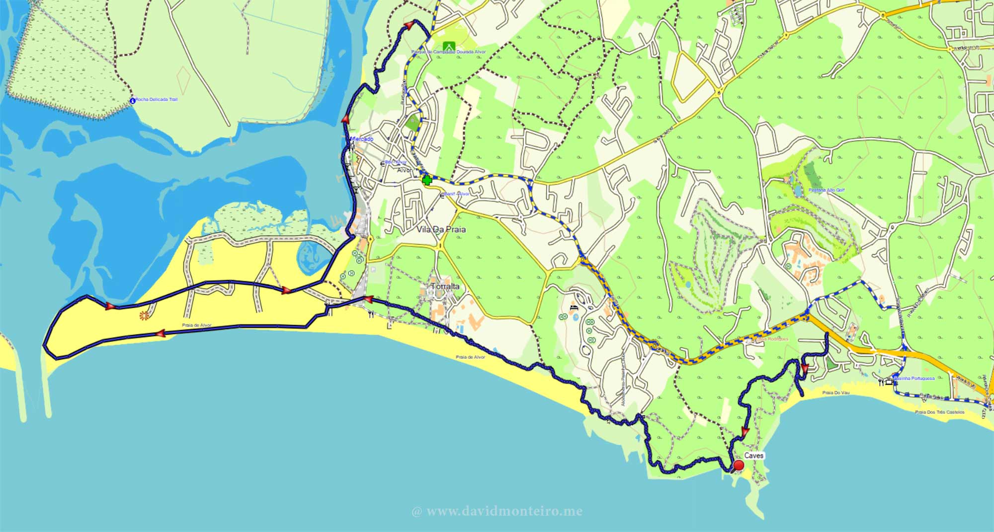
We end at Alvor Beach, crossing wooden walkways through marshlands at Ribeira de Odiaxere’s mouth.
We enjoy the peaceful marshes on the boardwalks.
Marshlands at Alvor
Exploring Alvor’s Marshlands in Active Style
The mouth of this stream teems with birdlife feasting on the abundant species of small fish inhabiting these waters.
Whether you stroll at sunrise or sunset, photographic opportunities continuously present themselves.
Birds dart hastily towards the water, creating captivating scenes ripe for photography.
Capturing these winged creatures in mid-flight poses a unique challenge.
Yet, the allure of this spectacle urges you to continue your exploration.
Your journey doesn’t have to conclude here.
Marshlands at Alvor
Expand Your Exploration: Extending Your Walk
Adjacent to the port area in Alvor, you can proceed along the waterfront of this stream.
At the terminus of the port avenue, a trail emerges, guiding you towards the Alvor camping park.
Following this trail, you can navigate your way back through the village.
Spanning approximately 12 kilometers, this walk poses no notable challenges and can be savored as a leisurely excursion.
Hiking from Vau to Alvor, Algarve, Portugal
Numerous bars and restaurants beckon along the route, offering ample opportunities to pause and indulge in a refreshing drink … or two.
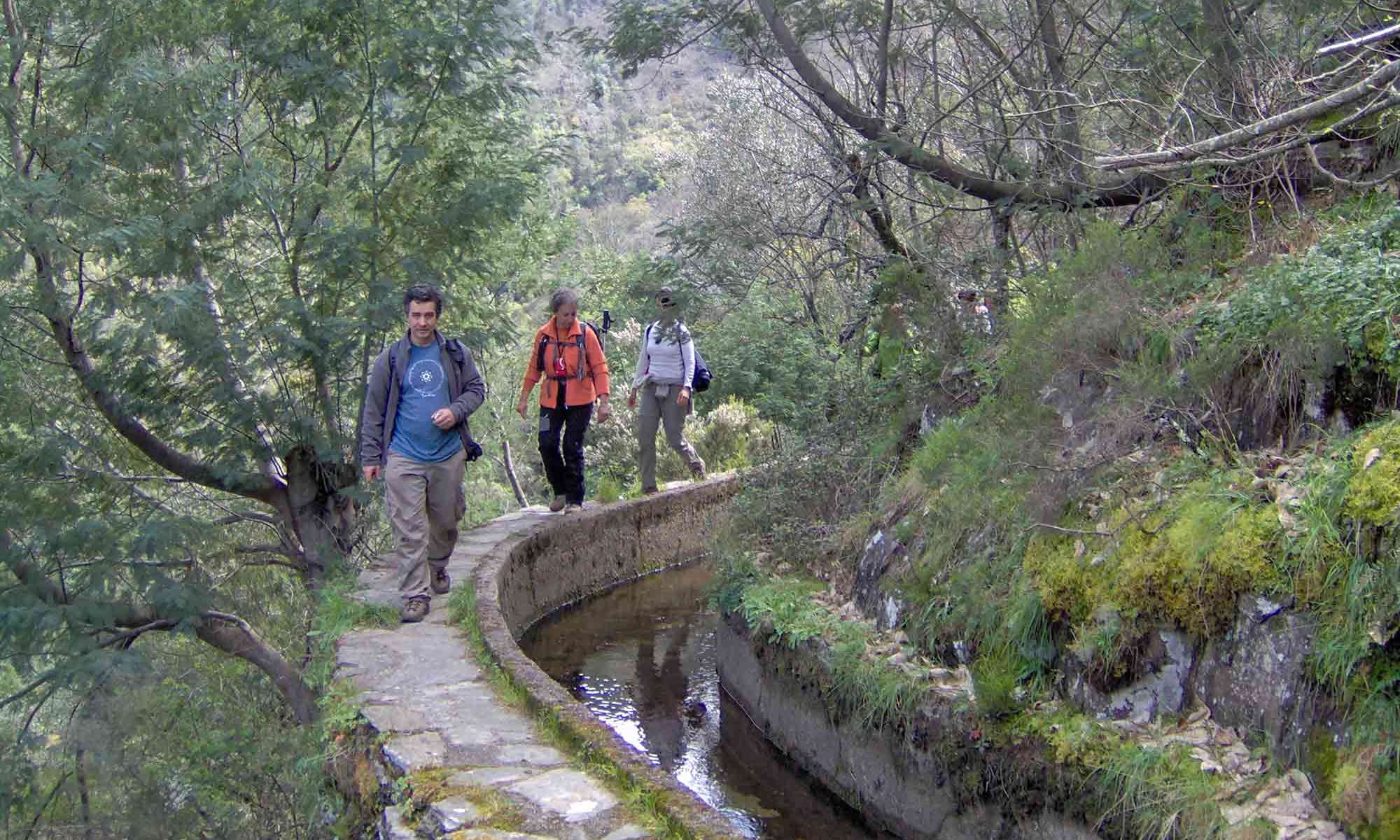
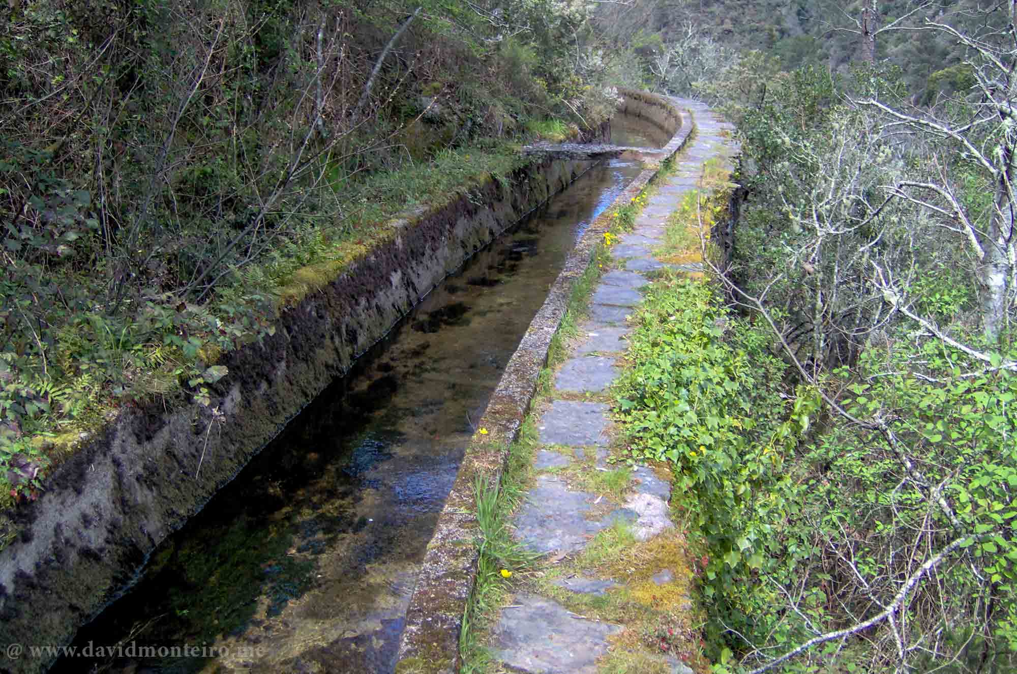
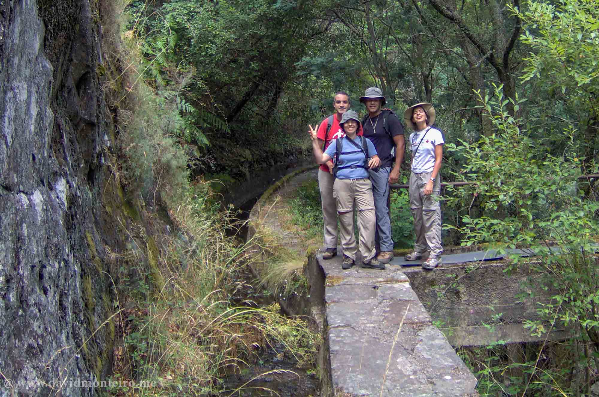
Near the town with the same name, while hiking on the Lousã’s aqueduct, you can enjoy yourself along a gorgeous valley.
Walking on the Lousã’s aqueduct
About the Lousã’s aqueduct
The Lousã Aqueduct, located in Portugal, has a rich history dating back to the 17th century.
It was constructed to supply water to the nearby city of Coimbra, serving as a vital resource for the local population.
The aqueduct features an impressive channel spanning across the picturesque Lousã hills.
Over the years, it has undergone various renovations and maintenance efforts to preserve its historical significance and functionality.
Today, the aqueduct not only serves as a testament to the engineering prowess of its creators but also stands as a popular tourist attraction, offering visitors the opportunity to admire its architectural beauty and explore the surrounding landscape.
Lousã’s aqueduct
About the walk
Enjoy a stroll along this picturesque two-mile aqueduct in the valley, immersing yourself in its scenic charm.
Accessing the aqueduct may pose some difficulty, but there are two potential ways to reach it:
From Senhora da Piedade (Lousã), you can embark on a single trail leading to the quaint village of Talasnal.
Upon arrival, indulge in the local delicacy, Talasnico cake, before descending the valley towards the aqueduct.
After a brief 150-meter trek, the path meanders through the bushes.
Continue downhill until the aqueduct comes into view, then follow it until reaching the trail leading back to the starting point.
You can access the aqueduct from the EN236 road at N40° 05.470′ W8° 12.814′.
Take a cab from Lousã to this location, locate the aqueduct entrance, and begin your walk back.
If you want to embark on this adventure or others like it, don’t hesitate to contact me.
With a sea landscape as my backdrop, hiking to Baleeira Beach, offering the possibility of a swim in the ocean – it couldn’t be better.
This stroll provided me with an excellent photo opportunity and a much-needed distraction from my usual affairs.
Praia da Baleeira, situated between Sesimbra and Cabo Espichel, Portugal, is often touted as one of the secret beaches in the area.
While not exactly a secret, its somewhat elusive access means it remains relatively uncrowded.
Although the hike described here could be considerably shortened, the aim was also to propose a morning walk option.
Hiking to Baleeira Beach
Start at Espiga coffee shop
Park your car near the Espiga coffee shop at the entrance of Casais da Azóia.
Here, you can indulge in regional delicacies alongside the traditional Farinha Torrada cake.
Fresh bread is always available, making it an ideal spot for a pre-walk coffee.
The suggested trail to and from the beach forms a semi-circle, utilizing both circular paths and the initial trail for the return journey.
Initially, you’ll traverse a dirt road passing by houses before encountering a footpath and denser vegetation as you approach the sloping beach access.
Be cautious: the trail becomes steeper in this area, requiring careful footing due to its technical nature.
It’s strongly advised to wear boots for better ankle support, as downhill sections feature gravel that can be challenging with walking shoes.
Additionally, bring sandals for swimming, as the beach consists of pebbles rather than sand.
One of the beach’s notable advantages is its southern orientation, providing shelter from northern winds.
Baleeira Beach
Baleeira Beach
Walking to Baleeira Beach
Hiking to Baleeira Beach details
– Length: 5,5Km – Elevation gain/loss: 220m (to both ways) – Kind of terrain: dirt and gravel – Average duration: 2 hours non-stop
Baleeira Beach hike map
If you want to embark on this adventure or others like it, don’t hesitate to contact me.


